Our drive from Queenstown to Te Anau was memorable only for one thing, the roadside cafe we stopped at for a short break after leaving Queenstown. On the main road in a tiny village named Kingston which lies at the southern tip of Lake Wakitipu, this wonderful cafe, gift shop and general store attracted locals and tourists alike. The smell of freshly cooked breakfasts emanating from the kitchen, the range of cakes, and the great 80’s music, made this a really pleasurable stop. (No I did not have a breakfast OR a cake….it was too early.)

Inside and out – The roadside Cafe at Kingston – That was all there was between Queenstown and Te Anau
Te Anau is the gateway to the Fiordland National Park and lies at the south end of the lake that carries its name. It is a small settlement but as with many places it is a pleasant enough place to stay for a couple of days. Its main attraction though is that it is the last village on the only road to Milford Sound, which lies two hours, and 75 miles north. It is also the reason we are here.


Clockwise from Top Left: The Marina at Te Anau; Us at the pub; Pano of Lake Te Anau. Us IN the pub; Lake Te Anau;
We had booked our Milford Sound cruise in Queenstown a few days previously, and had always planned to stop at Te Anau as an easy means of getting to the sound. Self drive is one way to get there, you can go by coach from Queenstown or Te Anau, or you can fly from either place to the airstrip at Milford Sound. Top tip, should you ever come here, drive yourself to Milford Sound and get up early for a 9am sailing. Most coach tours from Queenstown and Te Anau aim for a 1pm sailing from one of the four tour companies that operate in the sound. These depart from the very smart terminal so you can imagine, with all these coaches arriving it can get very crowded and noisy. An earlier sailing may mean an early start but it will be less crowded and you stand a chance of being able to park your car within easy walking distance of the terminal. Alternatively you could plan to end your tramp of the Milford Track at the terminal having walked for 4 days and do the cruise that way.
A little bit of information now. Milford Sound is named after Milford Haven in Wales and the river that runs into it, the Cleddau also has its naming origins in Wales. It has a Maori name, Piopiotahi, after the thrush-like Piopio bird, which is sadly now extinct. Piopiotahi means “a single piopio”, harking back to the legend of Māui trying to win immortality for mankind—when Maui died in the attempt, a Piopio was said to have flown here in mourning.
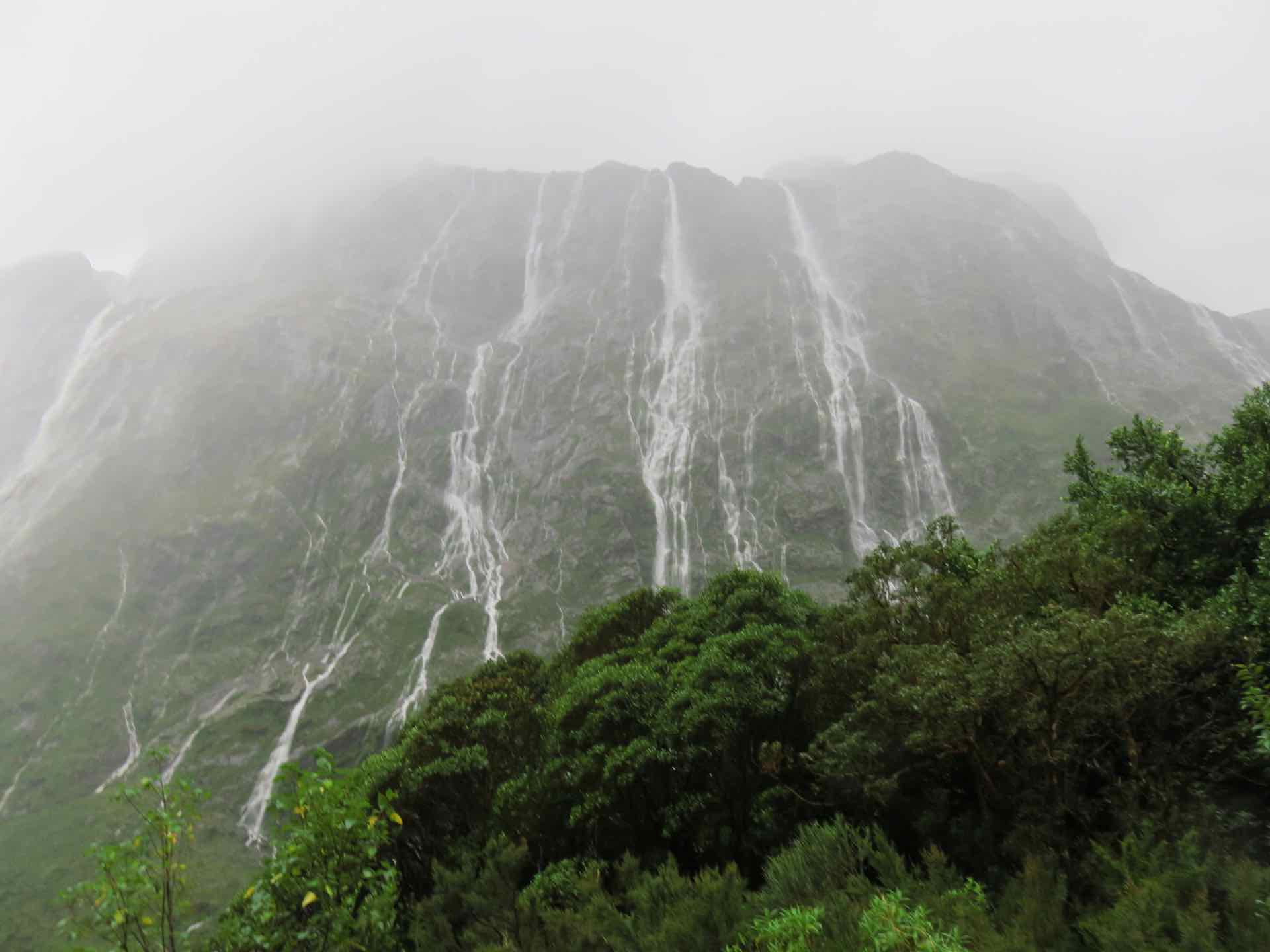
The sound runs 15km in from the Tasman Sea at Dale Point and the peaks that surround the entrance rise up to 1200m on either side. This view alone makes this destination one of the most popular for tourists in the world. On a good day the views are stunning, Unfortunately these days are rare if you go by the weather stats. Milford Sound is the regarded as one of the wettest places in the world, with an estimated 252 inches of rain per year, and it has been known for up to 250mm to fall in a single 24 hour period. This means that the peaks are often covered or masked by a layer of grey cloud or mist.
Our one concern was the weather. Numerous forecasts has predicted a strong wind and rain driving in from the west. As we went to bed we could hear the wind start to pick up. By the time we awoke at 5am the wind was rattling the window frames and whistling round the eves of our motel. At least it was not raining in Te Anau…….yet.
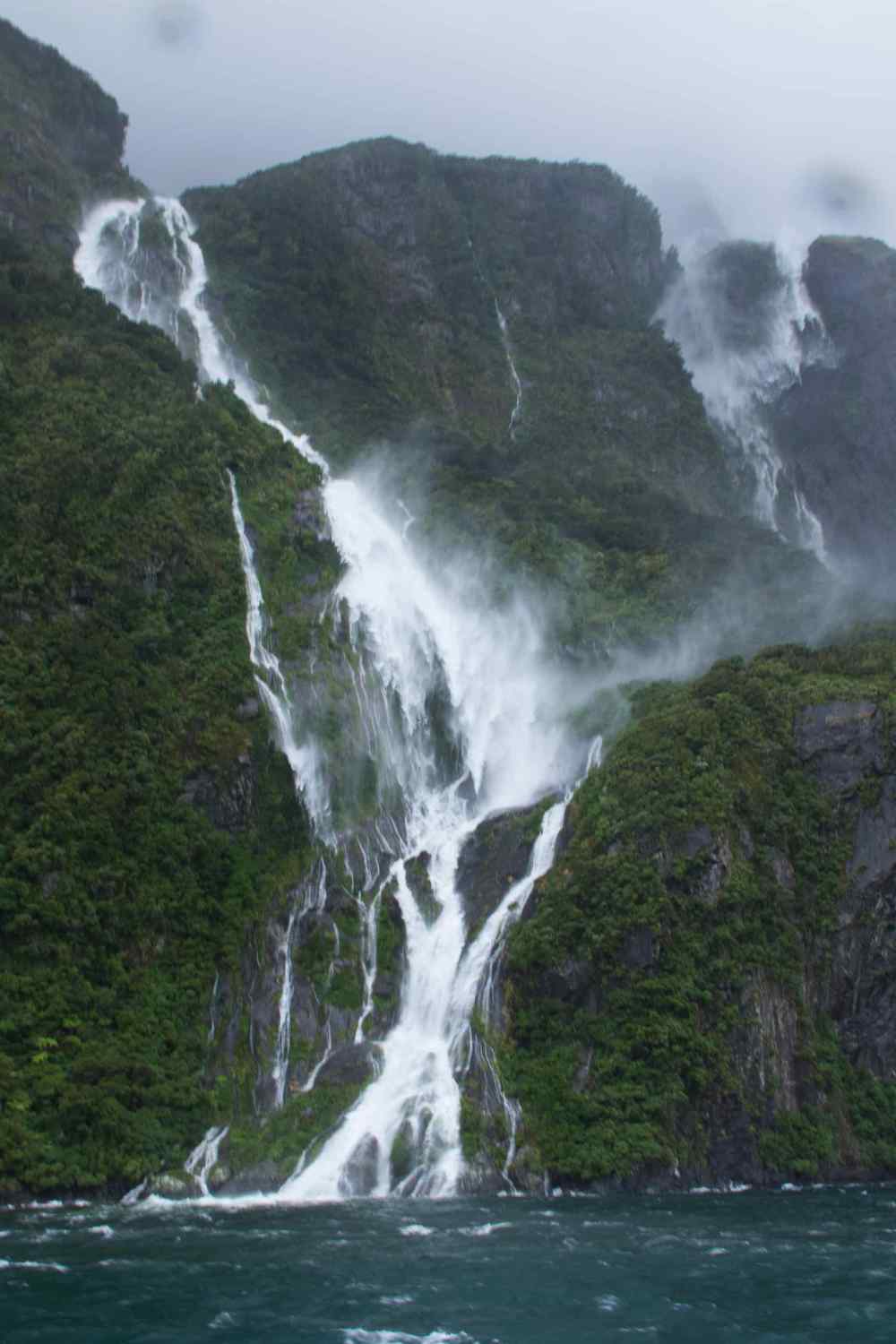
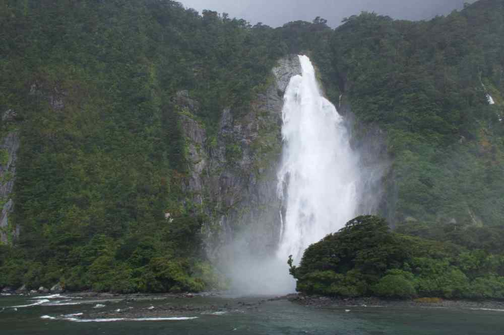
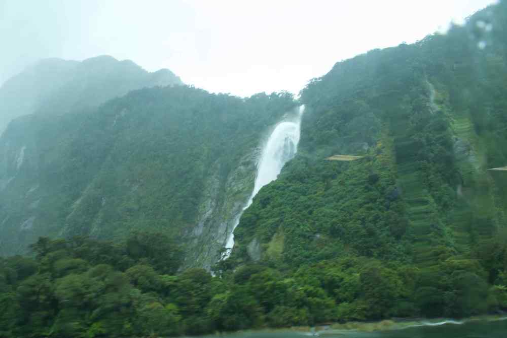
As we set off in the dark just before 6am the rain started. It was like someone had turned a tap on. It poured down. The road to Milford Sound has a number of viewpoints that are worth stopping at, if it was light but as we started to climb into the mountains, the rain got heavier and streams of rain water were flowing down the roadside. As it got lighter midway into our journey the scale of the peaks started to reveal themselves, and the reason why this area is so popular with tourists. The rain creates numerous waterfalls which tumble off the peaks and gives the rock face the appearance of having many white veins running down its face. The road became more twisty, the rain came down harder still and the wind howled as we got closer to our destination. The last major road landmark before arrival is the Homer Tunnel. Carved through the rock at an altitude of 945m above sea level and at length of 1.2km it is an unlined tunnel; that is, it is a tunnel of rock descending at gradient of 1 in 10 with a sharper drop at the Milford end. It is a single track road with traffic control at either end and at busy times this can mean long delays for those coming to Milford. Once through the tunnel the road emerges into forest carpeted canyons that descend to the sound. By this time it was fully light so the scale of these things could be appreciated. The waterfalls tumbling off the mountain sides defy description. This was breath taking even in the wind and rain and we had not yet arrived at the terminal.


Views of the rainfall off the cliffs on the road in to Milford Sound
Arriving early means it is easier to park and we found a slot opposite the cafe. The wind was blowing a steady 50kts (57mph) according to a weather forecast, so this was going to make the cruise a little uncomfortable. We walked quickly to the terminal in driving rain and checked in. At this point, Lyn, who is rarely comfortable on anything that is not solid ground, decided that the sound would be too rough for her with the rain and wind and decided not to sail. She would meet me in the cafe after the cruise.

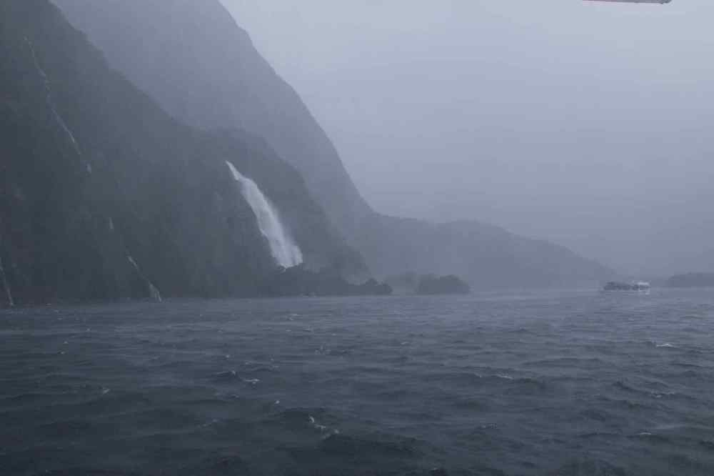
Lyn’s view of Milford Sound whilst I was cruising. Mitre Peak is the one shrouded in cloud
I boarded and took a seat on the upper indoor observation deck. When we sailed, the boat which normally holds around 250 people was less than one quarter full so there was plenty of room on the viewing areas. Others coming aboard had booked breakfast as part of their package so were tucking into a hearty meal as we moved away from the jetty.


Four shoes of the boat out in Milford Sound
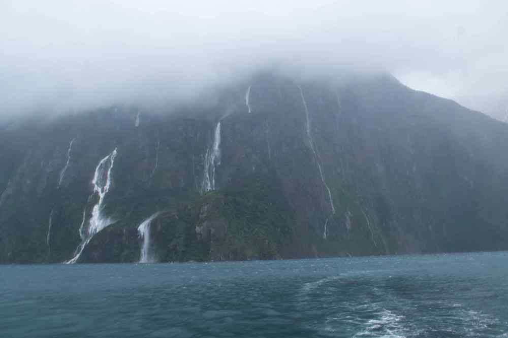
As we turned and sailed out into the teeth of the wind the full scale of the storm became obvious. Horizontal visibility was about half a mile but you could not make out any of the peaks, and the one that the sound is renowned for on a clear day, Mitre Peak which dominates the landscape on a clear day was anonymous. However this did not detract from the experience because the waterfalls pouring off the cliffs were spectacular. With the wind, many were actually being blown upwards! Spray was being blown off the tops of the waves in all directions.


More views of the sound – Visibility not stunning
Once clear of the harbour, the Captain opened up the bridge to visitors and a small number of us stood quietly behind watching the progress down the sound. Either side of the bridge are outdoor viewing areas facing forward. At the stern of the boat was access to the top deck outdoor viewing area and an undercover platform. I think I saw only two people risk standing outside on the top deck! I spent most of the cruise on either of the observation decks depending on which had the better photo opportunities and which was the driest!
The heavy rainfall was creating dozens of temporary waterfalls (as well as enhancing a number of major, more permanent ones) cascading down the cliff faces, some reaching a thousand metres in length. Smaller falls from such heights may never reach the bottom of the sound, drifting away in the wind. The journey down the left side of the sound took around 50 minutes. On a clear and calm day the route takes passengers out of the shelter of the sound into the Tasman Sea, but as today was anything but calm and clear we were relieved to hear that the captain intended to turn the boat on the edge of the sound and stay within relative shelter. As the boat turned so it got rougher and began to roll about being side on to the wind. That was the most uncomfortable part of the trip for me.

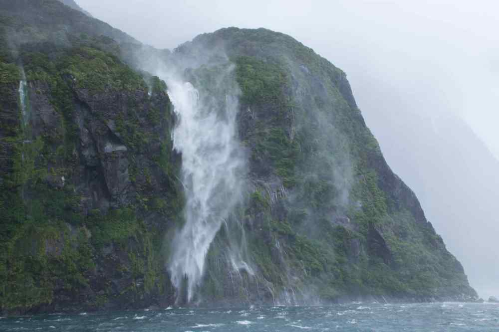

Top to Bottom: The power of the wind blows the waterfall upwards; The Four Sisters falls have some new siblings; Blown Away; Copper Point Falls; Another view of Copper Point Falls.
On the return leg one major landmark is Stirling Falls. These drop 151 metres These are iconic as many tour leaflets show a cruise boat sailing into a waterfall spray so that passengers can experience it. Well today was no exception and the boat sailed close to the rocks and the wind blew the spray over the boat, soaking those stood in the way. I ducked out just in time but one or two hardy souls persevered and duly took a soaking.
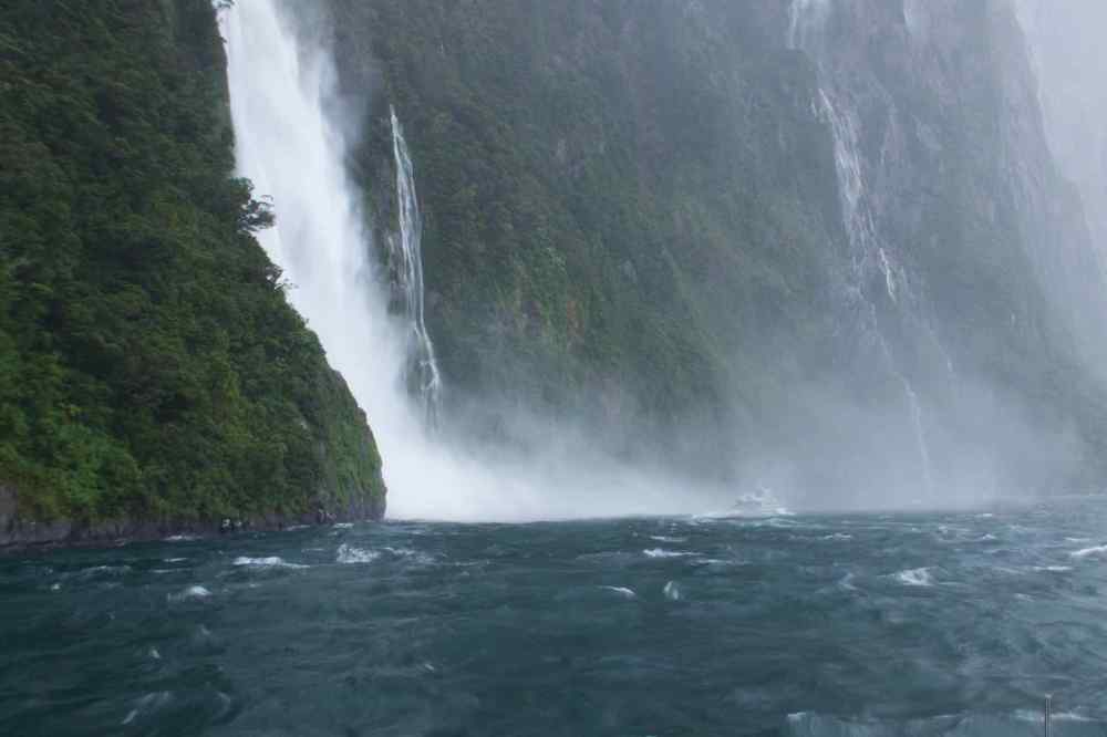
Stirling Falls – Note the size of the cruise boat in the spray of the falls.


Three views of Stirling Falls
Part of the inbound leg saw us dock momentarily at Harrison Cove. This is a sheltered part of the sound and is home to the Milford Underwater Observatory. You can visit this place, getting dropped off and picked up on a later sailing. Also if you are into kayaking, you can get off here and a guide will meet you and take you out on the sound in a kayak. Oddly there were a number of people willing to do that too, but their trip depended on the assessment of their guides as to whether that activity should take place. Rather them than me in that weather.
Our last landmark before returning to the harbour are the Lady Bowen Falls. The Bowen River travels a short 5 mile journey before plunging spectacularly off a 162m cliff face into the Milford Sound. These falls are higher than Niagara Falls (51m) on the border between Canada and the USA but the latter are more spectacular because of their width. Shortly after this stop we returned to the shelter of the harbour. It would have been good to see the sound on a sunny calm day but seeing nature in all its force, power and might is an awe-inspiring experience and one which will stay with me. I hope the photographs which accompany the blog try and show what it was like and the experience to be had out there in any weather.

Four images of Bowen Falls as we approach the harbour
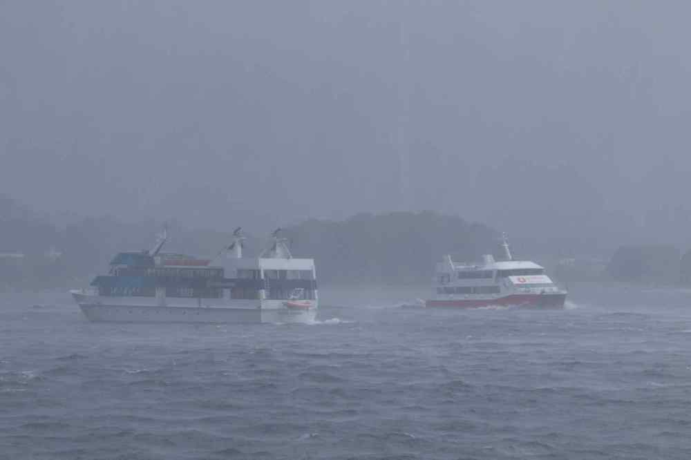
Two boats in the sound. The right hand boat was similar to the one I cruised on.
I’d like to say “once back on dry land” but that would be wrong, as the rain had intensified even further and as I made my way back under the covered walkway to the cafe I still got soaked by the driving rain blowing in through the open sides of the shelter. Re-united with Lyn we decided that there was little point in staying at Milford Sound because of the weather and headed back to Te Anau.


Views on the road home


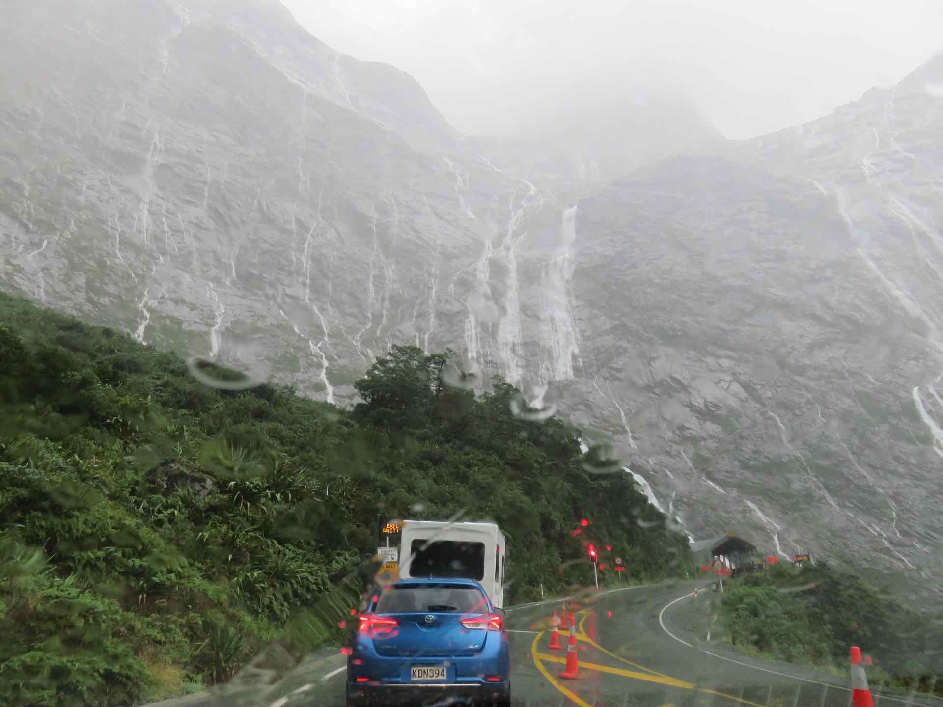
Waiting at the Homer tunnel on the way home.
Travelling out back up the road the streams of tourists and coaches that were coming in the other way had multiplied and the car parks were full, even on a foul weather day. The drive back was as challenging because of the rain water streaming off the rocks onto the roads and the increased danger of rock falls caused by the torrential rain.
We will return to Milford Sound. We both feel that because of the atrocious weather conditions that we want to come back and experience the sound on a calm and clear day. Lyn especially has missed out as the weather was too rough for her to sail.

Goodness gracious . . .!! Can’t keep up with all your adventures . . . Wow xx
LikeLike
Hope they bring you some pleasure in the rubbish weather you guys are having to endure at the moment.
LikeLike
Hi Both, Hope you are recovering from “The Beast from the East”. We have difficulty keeping up with ourselves! On last leg in NZ now before Melbourne on Saturday. It has flown by. See you soon Dave
LikeLike