Who is St Cuthbert and what is his way?
St Cuthbert was an Anglo – Saxon saint in the early Northumbrian church. He was a monk, bishop and hermit in the monasteries of Melrose and Lindisfarne, living between approximately 634AD and 687AD.
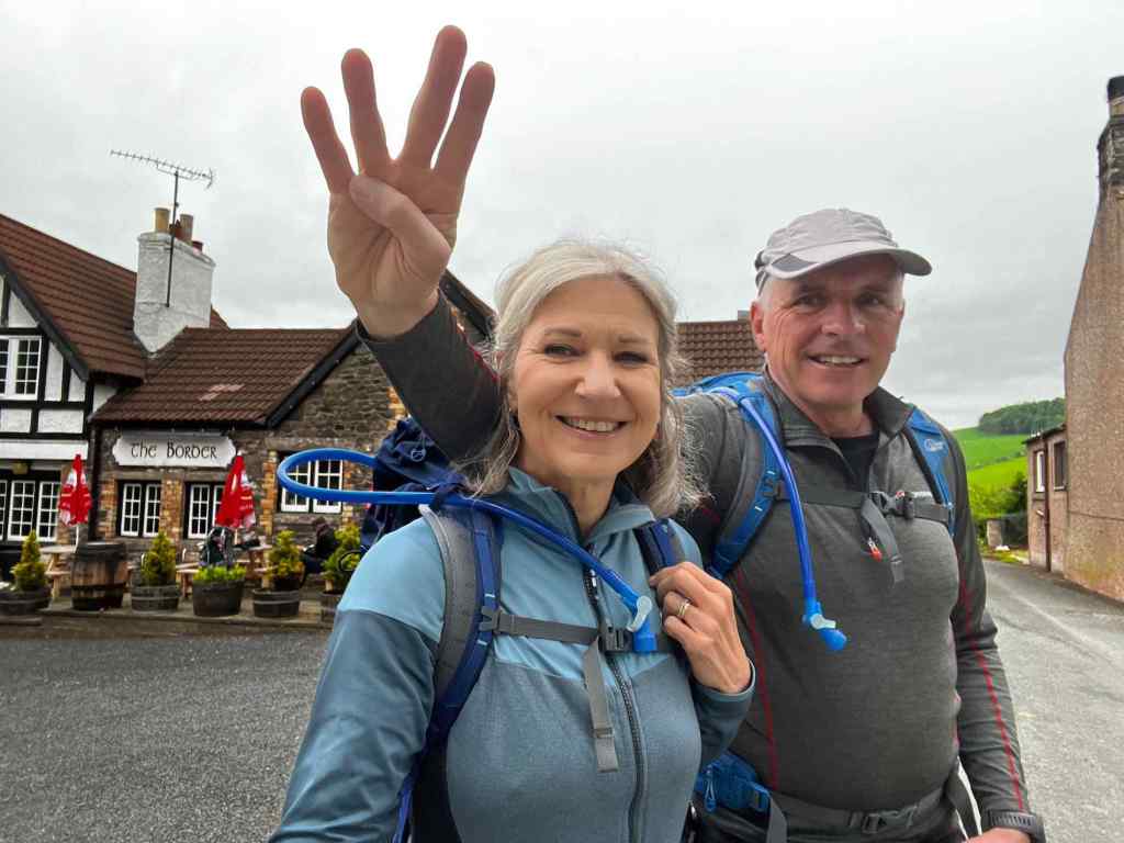
St Cuthbert’s Way is a long distance footpath between Melrose and Lindisfarne and commemorates the pilgrimage St Cuthbert took between the two places during his life. So it was, to Melrose that we headed in late spring to follow in the footsteps of this ancient monk for our point to point walk for2023.
Our journey up involved a night stop at Berwick on Tweed followed by a rail journey to Edinburgh and on to Melrose. Our B&B in Berwick was like a museum, with old pictures and collections of stuff everywhere. There were a couple of unusual pieces in the garden too. (see pictures!)

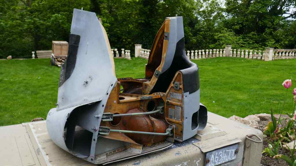
Our B&B in Keswick has some unusual “exhibits” in the garden, namely two wing tanks from an ex RAF Tornado and what looks like part of the fuselage from the same jet. Not sure what you do with this stuff!

Flowers seen in path side borders on the walk into Berwick town centre.

We explore Berwick before departing to Melrose and the start of our walk.

A illustration map of our route from Melrose to Holy Island
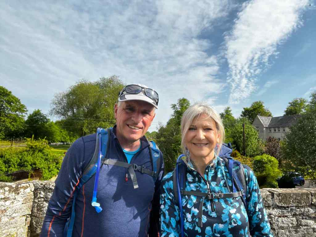
After the obligatory photos at the start in Melrose, we set off on the first stage. Almost immediately we started to climb through woods and eventually out between the round top peaks of the Eildon Hills. These two dominate the landscape and could be seen for miles as we followed the well signposted trail. The weather was fine and sunny with some high cloud, which made for comfortable walking.


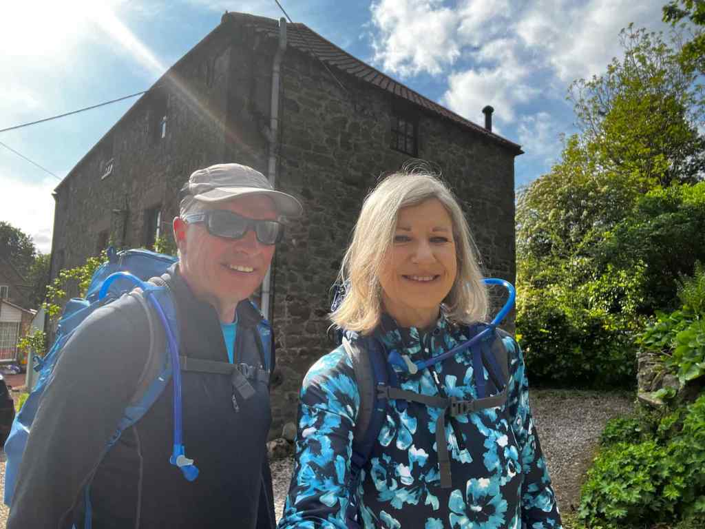
Top: Melrose Abbey – The day before; Bottom: Day 1 of the walk – Always helpful to find the start point!

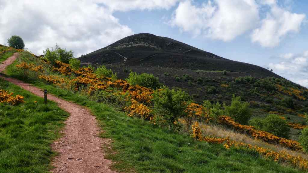
Top and Bottom: Climbing the Eildon Hills just after the start.
Once clear of these hills the terrain was fairly flat and our route very rural. We passed through the small town of Boswells and followed a path alongside the River Tweed for a good few miles. Our track eventually deviated from the river and shortly after we picked up an old roman road through woodland. We passed a stone marking the site of the battle of Ancrum Moor which was fought in 1545. The Scots were victorious and this put a temporary end to the English Army’s incursions into the Scottish border and lowlands. Nowadays the English are welcomed with open arms (well by the vast majority!)
Our first days walk ended at the village of Ancrum where we got a bus a short distance to Jedburgh. The stage actually ended at Harestaines but there is nothing there except woodland and a visitors centre, hence the bus ride.

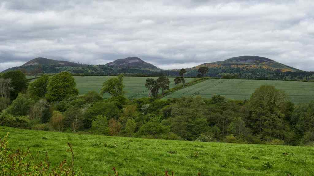
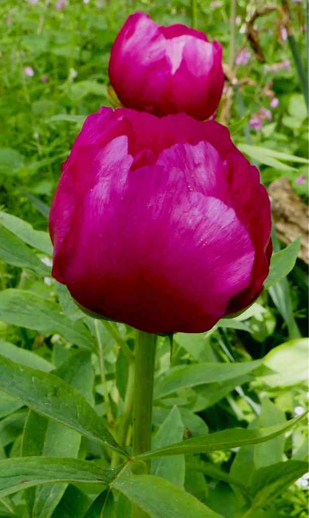
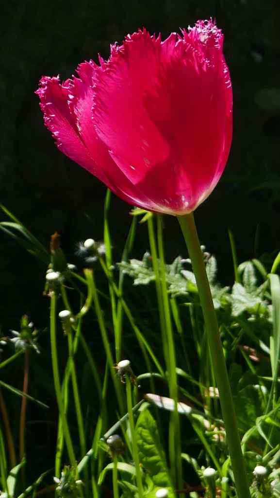
Top: Making friends with the locals; Centre: The Eildon Hills from the “other side”; Bottom: Late flowering tulip. (too early for a poppy)
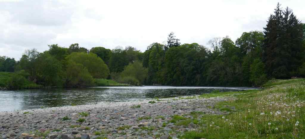
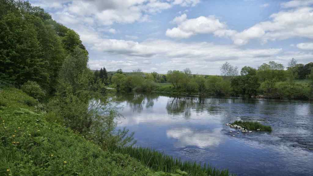
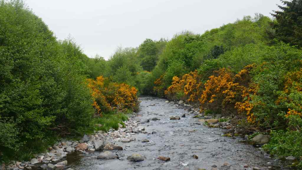
Three shots of the River Tweed. Our route followed this river for a good distance. The centre image is our lunch stop.

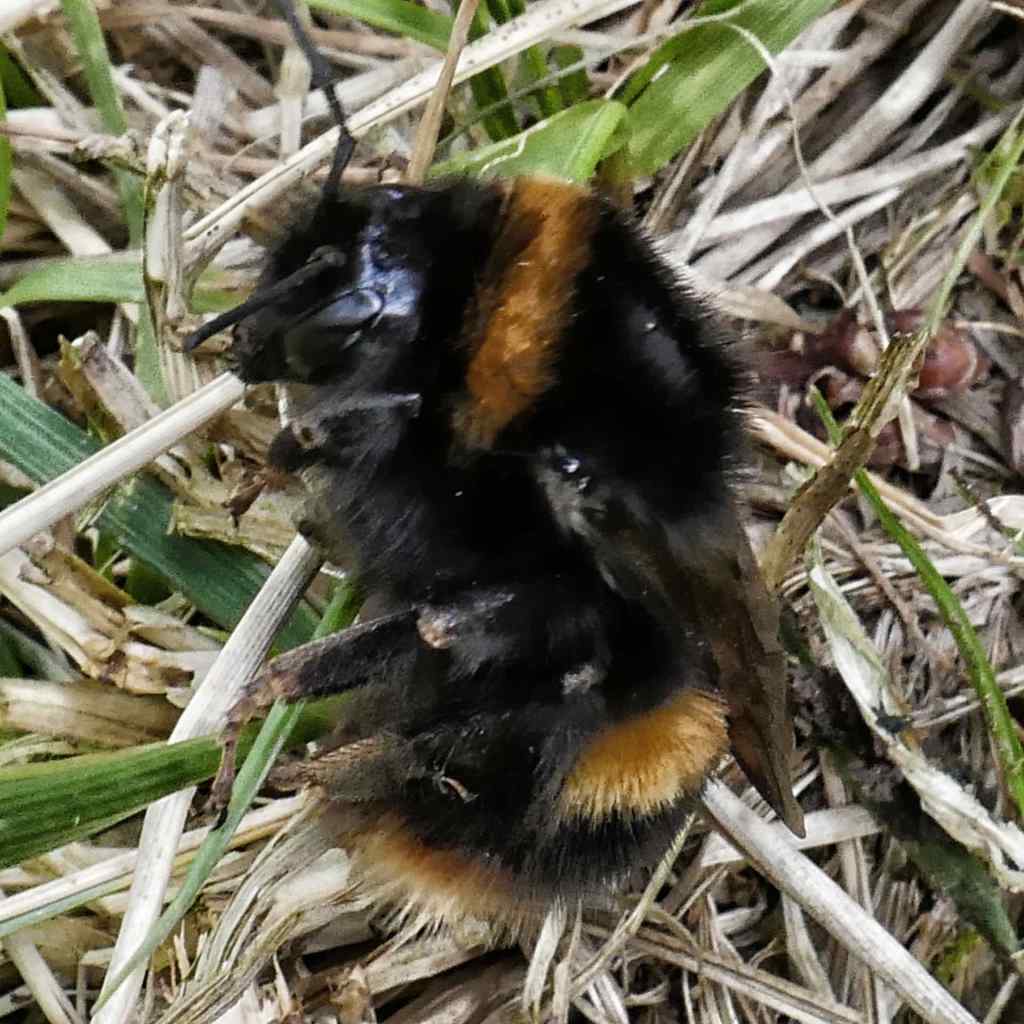
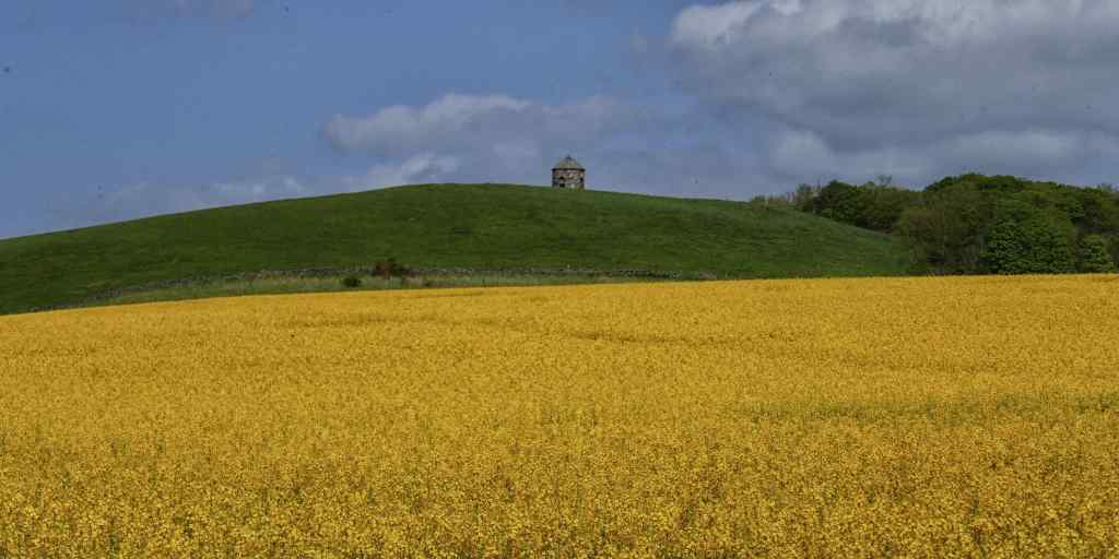
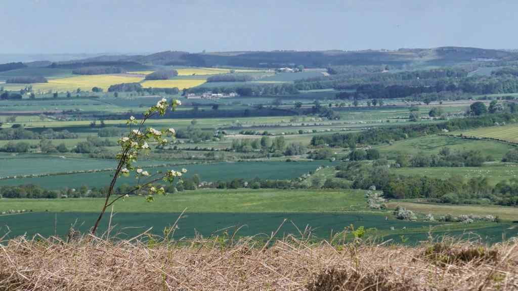
Top: The village church at Maxton; Centre: Wildlife shot, a bee helping itself; Bottom: Oil Seed Rape Field towards the end of our first stage.
Jedburgh is another charming borders town which we would have loved to explore further, but with anther leg of our journey to complete we could not linger. We found our path out of town and had a lovely walk through the woodlands and flower meadows of the Borders.

Top: Leaving Jedburgh; Bottom: Crossing the bridge over the Tweed – Jedburgh

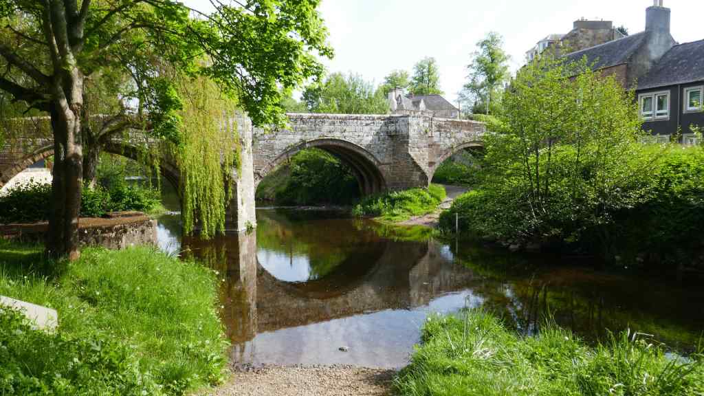
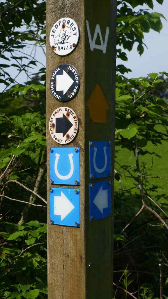
Top and Centre: The river in Jedburgh and the bridge that crosses it. Bottom: Which Way Now?
En-route we passed a castle ruin, Cessford Castle. Built around 1450, the castle was the home of Andrew Ker, an ancestor of the 1st Duke of Roxborough. It had a short lived life for a castle, being captured by Richard, Duke of Gloucester in 1482 being frequently raided by Scots and English soldiers. It was finally abandoned in around 1650.
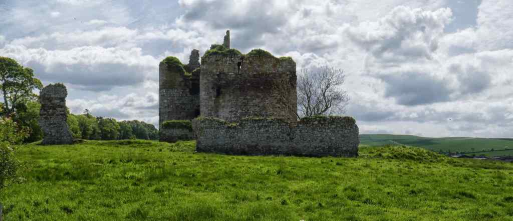
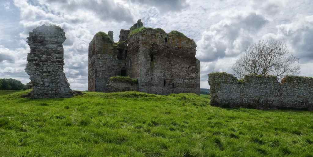
Two views of what is left of Cessford Castle.

Us at Cessford Castle
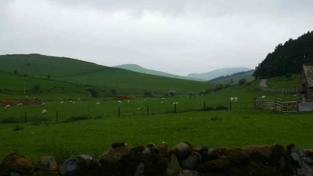
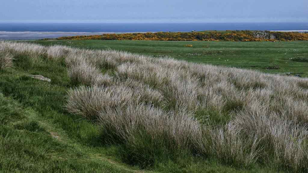
The latter part of todays route took us over rolling grassland hills and eventually to our destination, a small Borders village named Morebattle. Contrary to its name, no battles have ever been fought here. It’s name originates from the ancient Anglian mere -bool meaning dwelling place by the lake, the lake being Loch Linton, nearby.

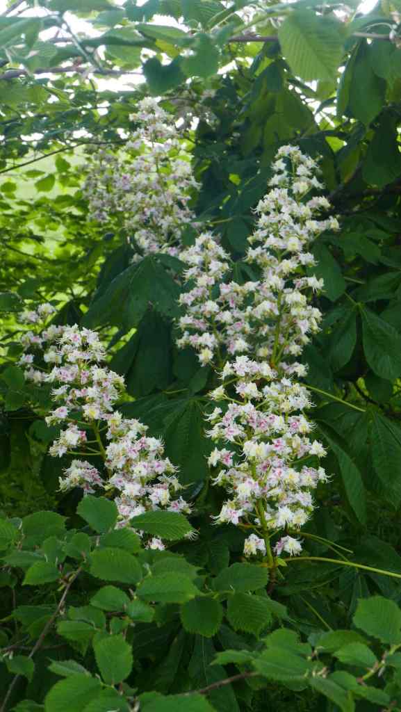

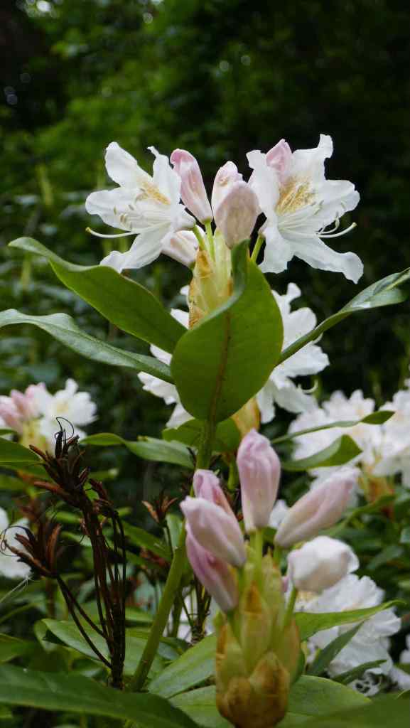
Some of the flowers on our route
The next day dawned grey and cloudy, which was a blessing as it was only short walk of around 7.5 miles to our next destination of Kirk Yetholm.
Leaving Morebattle

Top: The GPS and map said we cross here! Bottom: We actually crossed here, about 400m away!

On the short walk to Kirk Yetholm
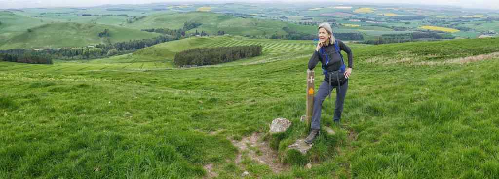
Although it was only a short walk (7.5 miles), it still included a climb to the highest point on St Cuthbert’s Way, Wideopen Hill, which also marked the halfway point of the walk. A gentle descent and easy path saw us nicely into Kirk Yetholm. It is a small village with one pub/hotel. For once we arrived before our luggage carrier so we enjoyed a relaxing drink in the sunshine in their beer garden.
The village is best known among the walking fraternity as the start/end of the first UK long distance walking path, the Pennine Way.


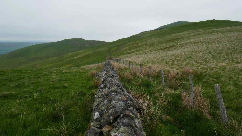
Top: The trail opens out. 2 and 3. More views of the route. Bottom: Wideopen Hill – the highest point on the walk.
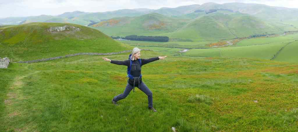
Lyn takes time to admire the view and for some yoga
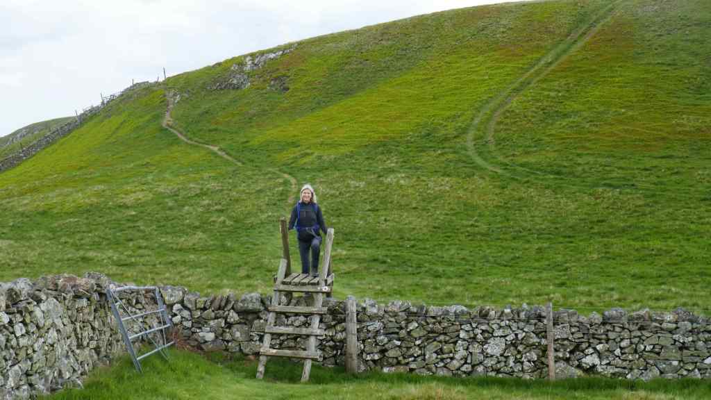

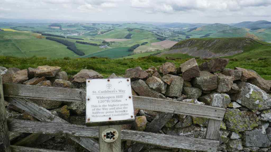
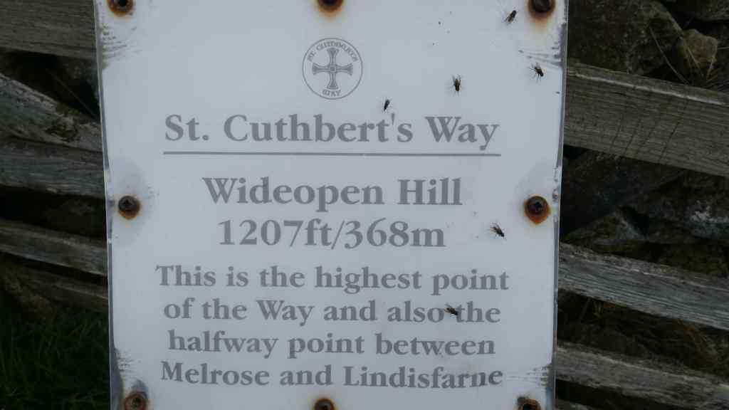
Top: Lyn crosses a stile. 2. More views of the trail. 3. View from the highest point on the walk – Wideopen Hill. 4. Info plate about Wideopen Hill.


Kirk Yetholm – the church and the only pub!
When we departed the following morning we past the Pennine Way commemoration stone as we left the village. We climbed onto the Pennines heading eastwards. The sunshine of the previous day had been replaced with ominous grey cloud which sat low above the summits.
Day 4 starts – Leaving Kirk Yetholm
After about an hour’s walking we came across a signpost and a wall. This was the stile that we crossed to walk into England. We paused for photographs before moving on, with still many miles to our destination of Woller.


Top: Curious locals; Centre and Bottom: The Border – England one way, Scotland the other. Which way now?
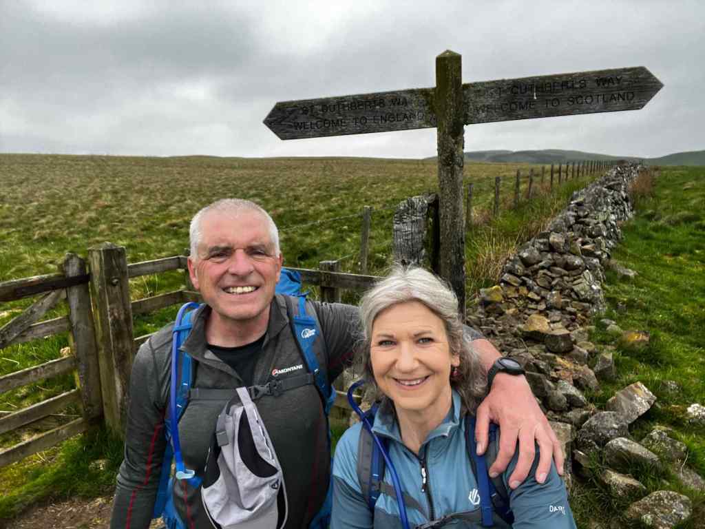
We cross the border into England – Not a soul in sight and only the sheep for company
The clouds got lower and as we left the village of Hesspool and started another long climb on to the Pennine moorland light drizzle started to fall. This range is notorious for poor weather and on this leg the area lived up to its reputation. As we climbed the cloud came down on to the summits reducing the visibility and the drizzle turned to light rain. It became universally dull grey and as we walked on, following a wide stony trail across the moor the light rain became that sort of lazy stuff….the rain that goes right through you rather than round!

Top: River Tweed at Hesspool with the grey cloud gathering; Centre: On the trail; Bottom: The cloud gathers on our route.


Trekking across the wet moorland as Lyn disappears into cloud;
We paused briefly for lunch, sheltering against a stone wall before moving on. By the time we were descending into Woller, about 2.5 hours later the rain had eased and the cloud lifted a little. We were looking forward to enjoying coffee and cake in local cafe but when we arrived we found that they were all closed for the day. It seemed that 3-30pm was too late!

Start of the descent into Woller.
The compensation was excellent accommodation and an outstanding evening meal in a local Italian restaurant that evening.
The next day was our last full day of walking. It dawned bright and sunny and the forecast promised a dry day. We made our way out of Woller and enjoyed a steep climb to the hilltops above the town. This gave us fine view of the town and to the landscape beyond, from where we had walked.
The sun shines as we leave Woller
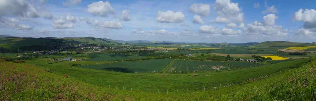
Panorama of Woller from the hills above

Top: More fine views; Centre: A lovely tulip (I think); Bottom: A view back up the hill we have just descended.


Top: Lyn on the trail; Centre: A grass path; Bottom: Coffee stop and a Flypast by an RAF A400 Atlas
Our route took us through St Cuthberts Wood and past his cave. Legend has it that St. Cuthbert’s body was hidden from raiders and marauders in this place as it was taken round the country after his death. Strange habits in those bygone days!

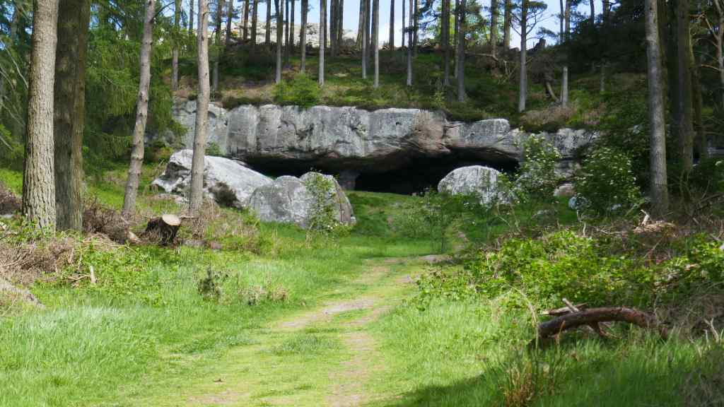
Top: St Cuthberts Wood; Bottom: St Cuthberts Cave

Carving of St Cutrhbert
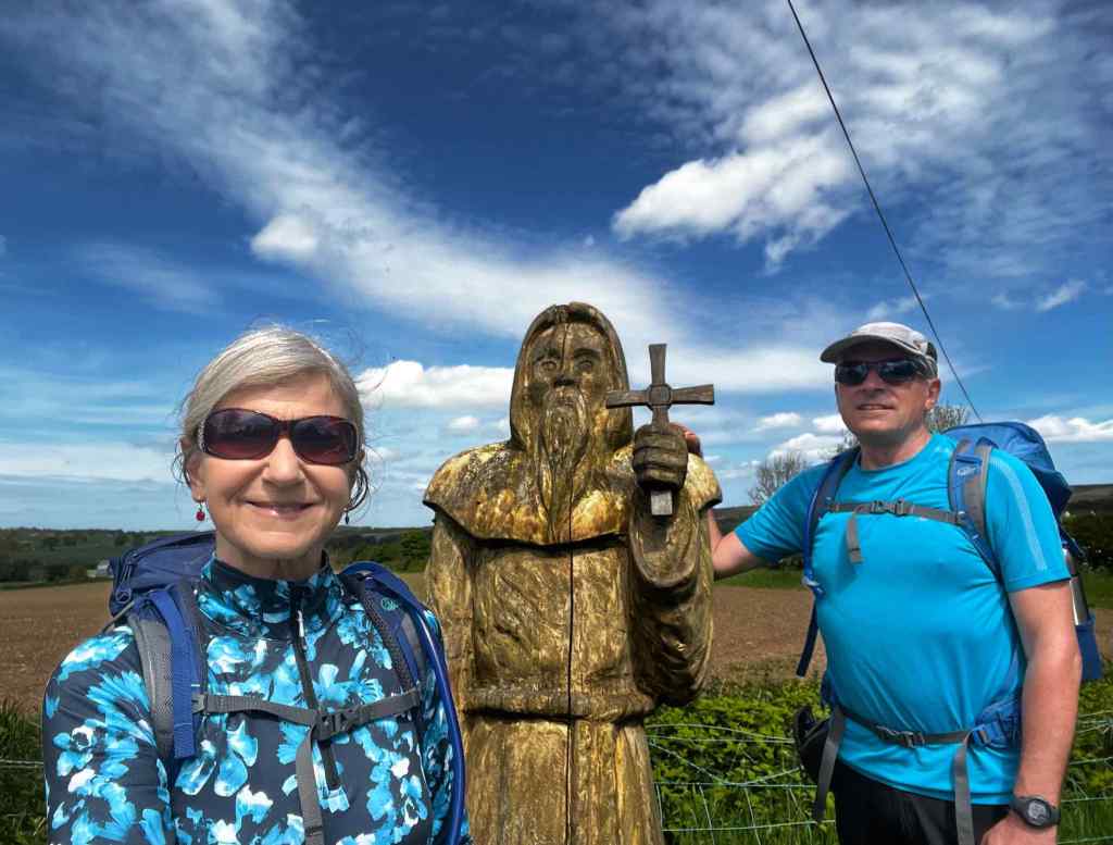
We greet St Cuthbert – His reply was a bit wooden!
Shortly after this we paused for lunch on a hilltop with glorious views of the North Sea ahead of us. From here our walk was relatively flat to the village of Fenwick, where we paused for afternoon coffee and cake in a delightful village shop. Our accommodation was about 2 miles away, on the Great North Road (A1).

Views from our lunch stop to the North Sea
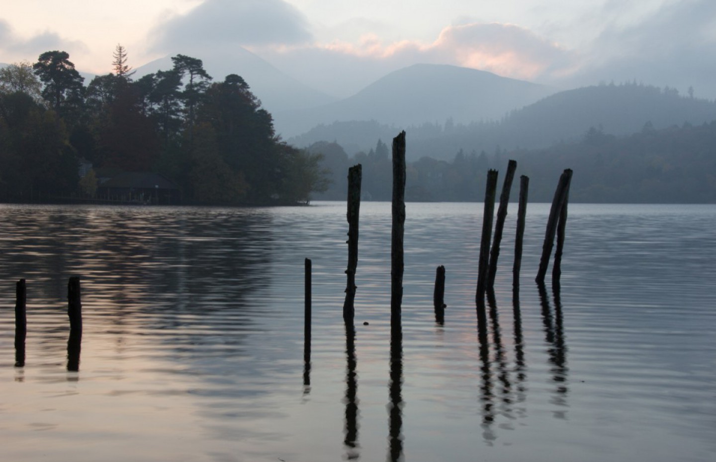
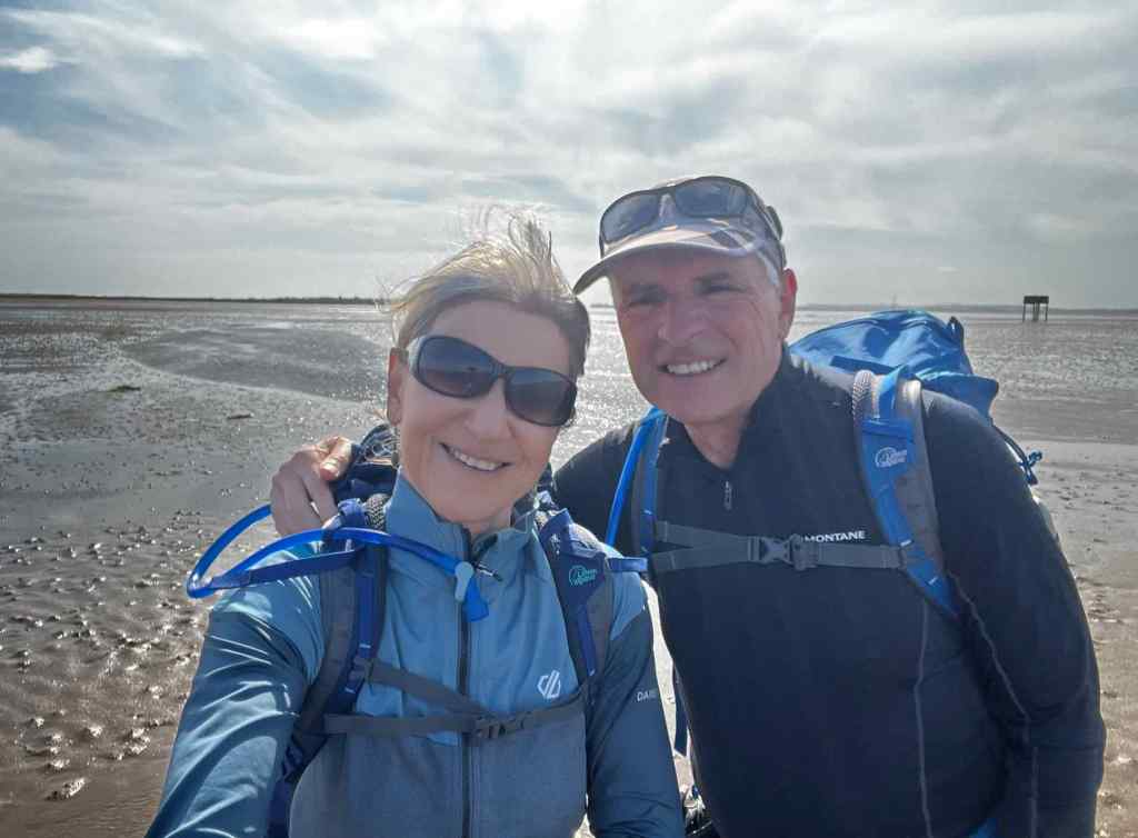
Our last day on the trail was a short, 6 mile leg on to Holy Island. As we approached the causeway, the tide was receding, so we followed it on to the island. There is second crossing which is to follow a line of poles across the sand. This is known as the Pilgrims route but it appeared to be partially submerged in places so would not have been good idea for a walk.

Top: Leaving Fenwick; Bottom: A short walk later we are on the causeway to Holy Island


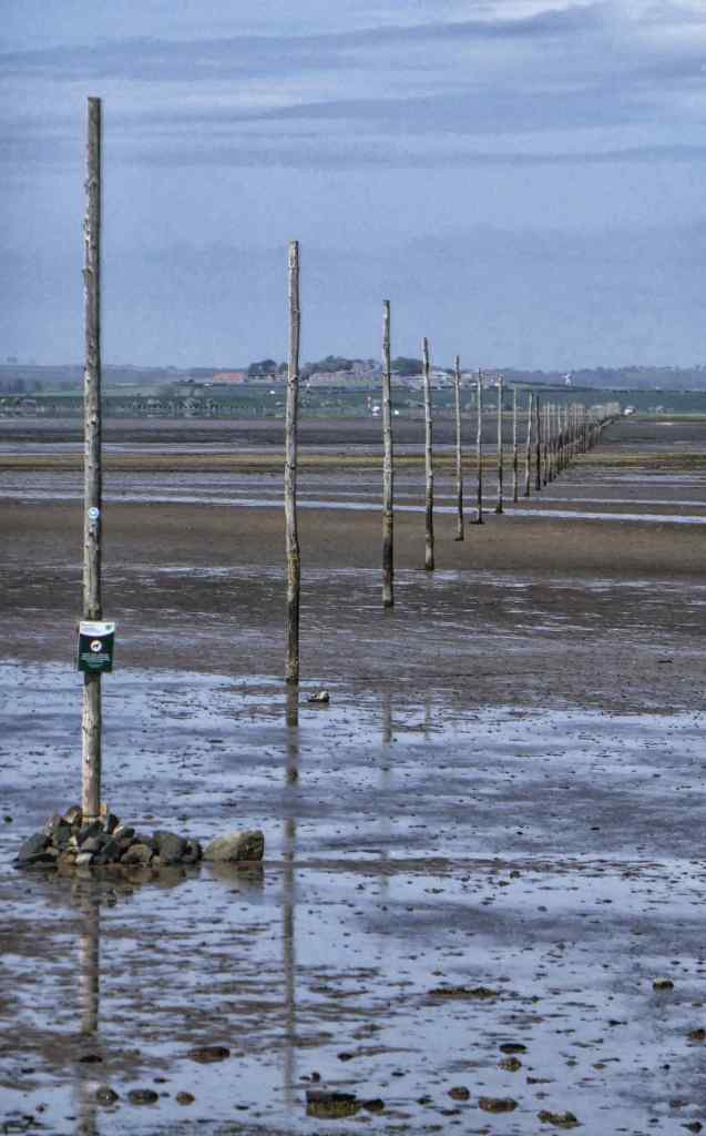
Top: Crossing – The Pilgrims Route to Holy Island; Centre: One of the Refuges on the causeway crossing to Holy Island; Bottom: The Pilgrims Route looking back to the mainland
After coffee and cake we headed off to explore. There is a path all around the island and we went off the beaten track, walking along beaches and generally trying to steer clear of the hoards who were crossing in cars for the day.

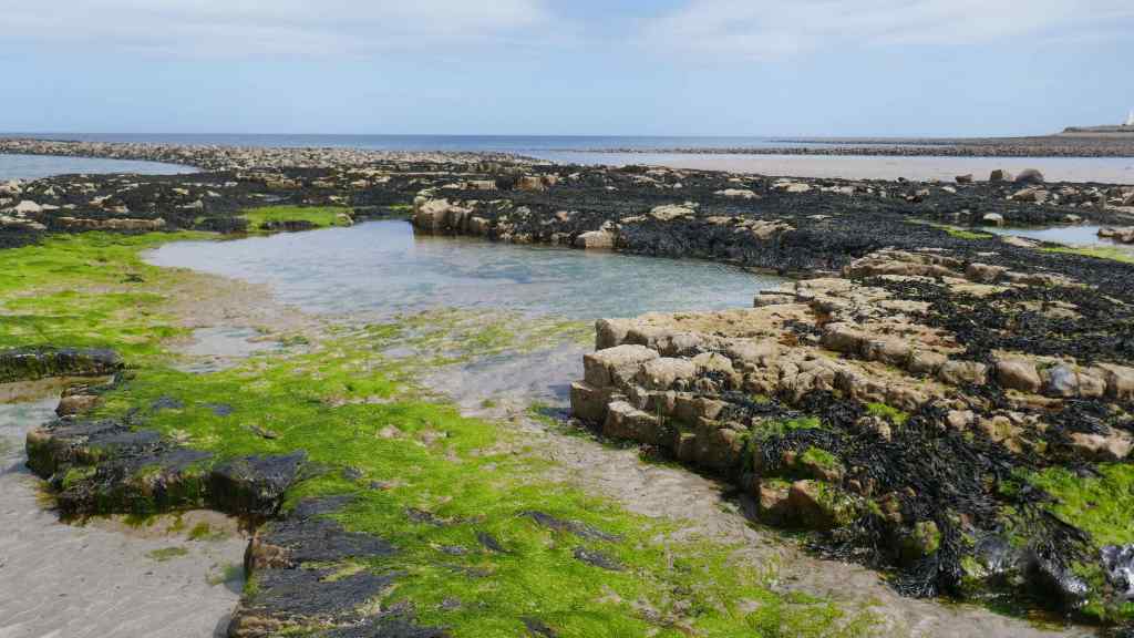

Top: Lindisfarne Beach; Centre: Rockpools at the beach; Bottom: Obelisk on the cliff path on Lindisfarne

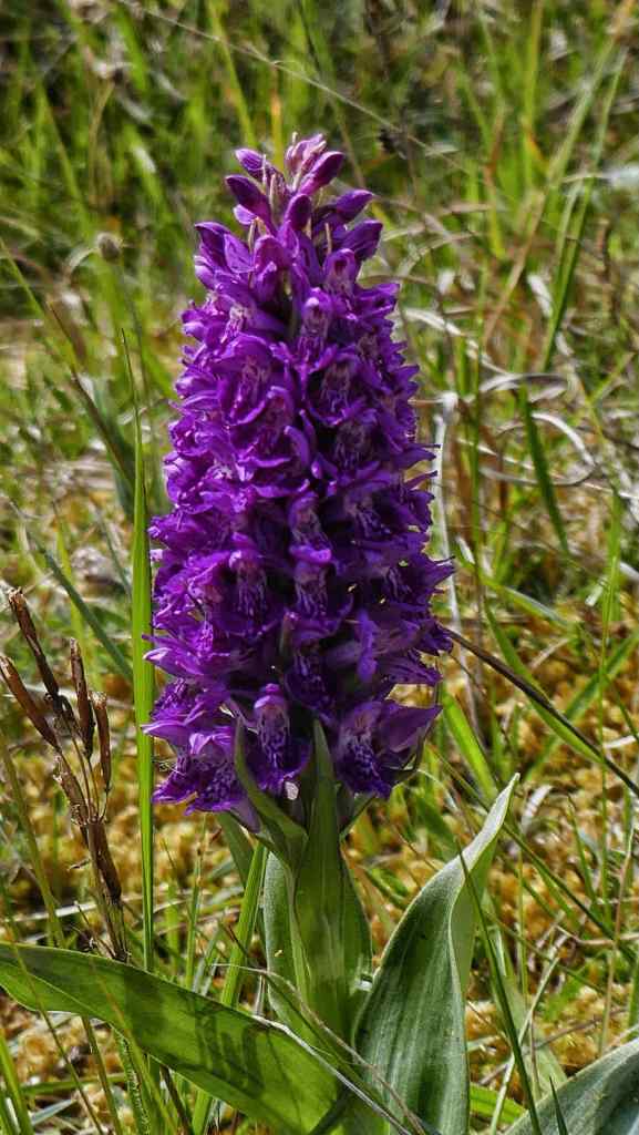
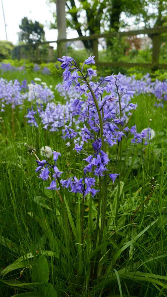
Top: Metal sculptures on the cliff path; Bottom: Wild Hyacinth
Lindisfarne Priory is recognised as the end of the trail and we walked in towards the end of our day. St Cuthbert visited there many times but he died on the Farne Islands which are a short distance to the south.

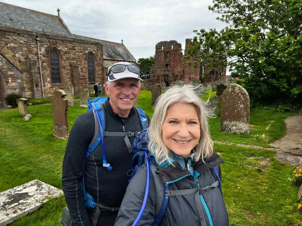
Top: Sparrow chicks nesting in the priory wall; Bottom: Journey’s End – Lindisfarne Priory.
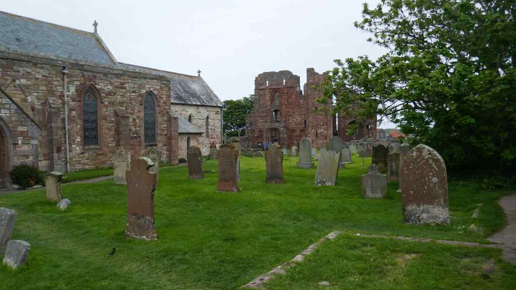
Lindisfarne Priory – Our Journey’s End
We posed for a couple of photo’s to mark the end of our walk before catching the bus back to Berwick on Tweed and our B&B.

Back at Berwick on Tweed
It had been a lovely walk in a variety of landscapes and we had met some lovely, kind people on our travels. One thought, it must have been much tougher for St Cuthbert; no Goretex to protect him from the rain
