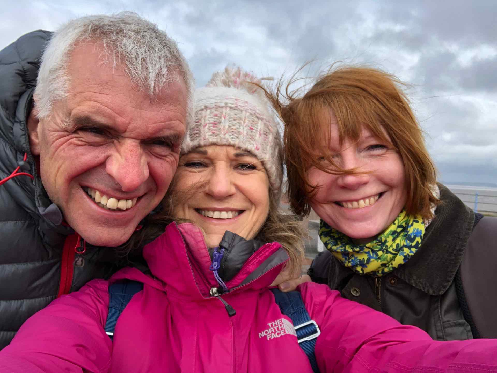
We are on our travels again, this time to the Lake District for some spring walking. On the way up we had a night stop in Lancaster to visit Lyn’s friend Jenny in Heysham, which is close by.
Heysham is a coastal town in the Northwest of England, noted mainly for the ferry terminal to the Isle of Man, and its proximity to Morecambe, a once noted seaside resort but sadly, like many English seaside towns, now fallen on hard times. We met Jenny in Heysham and headed to Morecambe for a look around.
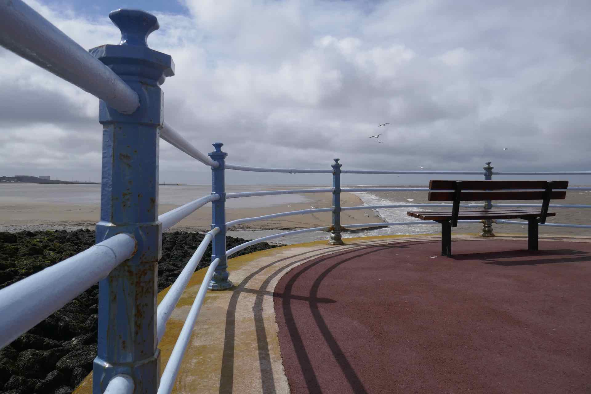
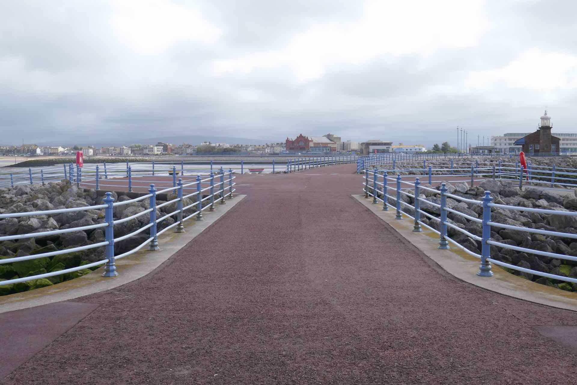
When we visited, the town was being battered by the remnants of Storm Hannah which had swept across Ireland and the west of England so it was cold, wet and very windy. After coffee in the only hotel in Morecambe, a rather austere looking 1930’s Art deco building (though very smart inside), we walked out along to the end of the pier. It was not the normal style of wood and steel pier though, but a long brick and concrete structure protruding out into Morecambe Bay. Along with sculptures of various birds, at the end of the pier was a small building that used to be a railway station, now long defunct. The wind blew hard and brought with it a biting cold, so we did not linger too long on this exposed jetty.


Clockwise from top left: Sculpture on Pier; Looking back from the end of the pier; Looking into the bay; The three of us on the pier; Midland Hotel, Morecambe; Another Pier shot.
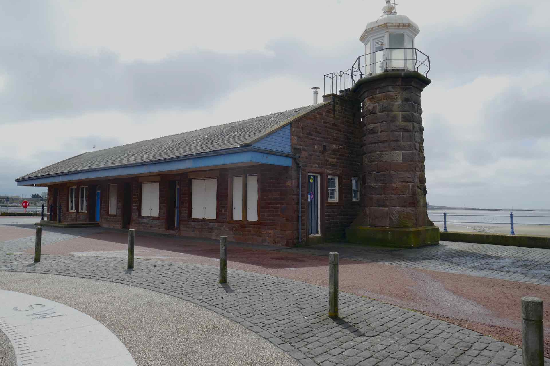
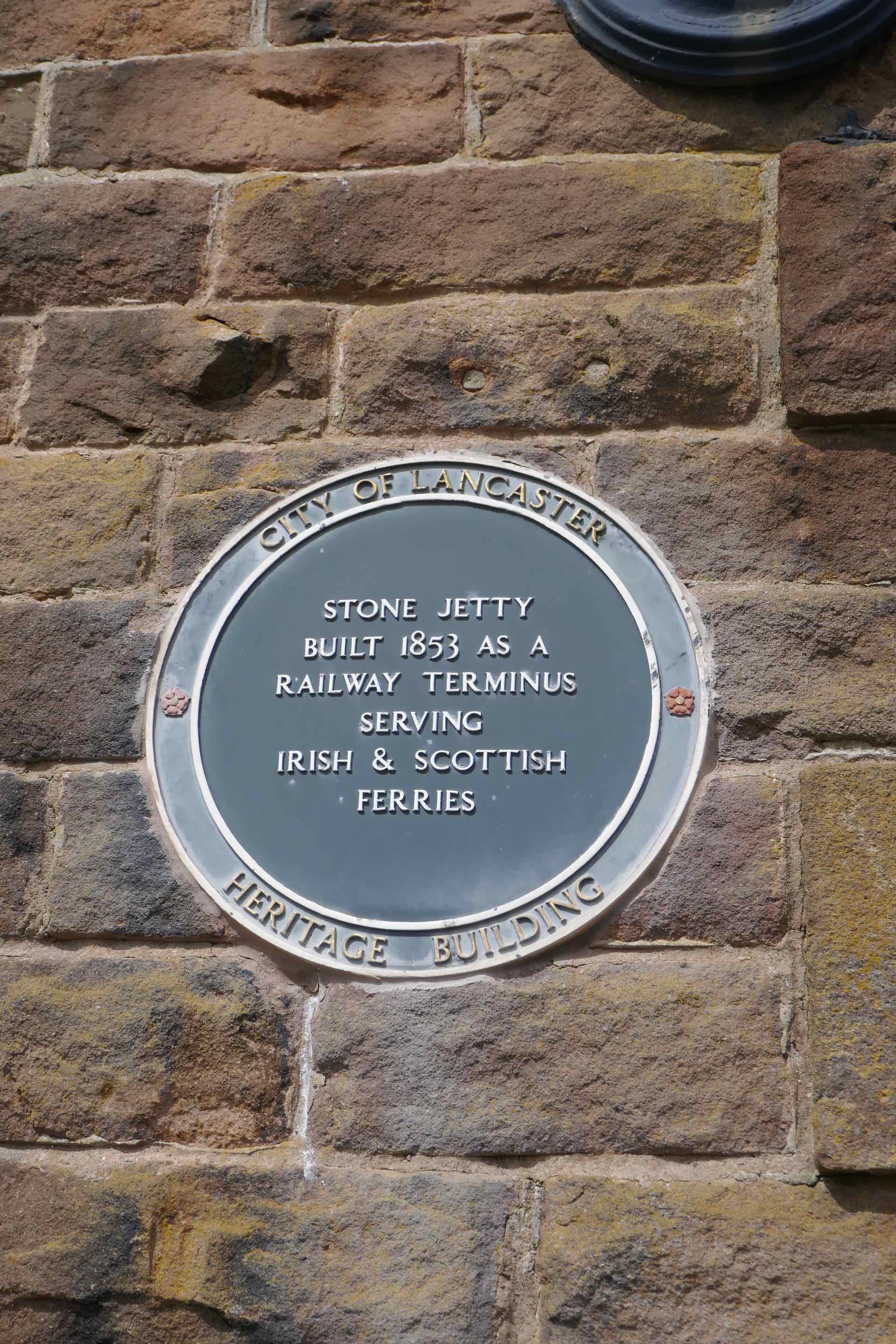


Top: Railway station and explanatory plaque Bottom Left: Windswept! Right: Pier Panorama with Jenny and me.
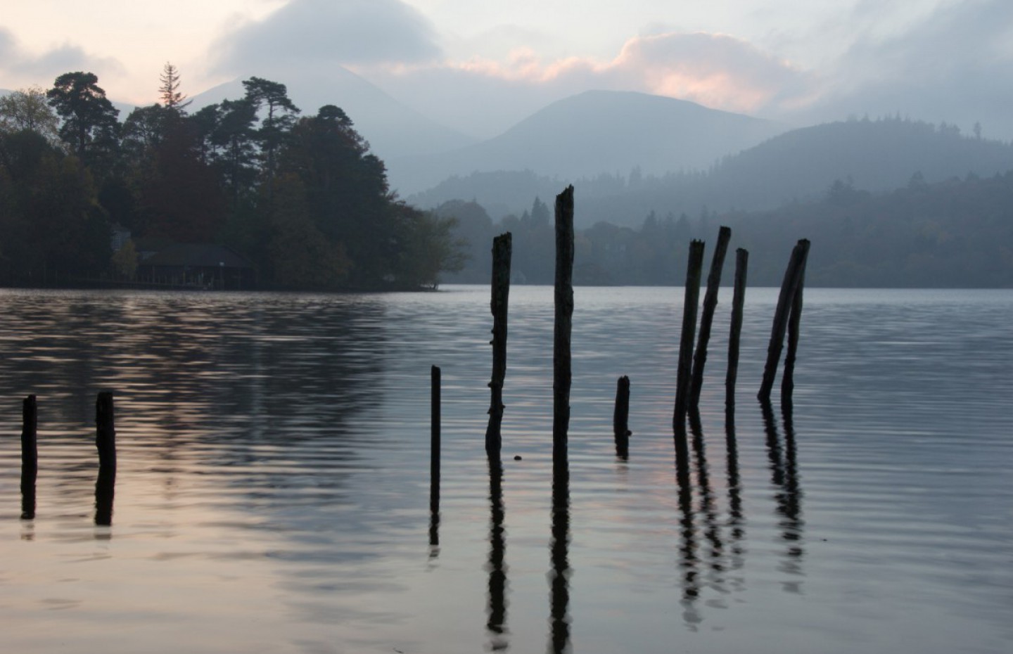
The area around Morecambe Bay was born in the last ice age, when retreating glaciers dumped soft sediments which formed expanses of sand which are now up to 80m deep. Sea levels rose and the area was flooded. The bay is now broad and shallow, with a tidal range of up to 10.5m at spring tides and an ebbing tide that can retreat as far as 12km. This means not much of the bay stays the same for very long, the shifting sands providing a constant hazard to those who try to walk them.


The beach at Morecambe Bay
Morecambe Bay is rare among seaside resorts in England for not having a sandy beach. The shore line is covered in pebbles but as the tide goes out enormous sandy mud flats are revealed which look very inviting to walk on, but they hide a dangerous side. The sand/mud is very soft and littered with unseen areas of quicksand which will swallow up anything that is unlucky enough to walk on it. It looks very inviting, even in a storm, however there are signs everywhere on the sea front advising people not to walk on the sand. People have lost their lives by walking out on the sand and either sinking, or being caught by the rapidly advancing tide. Even in the cold wind and rain the landscape held a fascination and beauty all its own.
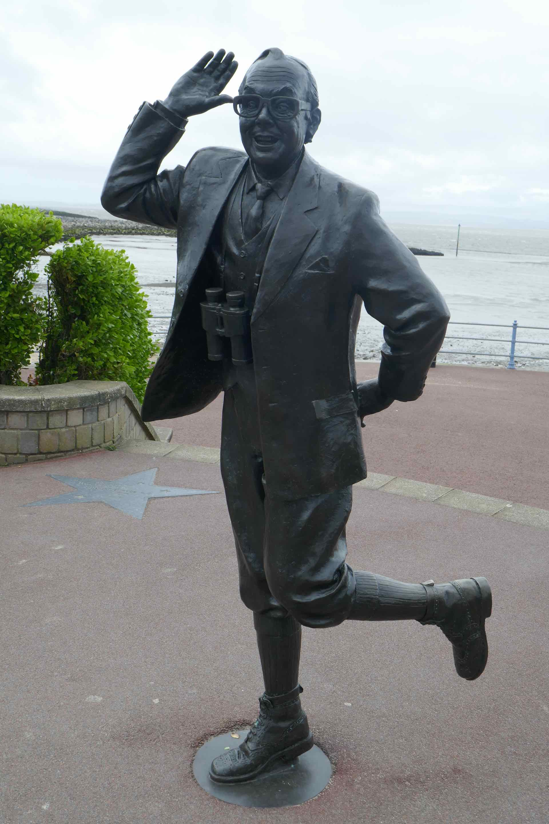
Further along the esplanade is a statue to Morecambe’s most famous son. Eric Morecambe was one half of the UK’s most popular comedic double act, Morecambe and Wise. Eric was born John Eric Bartholemew in Morecambe, and in 1941 his partnership with Ernest Wiseman began in the music halls of the UK. Together they grew their act and transferred it to the new medium of television in the early 1960s. They became hugely successful TV stars of their era, their Christmas shows in the 1970s becoming essential viewing for most people. Their 1977 show was said to have been viewed by over 27 million people. This in the days of only three available TV channels in UK! Their Christmas shows are often repeated on TV some 40 years later, and are still very popular. They regularly closed their TV shows with the song, “Bring Me Sunshine” and this title is embedded in the hard landscaping around the statue, together with inscriptions of many of his favourite catchphrases and an exhaustive list of guest stars who appeared on the show. Eric was my Mother’s favourite and to see him immortalised in bronze brought back happy memories of her watching Eric and Ernie on TV.


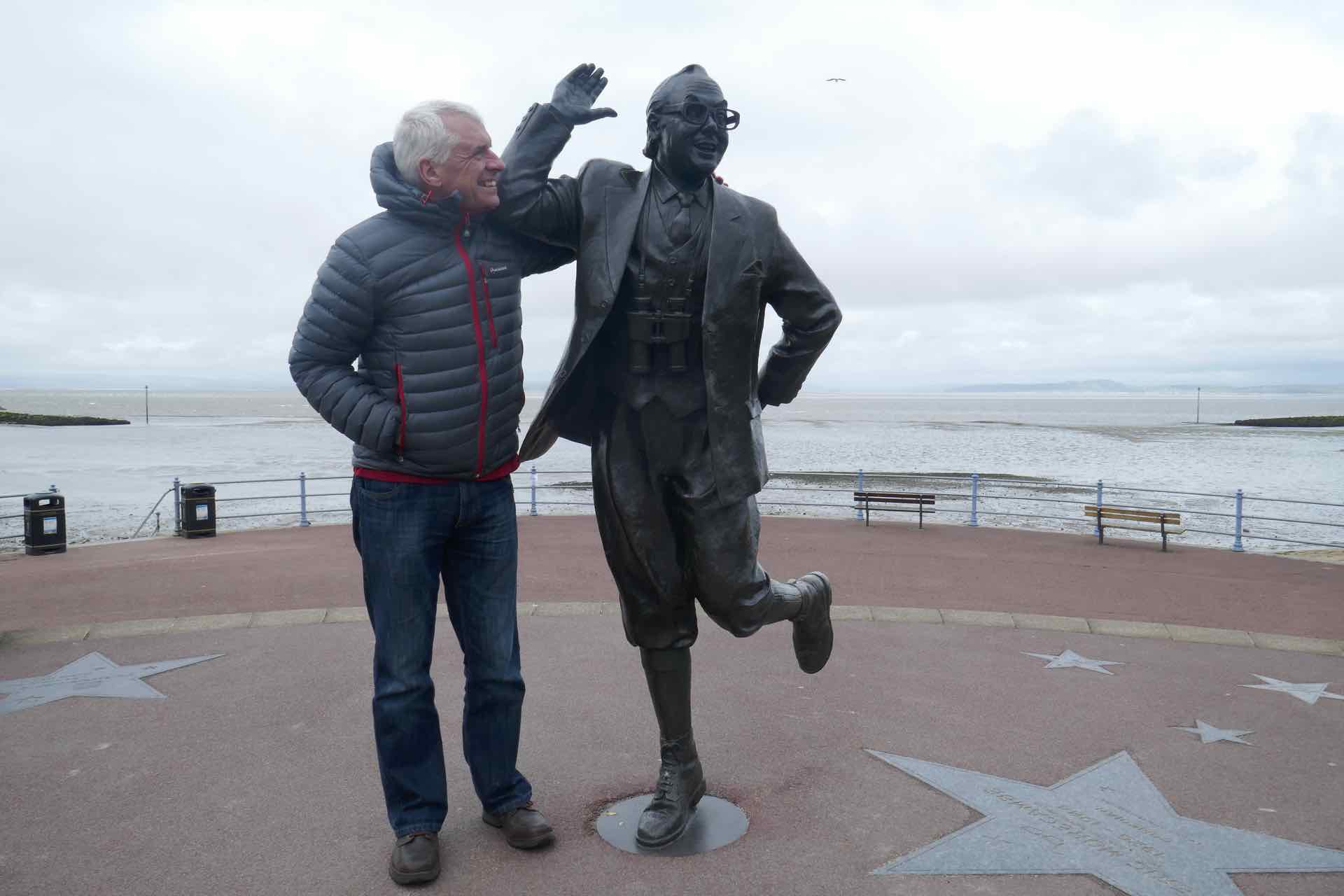

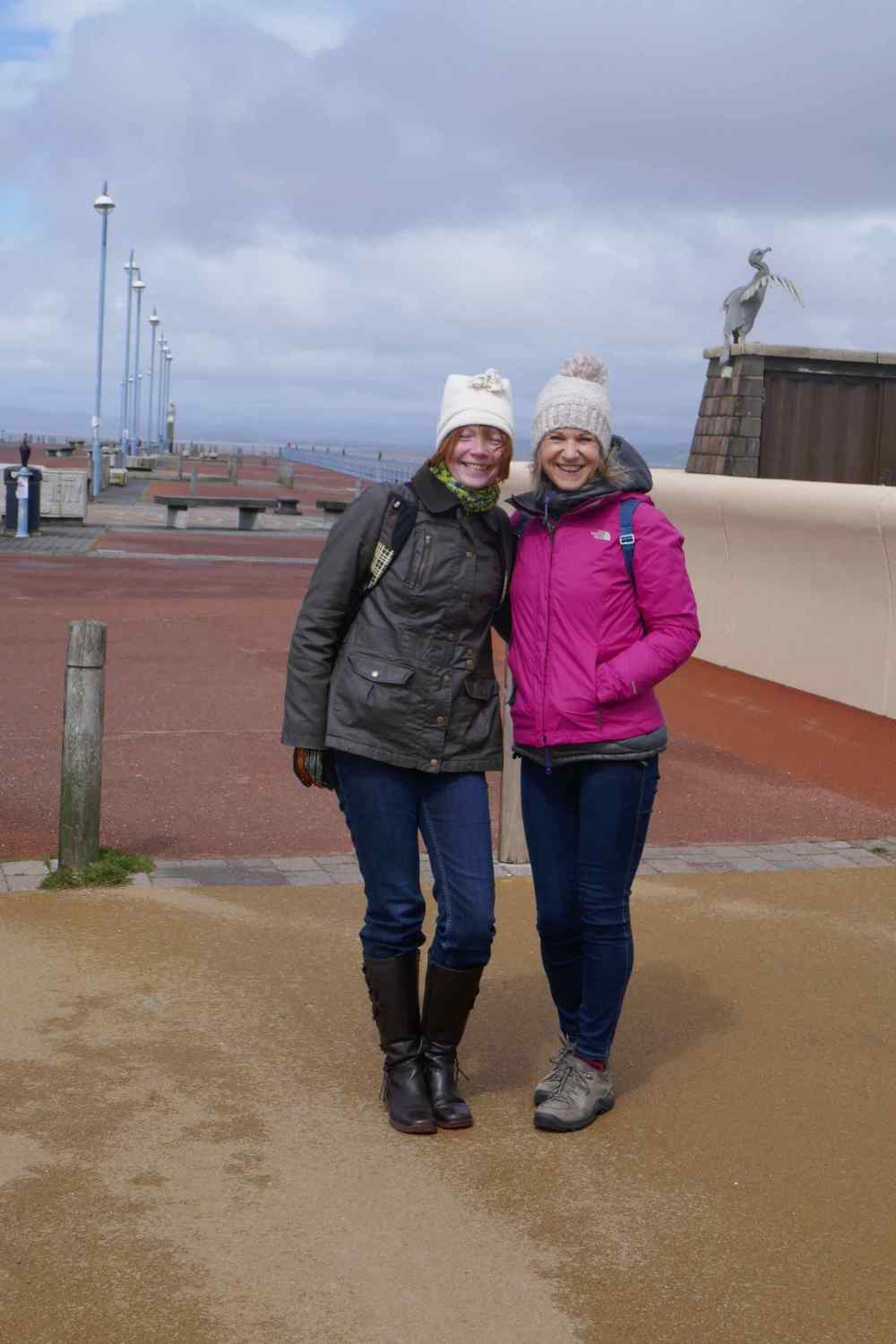
Morecambe’s Famous Son – Lyn and I share the limelight with Eric Morecambe


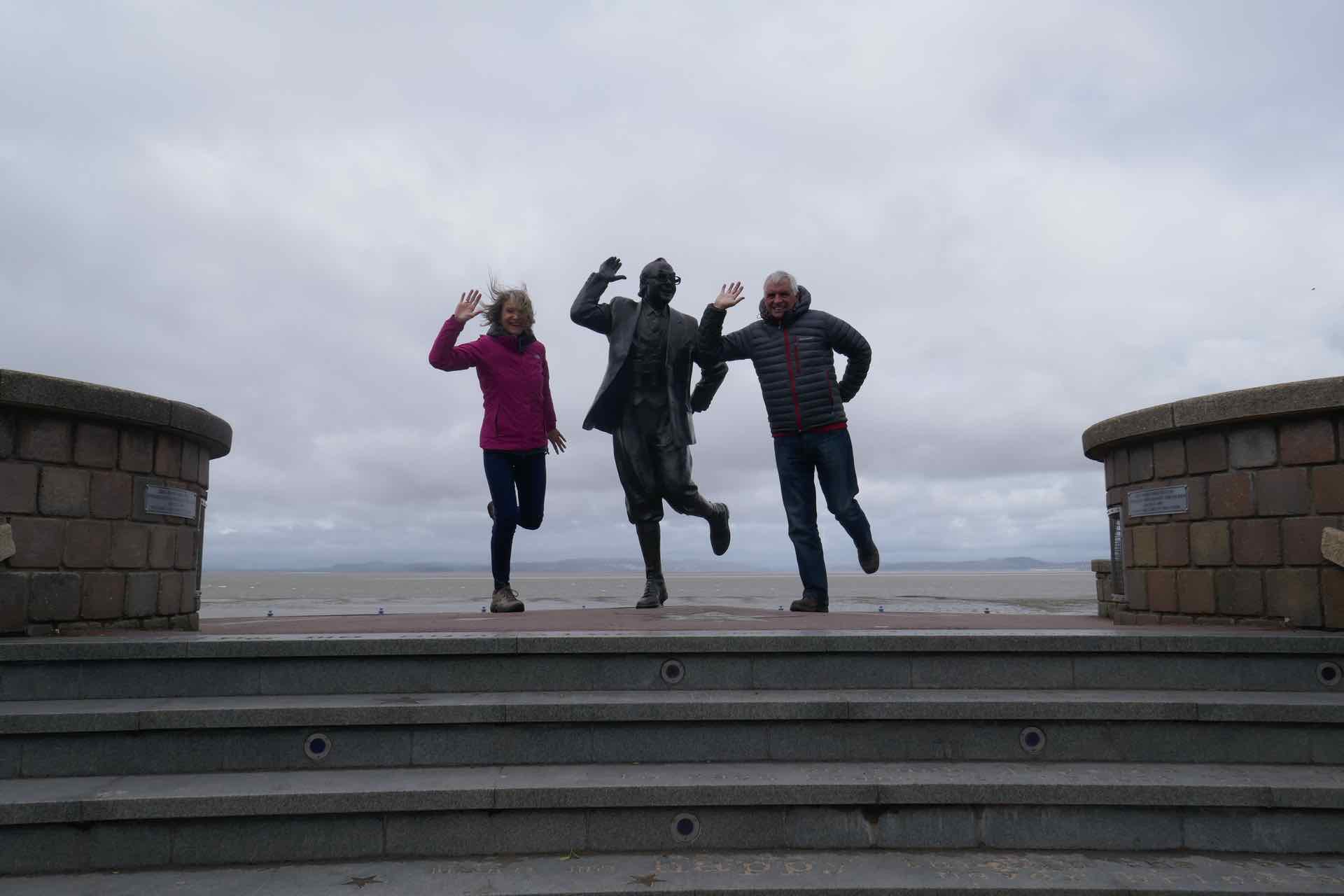
More of Us and Eric
We had a lovely time catching up with Jenny and her new surroundings but it was time to head off to Kewsick for our week of walking.
Jenny and Lyn
Our first walk was with our good friends Geoff and June, who live in these parts. The wet weather had disappeared to be replaced by warm sunshine and a gentle breeze as we headed out on the local bus to Rosthwaite for a walk up Castle Crag then on to Grange for coffee and returning via the west path of Derwent Water to Keswick.
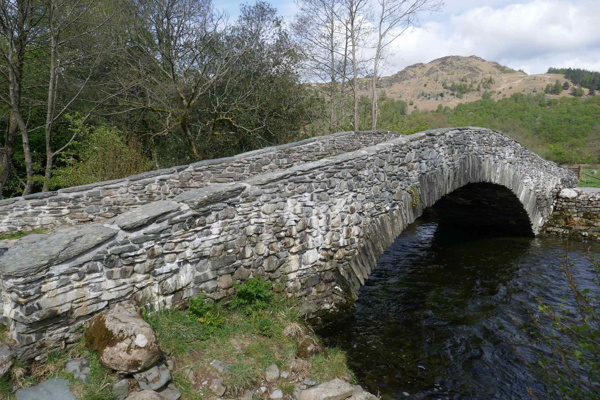
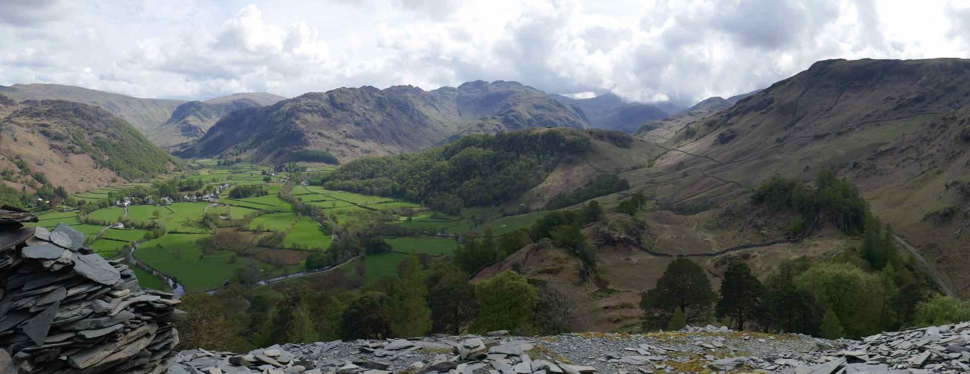

Clockwise from top left:Across the bridge with Castle Crag en route; Just below the summit; The Cairn just below the summit; Panorama looking south sown Langstrath Valley.
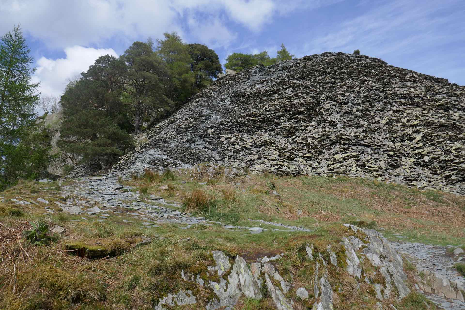
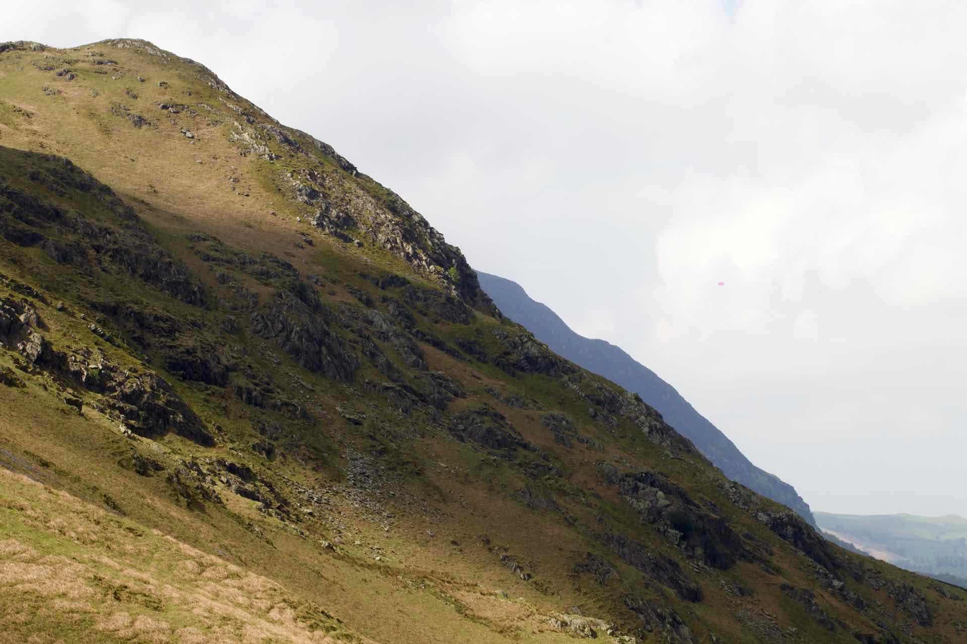
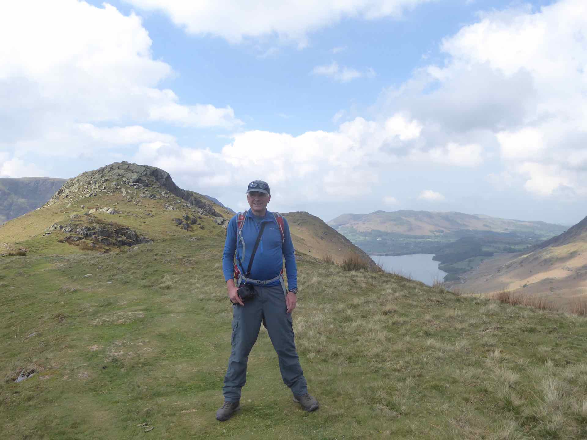
Castle Crag sits at the southern end of Derwent Water and at less than 1,000ft barely rates as a “fell”, however in his book of the North Western Fells, Alfred Wainwright writes “If a visitor to Lakeland has only two or three hours to spare, poor fellow, yet desperately wants to reach a summit and take back an enduring memory of the beauty and atmosphere……let him climb Castle Crag.” He was right! The walk up was not taxing but the view north up Derwent Water and to the south along the Langstrath Valley were superb and on a lovely warm day. Well earned coffee and cake in the small lakeland village of Grange was a delight.
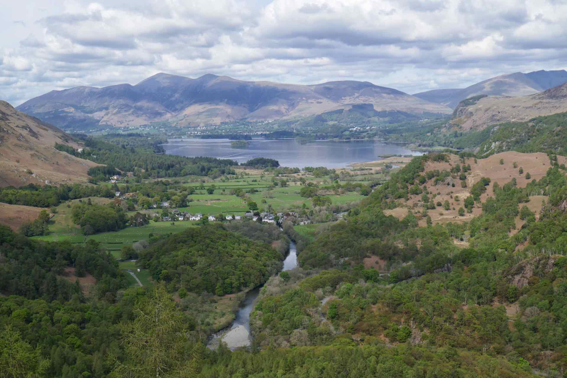

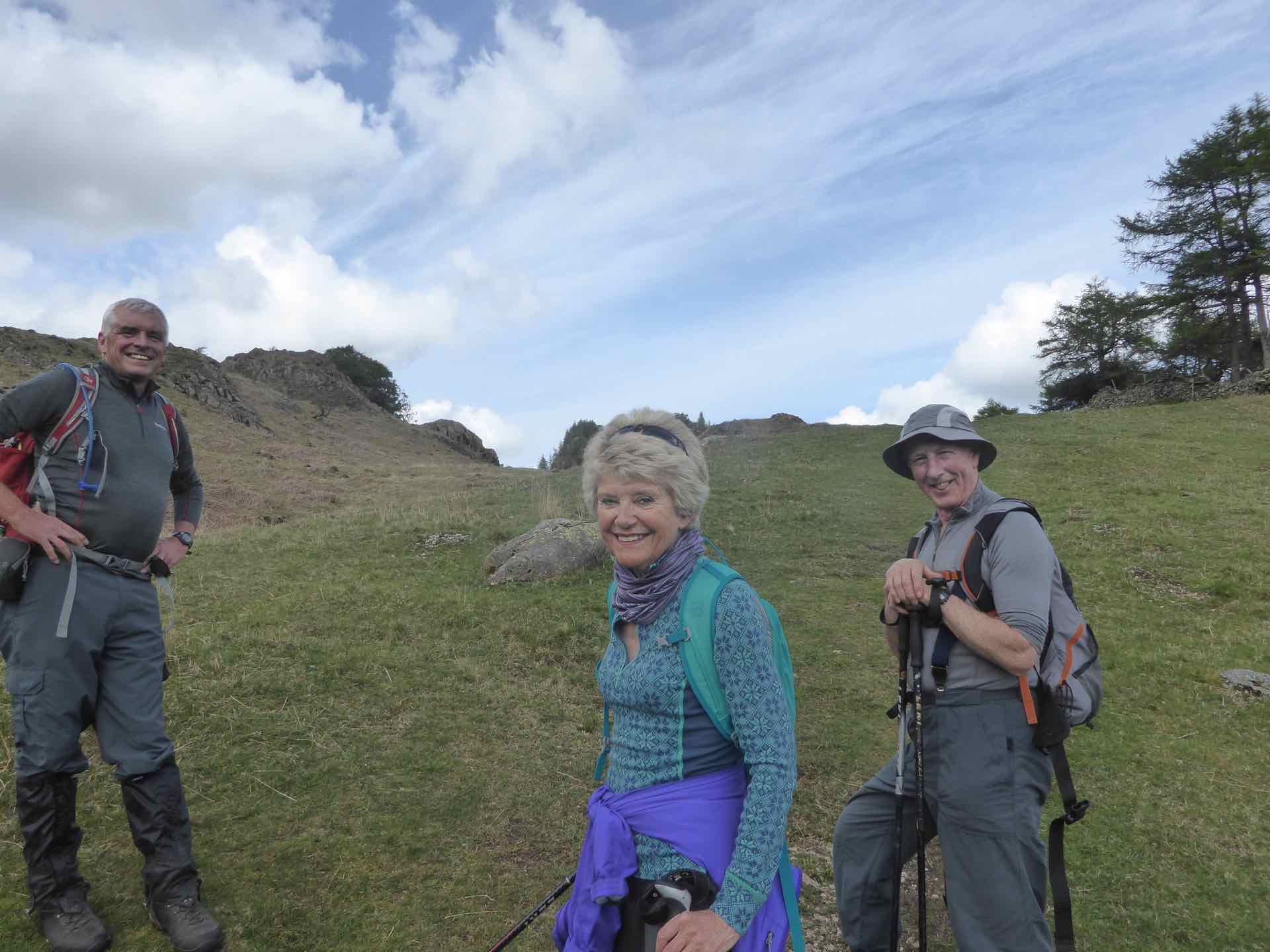

Clockwise from top left: The view from Castle Crag. A. Wainwright was correct!; A couple admiring the view; The four of us at the summit; Just below the summit.
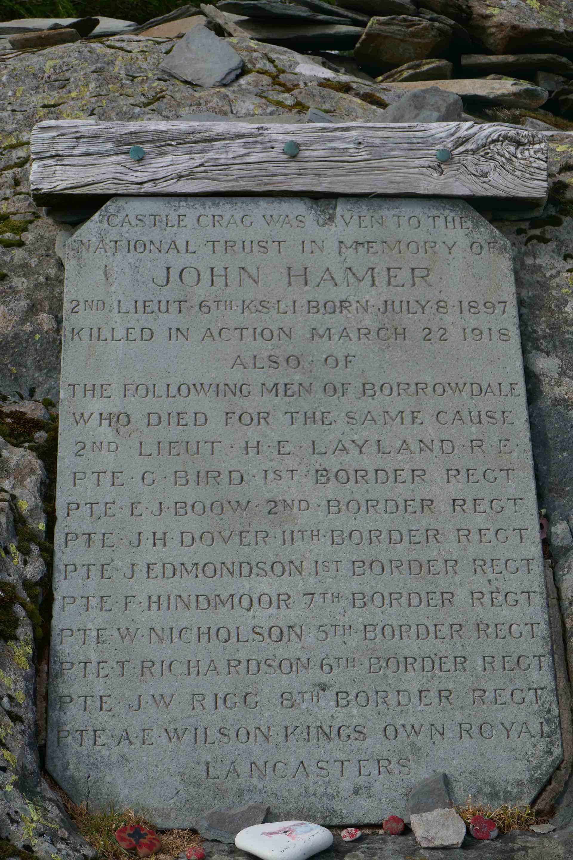
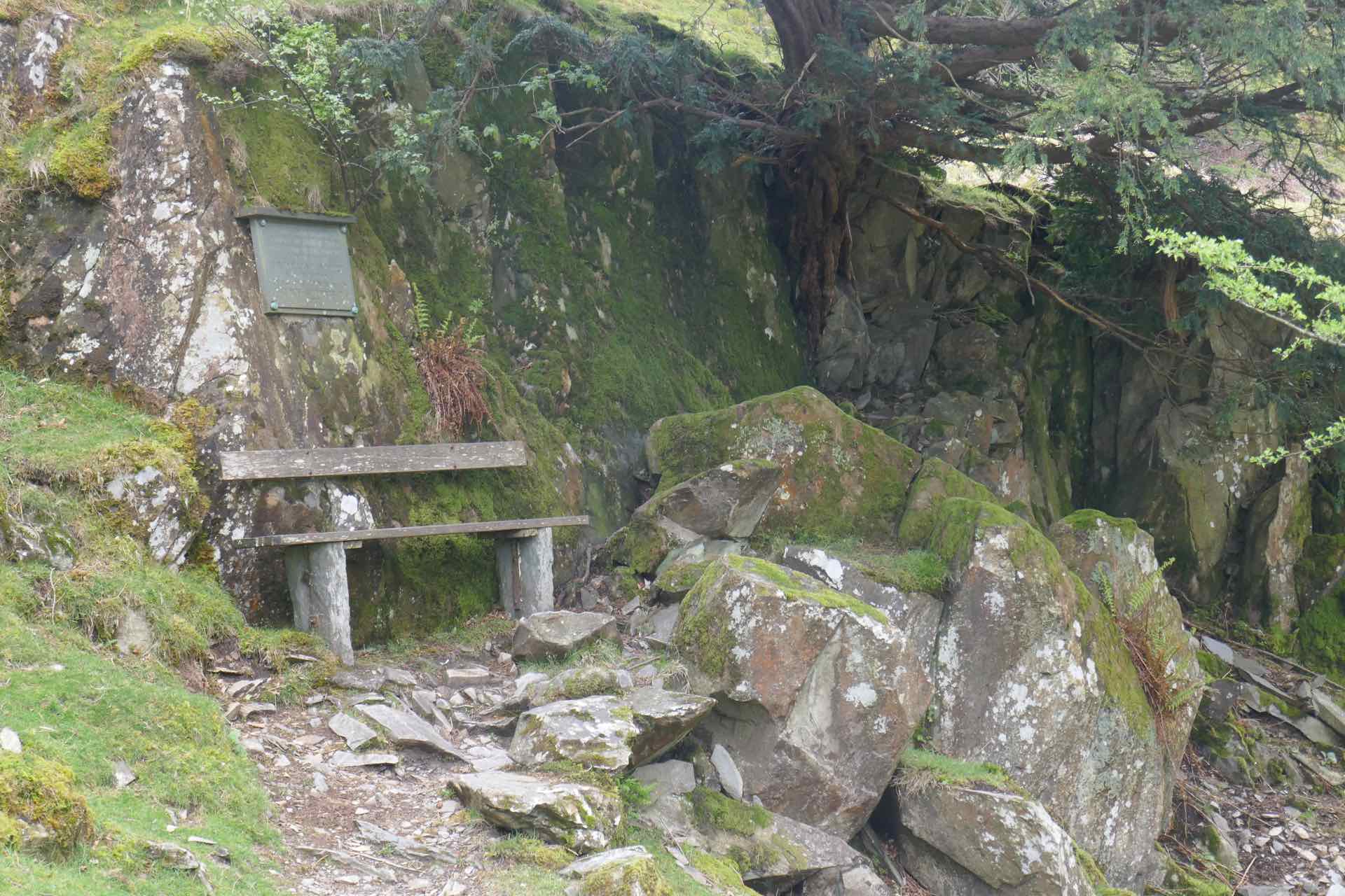
Left: Memorial stone to John Hamer and others from WW1; A rest spot on the descent.
Rannerdale sits on the eastern edge of Crummock Water and is a short drive from Buttermere. A little known historical fact is that this area was once the scene of a fierce battle where Norman invaders were ambushed and routed by the English in the years after the Conquest.
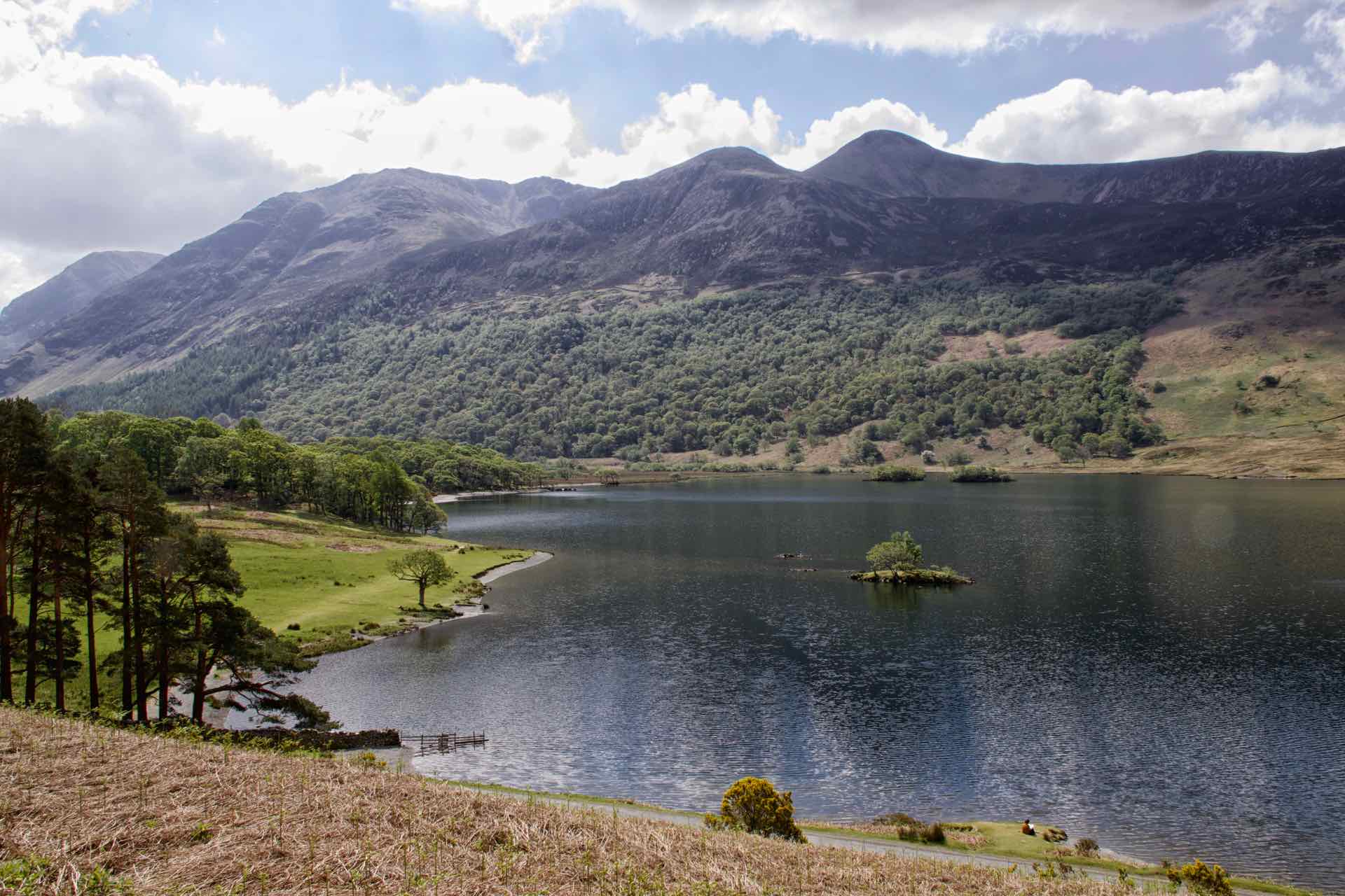
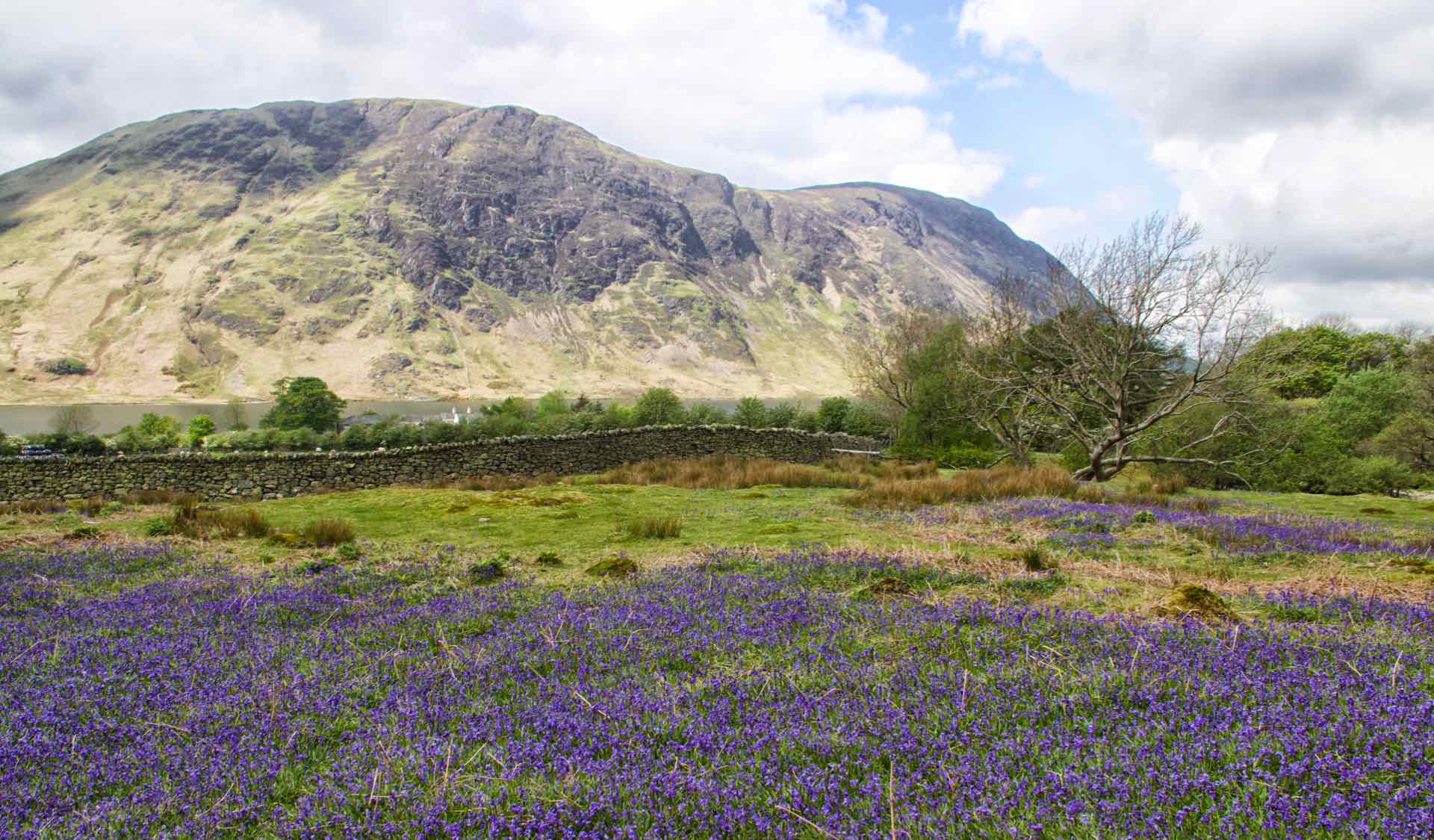
Clockwise from top left: Crummock Water with Red Pike and High Stile in the background; Looking North up Crummock Water; Rannerdale Bluebells x 2
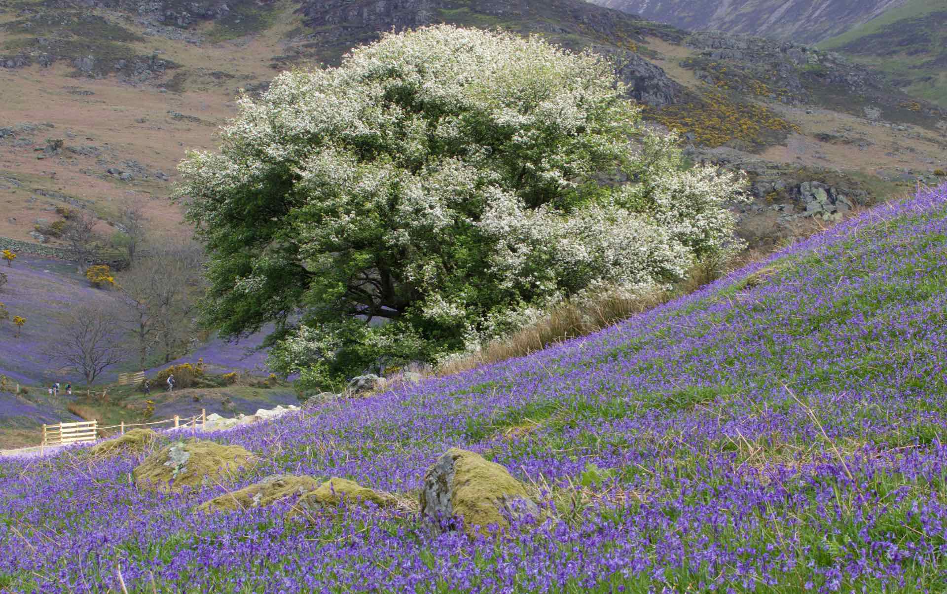
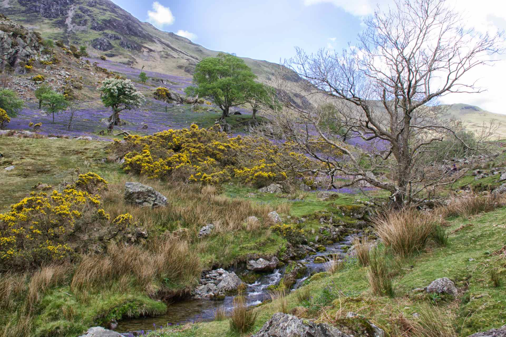
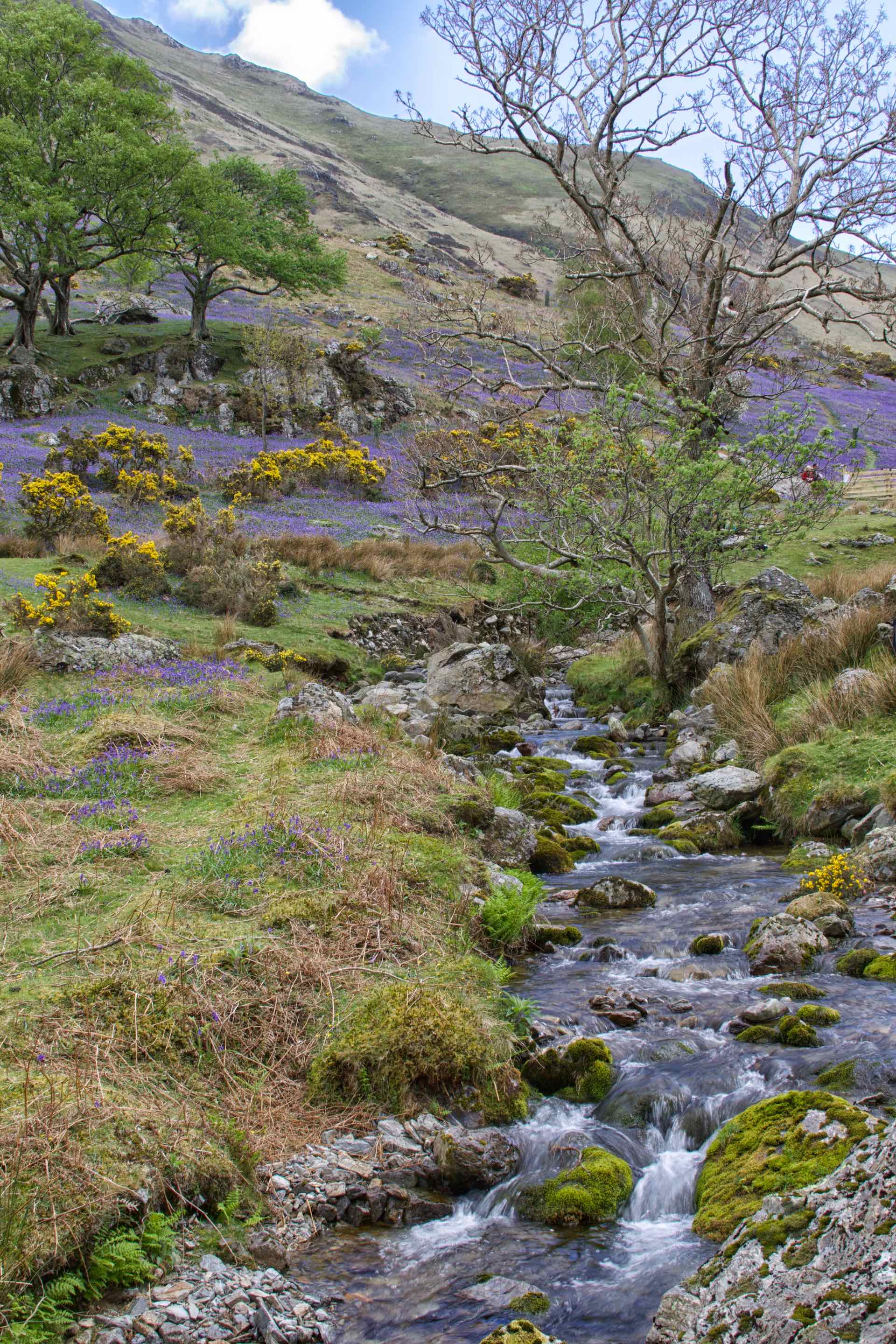
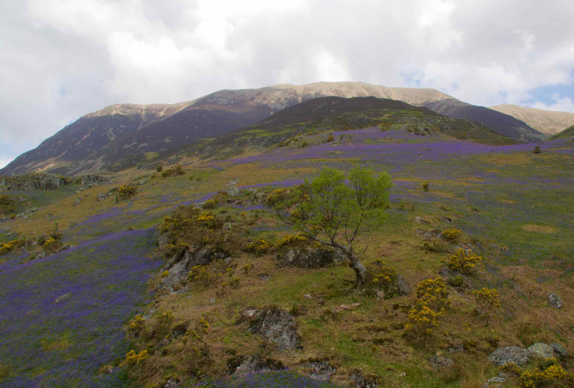
At this time of year Rannerdale is covered in bluebells and yellow flowering gorse. The sun was shining on a warm day and as we walked up the path towards the beck which would be our turning point, the blue flowers were carpeting the ground and small patches of yellow gorse made a great contrast.


Top Row L-R: More views of the bluebells at Rannerdale. Bottom row: L and C More of Rannerdale; Rannerdale Knotts, our summit for the day.
Our walk was up to the summit of Rannerdale Knotts via the flower covered valley. It was wonderful sight, made even more remarkable in that the bluebell is normally found in woodland, yet here it thrives on sunny banks with barely a tree in sight!


L: A noisy interlude, USAF F15 Strike eagle from RAF Lakenheath; C The summit approach; View from the summit of Rannerdale Knotts
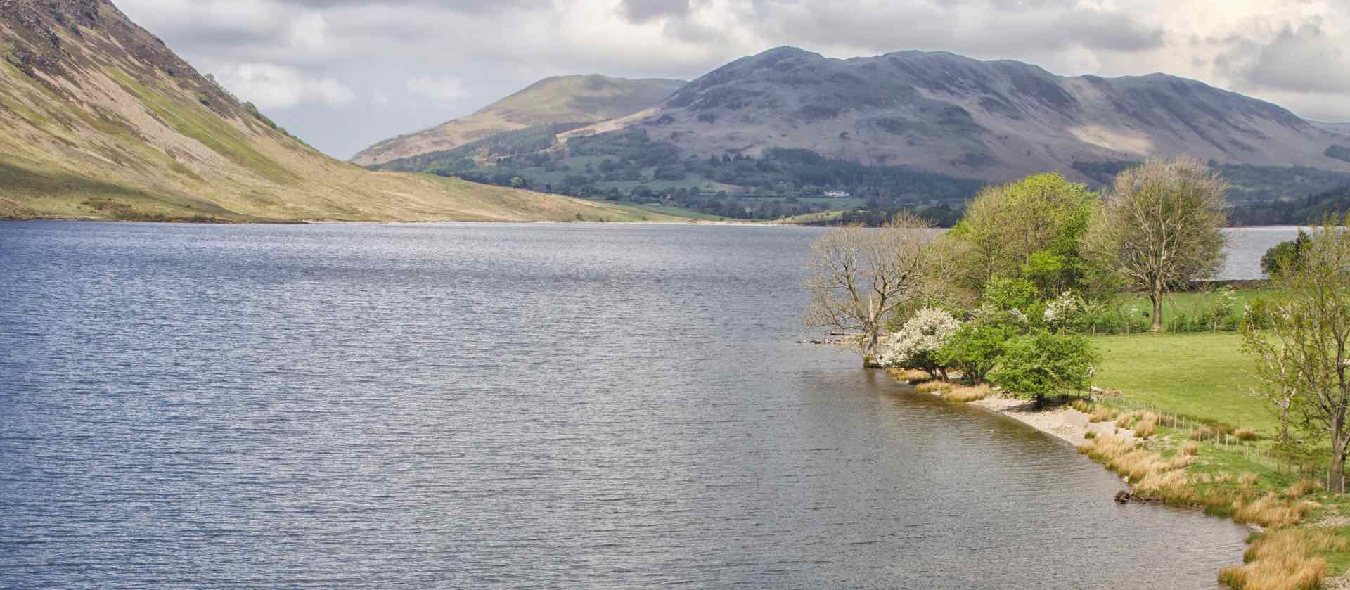
The walk up was straightforward, as was the descent off the summit. The highlight was seeing the bluebells in all their glory, a wonderful view especially from the top of Rannerdale Knotts. This point also gave us views of Crummock Water and back down Buttermere with many notable peaks to be clearly seen.


Clockwise from top left: Lyn among the Bluebells; Us in Rannerdale; Panorama from the top; M on the summit.
All in all two very enjoyable but shortish walks to start our week in the Lake District. We still have five days walking to look forward to alone and with friends.
