An early morning taxi ride to the Inter-Islander Ferry terminal in Wellington was the start of our South Island adventure. No car, we were travelling as foot passengers and collecting our hire car in Picton.
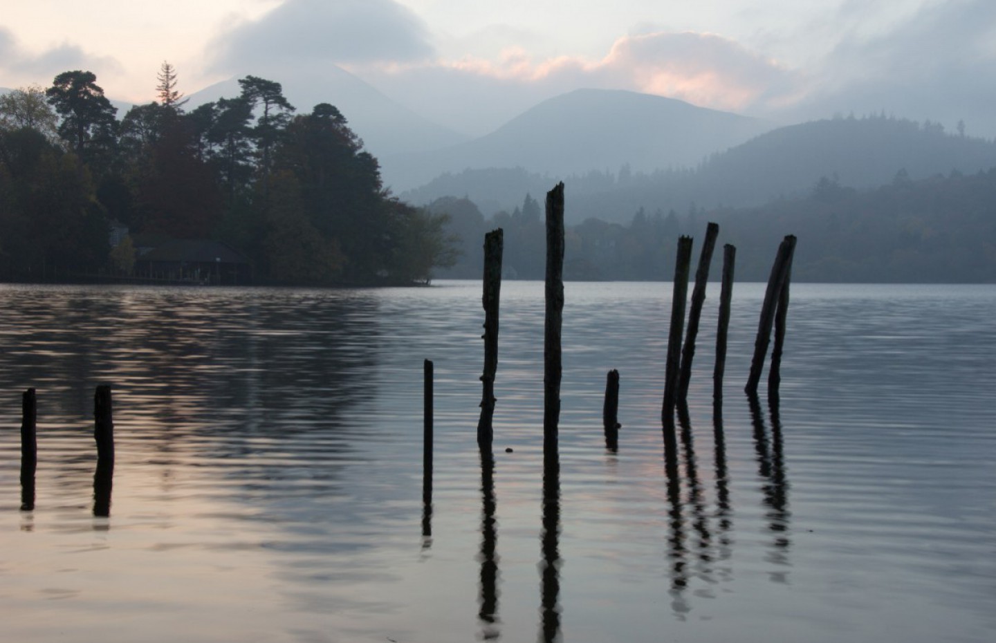
At check in our bags were loaded separately into the hold to be collected at the other end and just like the airlines we hung around a grotty terminal awaiting a boarding call. Off at 9:00 for a 3.5 hour trip. We found seats in the café but the queue for breakfasts was about fifty deep so we declined that luxury and bided our time. The crossing was calm if very breezy and the sun blazed down, but the views of South Island as we sailed into Queen Charlotte Sound were amazing. I have never been to the Norweigan Fjords but imagine that this must be very similar.

Entering Queen Charlotte Sound
Once again with our feet on terra firma and an interminable wait at the car hire desk we collected our car for a three minute drive to our motel in Picton.

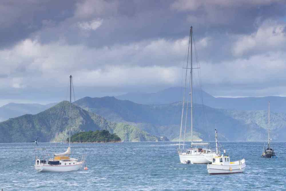
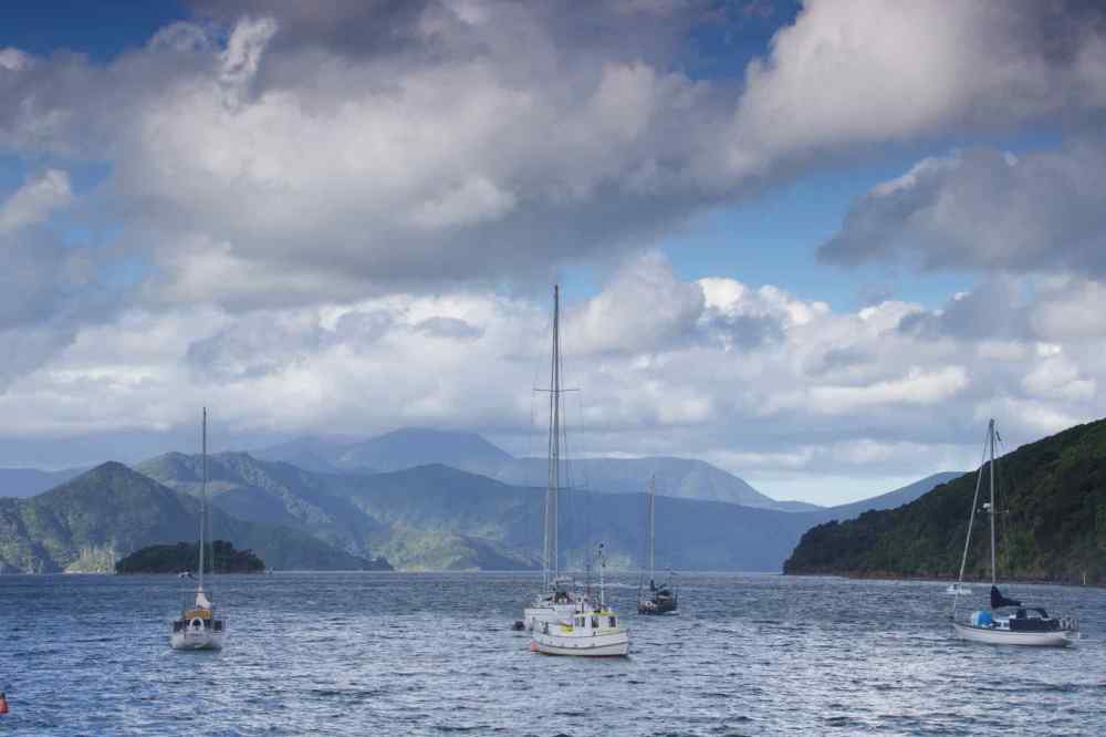
 Four views of Queen Charlotte Sound From Picton Waterfront
Picton is a small town lying at the head of Queen Charlotte Sound and is the arrival point for all Inter-Island ferry services. The wide streets and historic buildings along the waterfront reflect the town’s European beginnings. Orginially known as Waitohi the town was chosen to become the port for the Wairau district and became capital of the newly formed province of Marlborough in 1859. I am not sure who the locals upset but in 1866 the provincial capital was move to Blenheim. Passenger ferry services started around 1899 and the first joint rail and car ferry began in 1962. Today there are motels, backpackers hostels, café’s and restaurants aplenty and together with the magnificent views of the surrounding hills from the quayside, Picton is a great place to start our tour of the South Island. There are a number of local walks around Picton ranging from a few minutes duration to over 4 hours. We followed one-of the longer ones which was a pleasant route to a local village and marina.


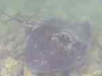

From Top Left: Us on Picton Waterfront; On a walk from Picton; War Memorial; Stingray in Picton Marina; Picton
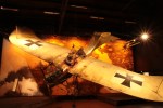
About twenty-five minutes from Picton is the village of Omaka which is home to an Aviation Heritage Museum. The film director Sir Peter Jackson (he of Hobbit and Lord of The Rings fame) has had a big influence in the setting up of this site and he has created a series of static scenes throughout the museum which tells a particular story from the first World War. Examples include the aftermath of the shooting down of Baron Von Richthoven which shows his crashed aircraft crumpled and figures aiding the fatally wounded pilot. There are many other scenes from WW1 and WW2 as well as exhibits of memorabilia from the era. However the best exhibit is a sound and visual drama. In one room he has used film and sound techniques to re-create a vignette from the siege of Stalingrad in 1943. As you sit in the room or walk around it you hear the sound of sniper fire, machine guns, bombs being dropped as if from an air raid, whilst the room shakes and the “sky” is streaked with shellfire and mortars as the “battle” rages around you. It really felt like you were there. A visual and aural experience not to be missed.


Four “Action Vignettes” from the Aviation Museum. Clockwise from Top left: Rescue of pilot from crash; Fokker Eindekker swooping to shoot at the enemy; jump! British Pilot jumping prior to crash landing; Four Fokker Triplanes;


L-R Workshop Scene in the field; Shot down!; Spitfire in the Jungle WW2
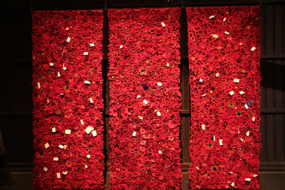
5000 Poppies. Wall of remembrance for all killed in 2 World Wars. One Purple poppy in each wall remembers all the animals killed as part of these conflicts.
Our stay in Picton was short and time to move on to Motueka, a small town on the edge of the Abel Tasman National Park in the north of South Island and home to the Abel Tasman Coast Track, more of which shortly.
Motueka is a coastal town which lies at the heart of a large fruit growing area with the main crops being Kiwifruit and apples. On a walk around the bay area we met with some locals, as you do, and as you, do we got chatting. We wondered why there was so much driftwood and other natural detritus in the hedge along the path, and on the beach and sand-spit exposed at low tide. Whilst we were in North Island a couple of weeks ago, on the night of the Blood Moon, much of the west coast of both islands was battered by one of the worst storms in living memory. It threw up driftwood, it washed abandoned cut logs down from the hillside and caused landslips in many areas that closed roads. The local council have only recently cleared the path we were walking on, leaving the logs and brushwood on the side, either to create a new home for wildlife or more likely the task of removing it is to great to be tackled unaided. However the driftwood made for some interesting landscape photographs.


Views of Driftwood washed up from a recent storm
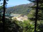
The Abel Tasman Coast Track is one of the major walking routes in New Zealand. None of the route is accessible by road so the only way in and out is by boat. A number of companies operate out of a little village by the quaint name of Kaiteriteri. These boats will drop you off and pick you up to a timetable run seven days per week during the summer months so if you plan on doing the whole track you are taken to your chosen start point, dropped on the beach and left to get on with it. You either camp or pre-book a bunk in a hut en-route. The whole walk takes 3-5 days and you carry all you need for the time you are on the track. We elected to do one of the day walk options, from Tonga Quarry to Anchorage Bay, a walk of just over 10 miles.
Dropped off at 10-30am we had to make it back to our appointed pick up beach by 3-45pm. Miss your boat and the last boat home at 5pm and you are stuck! NZ$300 for a private boat out to rescue you. No pressure then.


Clockwise from Top Left: Us on the boat out; Split Apple Rock, a landmark on the outbound trip; Tonga Quarry, our start point; Local wildlife.
Actually it turned out to be a far easier walk than we thought. What we found most disturbing was the large numbers of walkers out, either in the middle of the whole route or like us out for the day. At one point on the walk there is a long swingy bridge and a sign that said “No more than five on the bridge at any one time.” When we got there six people were waiting to cross and they all wanted photos and selfies on the bridge (no selfie sticks though………are they finally becoming unfashionable?) so that took some time. Then it was our turn. Lyn went first and as she moved slowly and carefully across the bridge, I looked behind me to see about ten people waiting patiently for their turn! I crossed quickly pausing only for a couple of pics and no selfies!


Clockwise from top left: Lyn on the first “Swingy Bridge”; Viewpoint on the trail; Our lunch stop before the hoards arrive: Us on the trail;
For lunch we found a bench at a lovely viewpoint on the walk. A couple ahead of us had stopped to take a few pictures so we hung around momentarily before sitting down. Immediately the rather large lady of the couple parked herself next to Lyn leaving me no space to sit. She eventually took the hint and moved over so I could perch on the end. No sooner than I had sat and was admiring the view, whilst munching on my cheese sandwich, than several other walkers/hikers came round the corner, saw the view and paused to admire and photograph it, totally blocking ours out. Luckily I had taken my pictures before I sat down. The only views I managed to get were of peoples legs and backsides as they stood in front of us looking at what we wanted to view. Not 5 yards further along the trail was an equally good view point each of them could have used. It was like sitting on a bench at Waterloo Station in the rush hour!


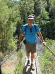
Clockwise from Top left: Queueing for the second Swingy Bridge; My bridge to cross; Viewpoint on Abel Tasman Track; Me at the end of the bridge.
The walk continued and we came across Torrent Bay. This is a very exclusive area because, as well as a camping site and a bunk hut, there are about twenty rather luxurious holiday homes set back from the beach. These have no mains electricity or other services but are very exclusive and very smart. All have Solar Panels and I assume each has access to a fresh water supply. Our Boat driver said that they come up for sale very rarely, being handed down within families. Remember there is no road access, the only way in is by boat so there must be some money floating around Torrent Bay. After a short pause to admire these holiday homes, we pushed on.
We eventually arrived at our appointed pick up beach about an hour early and spent sometime just relaxing and listening to the waves wash gently on the shore, almost like a paradise island. Despite the large number of people on the trail it was a thoroughly good walk on a beautiful sunny day with a little of the breeze that this part of NZ is known for. No camping for us, no hutting for us…..we like a bit more comfort these days! Back to our motel for a stretch and a shower.


Left: Torrent Bay; The end – Anchorage Bay; homeward Bound
Our last day in Motueka we spent enjoying the lovely warm sunshine and exploring some of the local trails around the town. We walked out to the Marina in the morning and found a delightful little cafe where we joined the locals for coffee and cake whilst watching the fishermen ready their boats for a day out on the water. We came across a Community Garden where volunteers from the town cultivate a veg and fruit garden where all can share the produce, and a Sanctuary Garden, built by a local man and donated to the town after he died. Motueka also has a large Nature reserve which is home to a number of bird species, most commonly Black Winged Gulls and Grey Cormorants, known by locals as Shags. Walking back up the foreshore path we passed more beach front properties. As we got closer to the golf club and the town, they became larger and more exclusive.


Clockwise from top left: Marina Cafe; Wild Flowers; View from the Marina
Nearby is the rusting hulk of an old ship, the Jamie Seddon, named after the niece of a former Prime Minister, Robert Seddon. This wreck had an interesting history. Built in Scotland in1901 as an anti-submarine mine layer she saw service in both world wars before being bought firstly by the New Zealand Land and Survey Department whom later sold her on to the Motueka Trawling Company. They found her uneconomical to operate so she was stripped and beached in the bay in 1955 and has been rotting slowly since then. She is still a popular location for photographers.


Left: Lyn on a Swing…Again! Top Right: Bench Bottom Right: Jamie Seddon wreck
Motueka is a place we could have stayed longer, just for where it is and the vibe in the town, pleasant, friendly and relaxed. But we must move on. Our next stop is on the west coast at a town called Hokitika.

Ah, the South island, spectacular is an understatement… just love the turquoise blue waters there!
LikeLike