Up early for the next stage of our journey, this a long drive to Hokitika a small town on the west coast of South Island.
An interesting drive initially through the western half of the Abel Tasman National Park we eventually left the fruit growing areas and began to climb through the mountains joining the main west coast road after about 1 hour. Driving in NZ is mostly a joy. Outside the cities and towns there is little traffic so hold ups are rare, save for roadworks which are always a guessing game as bollards and arrows point everywhere at the same time. Normally there is someone with stop/go boards so your progress is at their whim. Also the contractors are quite happy for you to drive on a temporary road surface. Several times on our journeys we have had to drive on surfaces that can only be described as compressed gravel and ballast, and not for short distances either; on one trip this temporary surface lasted for about 3 miles. Service areas are a rare thing in NZ especially on the ordinary roads. We found very quickly that it is best to refuel at your departure point for a long journey just in case there are no filling stations on your route. Mind you most villages we drive through (and there are not that many) have at least one coffee shop to help sustain the driver(s)
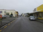
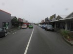
On our journey down we drove through only two towns before entering Greymouth, a large port city on the west coast. En route we stopped at a small town named Murchison, for coffee. As with many small places the main street is all there is, with dwellings down side streets leading off the main road. A good cafe with outstanding choice of music; when we were there they were playing “Meddle” by Pink Floyd. Big smiles…from me anyway.


Clockwise from Top Left: Inside the cafe in Murchesson; A busy Road on South Island; Single Track Bridge on a main road, of which there are many here; Roadside Art Gallery in the middle of no-where; Main Street Murchison.
From Murchison the roads were very straight and flat as we progressed down the West Coast highway with not a beach in sight. We were in a flat wide valley with hill ranges either side
After all this we eventually arrived in Hokitika. Our motel for this stay was only a short walk from the town centre so we went out to explore. We found out that the weather was about to break, so any ideas we had of heading into the hills for some walking was looking unlikely to be fulfilled. The streets in Hokitika are arranged on a grid system which makes finding your way around very easy. Chatting to one chap, we found out that Hokitika was planned out in 3 weeks. Normally it takes years!
Founded on gold mining in 1864, Hokitika was one of the centres for the West Coast Gold Rush. By late 1866, it was one of New Zealand’s most populous centres and by 1867, the port of Hokitika ranked first in New Zealand in both the number of vessels entered inwards and in the total value of exports. At the height of the Gold Rush, the main street – Revell St -which is dead straight save for a small bend in the road close to one end, and a mile long, had 97 pubs operating. These offered a variety of “attractions” for gold miners from beer, cheap accommodation, music, food, and the “company of ladies”. Today some of the buildings look like they date from that era, but most of the pubs are long gone, replaced by a variety of shops, cafes and galleries, oh and the obligatory supermarket. Again this is not a crowded town but businesses seem to thrive nonetheless.


Revell Street Hokitika
We had been advised that the weather was about to change from cloudless skies and unbounded sunshine, to something resembling a wet day in Wales after a Rugby defeat (sorry Welsh readers, I could not resist slipping that in) so we made the most of exploring the town whilst the sun shone. At the end of what used to be the harbour but is now a breakwater is Sunset Point, from where the Heritage trail leads up the beach. Along the way there are more sculptures, some made of driftwood. There is an annual competition for the locals to see who can come up with the most original work using only driftwood gathered and supplied by the organisers. Sadly many of them have not survived the storms but the odd one or two remain, mostly in a state of semi collapse. Sadly no sunset for us later on, the clouds were rolling in from all directions and the earlier forecast looked like bearing fruit.


Left: Town sign in Driftwood; Right: Another driftwood sculpture


Two shots of us waiting for pizza in Fat Pipi’s Pizza place
Sunday arrived dull and very wet. Rain had set in overnight and was forecast to continue for most of the day, so long walks were definitely out. As is usual in these situations we de-camp to a coffee shop, Lyn to write, me to update my diary of the trip, and both of us to decide what to do next. That was easy. There are many art and craft galleries to visit, and the town museum housed in a wonderful old building that used to be the council offices.
The Carnegie Building is one of quite a few buildings still standing from the early 1900’s and has survived all that New Zealand can throw at it. Earthquakes, storms and volcanoes have all failed to dislodge this structure. However, the curator was telling us that they have only just moved back in as the local council declared it not earthquake proof in 2016 and promptly closed it without consultation. Campaigners fought hard to get it re-opened which they did following the election of a new Mayor last year. The museum reopened in this building in January this year. There were some great illustrations, and models, including a full size replica of a Police Cell, including a mannequin prisoner with a ball and chain attached to his ankle. You could reach through and test his “attachments” Believe me he was not going anywhere with that weight attached to his leg! Other exhibits included a small room made up of period furniture from the gold rush days, a feature on the Whitebait fishing industry that still exists today and loads of old monochrome photographs of the Gold Rush days and after. But the one exhibit which delighted Lyn more than any other was an old wind-up record player and a collection of 78rpm records (for my younger readers who do not remember records, these were like 12 inch CDS made of black plastic. (If you can’t remember CD’s ask your parents!). The Curator told us that this collection was donated by the family of a local man who had recently passed away, and Lyn was particularly taken with a recording of Nat King Cole singing Mona Lisa. Look it up on You Tube if you are curious to know what it sounds like.
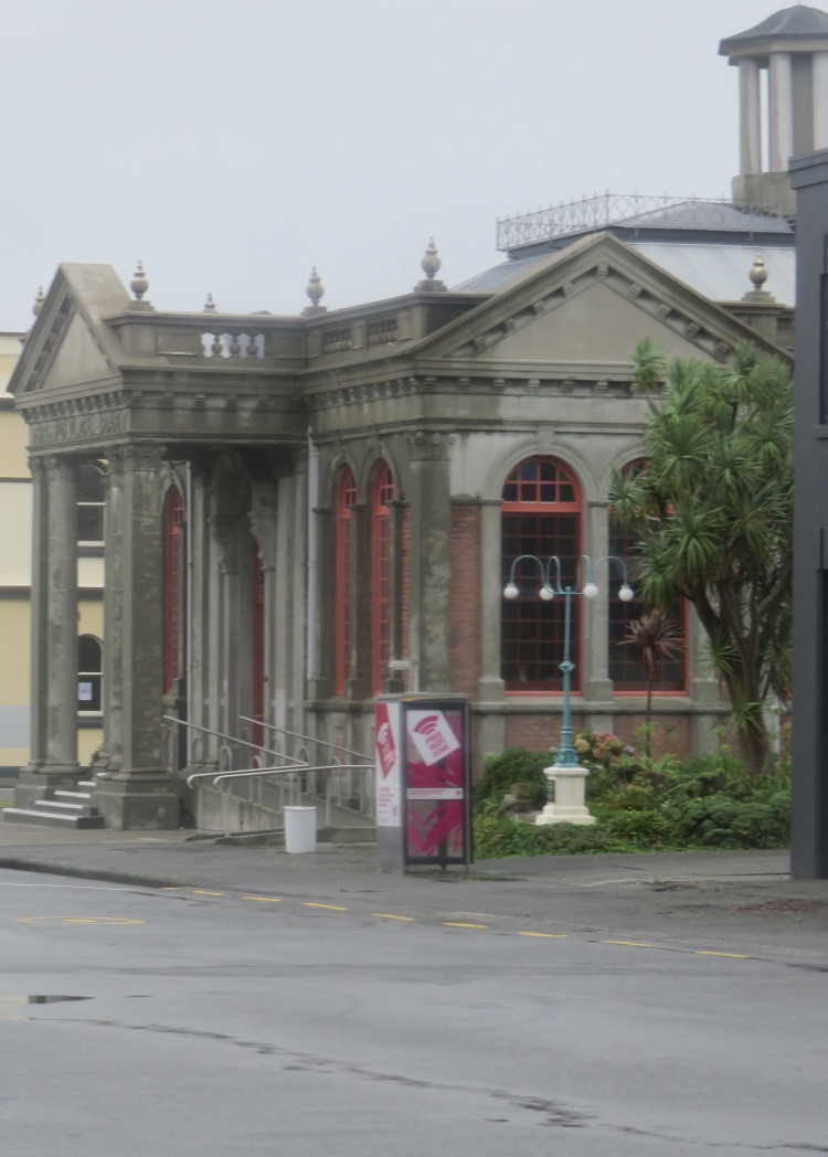
Carnegie Building Hokitika
Just round the corner from the Carnegie building is another of Hokitika’s old buildings. This one has a slightly different history. Built around the turn of the last century it was originally the old bank building. Now it is the workshop and gallery of a sculptor working in copper.


Left: Former bank now a sculpture workshop and gallery. Right: Dixie the dog
Ianzart specialises in creating sculptures and pieces from recycled copper, be it sheet, pipes, wire and even old copper coins from which he fashions small pieces such as crabs and spiders. Strangely what attracted us to visit was his dog, Dixie, who was sat quietly in the doorway. We wondered over to say hello and before we knew it we were inside watching Ian at work on a new piece. Chatting to Ian and his wife we found out that they own the building and have restored the exterior to the original colour scheme, a sort of pastel yellow and Terracotta. It stood out beautifully against some of the drab buildings nearby. It is also their home as they live upstairs. There are not many who can say they live in an old bank. There was some very intricate work on display and Lyn bought a small piece as a memento of our visit and to remember Dixie the dog.
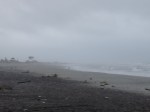
After lunch we wanted to complete our walk of the heritage trail and headed towards Sunset Point although the chances of seeing any sun, let alone a sunset were non-existant. Heavy drizzle blown on the wind was making it a rather unpleasant walk. Adjacent to Sunset Point is the re-inforced wreck of an old sailing ship, The Tambo. This acts as a memorial to those who perished in the seas around Hokitika during the Gold Rush. It is said that a ship was lost on average every ten weeks between 1864 and 1866 owing to the hazardous seas around the bay. A terrible loss of life as gold prospectors and miners arrived on the west coast seeking their fortunes. At this point, the sand on the beach is a dull grey colour, caused by volcanic ash mixing with sand. Further up the beach part of it changes to black sand, this is unadulterated black ash again from volcanic fallout. It still has the texture of normal sand, and still gets stuck in your toes if you walk bare foot on it.


left to Right: Lyn does her Titanic impression; Two tone sand; Us at Sunset Point, not living up to its name!
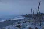


More Driftwood Sculptures
Continued heavy rain (and South Island has had a great deal of that recently) causes major problems with landslips in the mountains occurring on a regular basis. Out of curiosity I checked the Traffic Website for our route south the following morning. With some concern I read that the road we were to follow to our next destination, Fox Glacier, was closed due to a landslip. It said no more and that further information would be posted no later than midday on Monday. What now? We decided to wait and see what Monday brought.
Morning came and it was raining hard, again. Checking with the Motel reception, we were told that it was minor slip and that the authorities were confident that the road would be opened later that morning. With that information we decided to get on the road, and if we get turned around at Franz Josef Glacier we would worry about it later. As it turned out, we took an extended coffee stop in a quaint little village called Harihari. This was another of those one street villages with a cafe, a petrol station and a general store. They must supply the local farmsteads as there was a steady stream of customers in and out, as well as passing trade for refreshments.
The rain eased and as we approached a very crowded Franz Josef village it was plainly evident that the road had been re-opened because the stream of traffic coming the other way went from a trickle to a flood. We drove down a busy main street and joined a long stream of southbound traffic. A short while later we drove past the site of the slip it was obvious that there had been a large mud slide as a large gash had appeared as tons of mud had slipped down the hillside and blocked the road, taking trees and logs with it. These had been bulldozed to the left side of the road into a flat area and the road cleaned up. Further along the road those trapped in Fox Glacier the previous night had started their journey north which was causing traffic queues, especially at the single lane bridges on the main road.
We eventually drove into Fox Glacier village around lunch time and it had the feel and the buzz of an alpine ski resort in summer. Many people stuck overnight were still around and it was very busy for such a small place.

Love the updates and lyn your titanic pic is rather good! The weather you are experiencing is making me glad we’re opting for a camper van and not a tent!
Sent from my iPhone
>
LikeLike