Before anyone gets any ideas, this is not a suggestion for a remake of that most famous of road trip movies, “Thelma and Louise”. No, this is something far too mundane for Hollywood, but wonderful for us, the next two destinations on our Canadian adventure.
The resort of Lake Louise lies sandwiched between Trans Canadian Highway 1 and the Canadian Pacific Railway. It is a small hamlet consisting of a couple of hotels, a large car park with a community of shops and cafes on two sides and a large Information Centre close by. However about 4 miles away is its most famous attraction, a beautiful lake set in stunning mountain scenery.
Originally named “Lake of the Little Fishes” by the Stoney Nakota First Nation people, it is a glacial lake which gives it its spectacular turquoise colour. This comes from the microscopic minerals (called rock flour) in the glacier melt which absorb all but blue and green light and gives the lake this hue. The Lake gets it’s modern name from the fourth daughter of Queen Victoria, Princess Louise Caroline Alberta, the wife of the Marquess of Lorne, who was Governor General of Canada between 1878 and 1883.


Left: Lake Louise Village; Right: Lyn on the bridge with the village behind. Gives an impression of how small the village is.
In order to get the best out of a visit to Lake Louise it is best to get there early. There is minimal parking on site so a shuttle bus runs from a Park and Ride (P&R) location about 5 km from the village. We arrived at the P&R car park at around 9.25 am but it was already half full and had to wait around 35 minutes to get on a bus. It was cheap though, at CDN$4 each for a return ticket. We arrived at the lake and took the short walk from the bus park to the lakeside. Already the crowds were large and well on the way to the estimated 10,000 visitors they get each day during the tourist season! At the top of the access path from the bus stop is a large luxury hotel on the right hand side, the Fairmont Chateau Lake Louise. It is one of Canada’s grand railway hotels, located on the Lake’s eastern shore. It is a luxury resort hotel built in the early decades of the 20th century by the Canadian Pacific Railway to encourage tourists. It was obviously very popular as there were no vacancies!


Three images of what you see when the lake comes in to view
After a short break for a coffee we walked slowly round the eastern shore, taking in the views, the lake itself and the people walking around or sitting on the benches soaking up the hot sun. We had planned to take the shuttle bus to nearby Lake Moraine which is supposedly quieter and more beautiful than Lake Louise, however they stop running when the place gets full, usually about midday, and as we were still enjoying Lake Louise, at that time, we decided to save Lake Moraine for another visit.


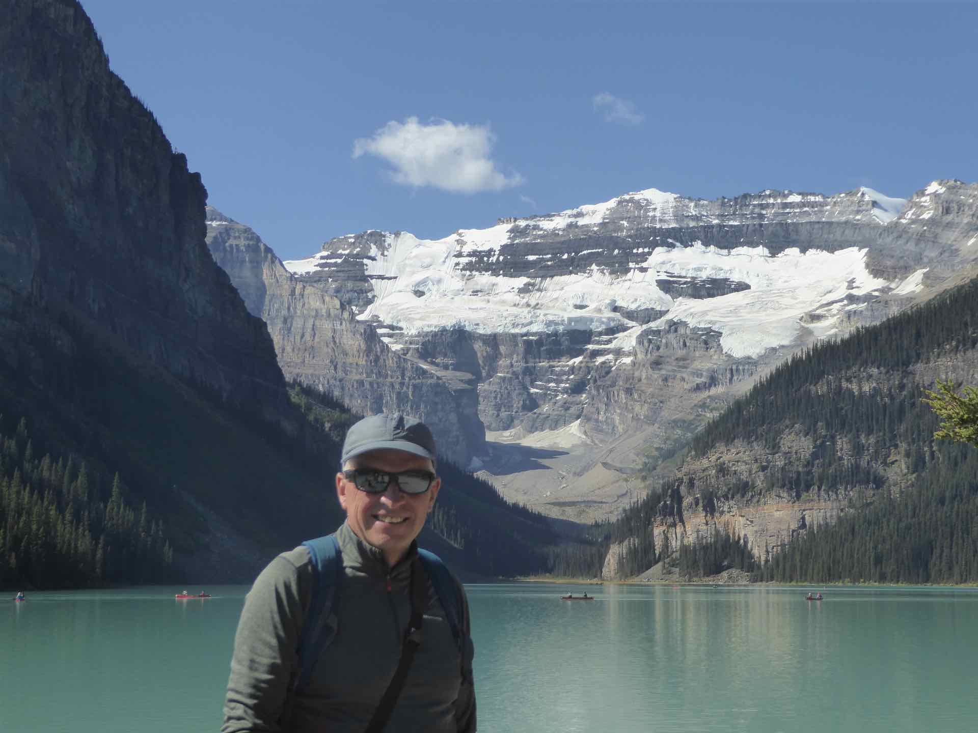
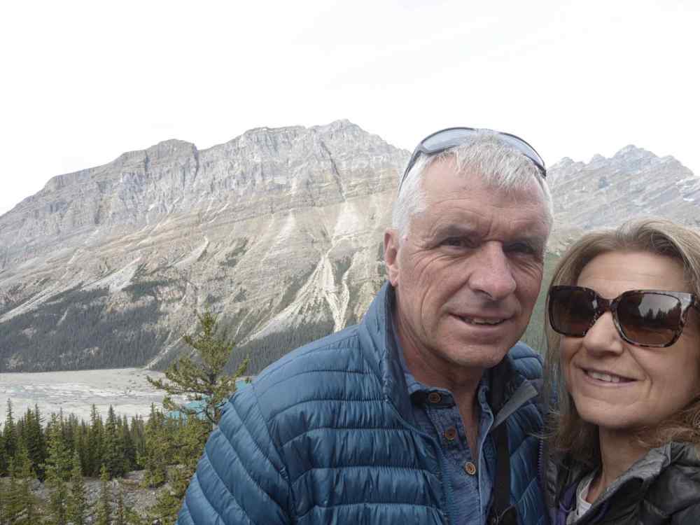
Us posing in front of Lake Louise
Close by Lake Louise is Lake Agnes, which is walkable (about 3.4km) so we decided to walk there instead. What the tourist map did not tell you is that it is 3.4km uphill and some steep climbs at that, but crucially no bears. They must be fed up of the sight of so many people that they go and feed elsewhere away from the noise! The walk took just over an hour, with a short pause to admire the much smaller Mirror Lake on the way up. Strangely the water here was absolutely clear and more impressive for it. The only thing spoiling it was the number of people on the shoreline posing for photo’s. It made getting a decent shot of the whole lake almost impossible.


Top: Lake Agnes; Centre: Lake Agnes Tea Shack; Bottom: Mirror Lake
Similarly Lake Agnes was thronged, mainly because of the presence of a tiny Tea House, a wooden structure with an open covered verandah overlooking the lake. It was hugely popular with folk arriving and in need of refreshment. I did wonder how the staff get to and from this place, carrying all that they need for the day. It must be a long walk to work and back again at the end of the day but very rewarding.
The walk back from Lake Agnes took much less time (not surprising as it was all down hill) and we made it back to the bus pick up late afternoon. We only planned one full day in Lake Louise so it was time to pack up and the following morning embark on the longest leg of this part of the trip, the 145 mile drive along the Icefields Parkway to Jasper.
The Icefields Parkway runs between Lake Louise and Jasper and our guidebook noted that it is one of the worlds ultimate drives. It is not narrow or particularly twisty but the dramatic landscape the road passes through, lakes, mountains, glaciers, yes I did say glaciers, all feature on this 150 mile drive through the Rockies.

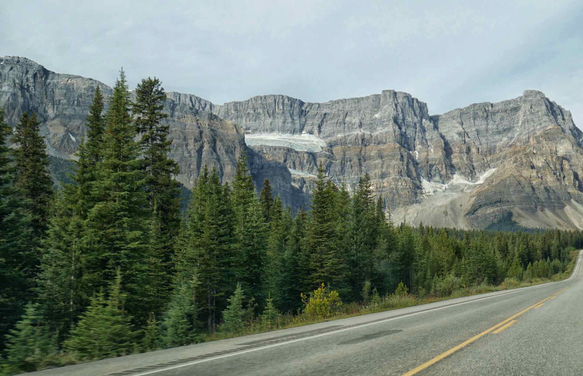

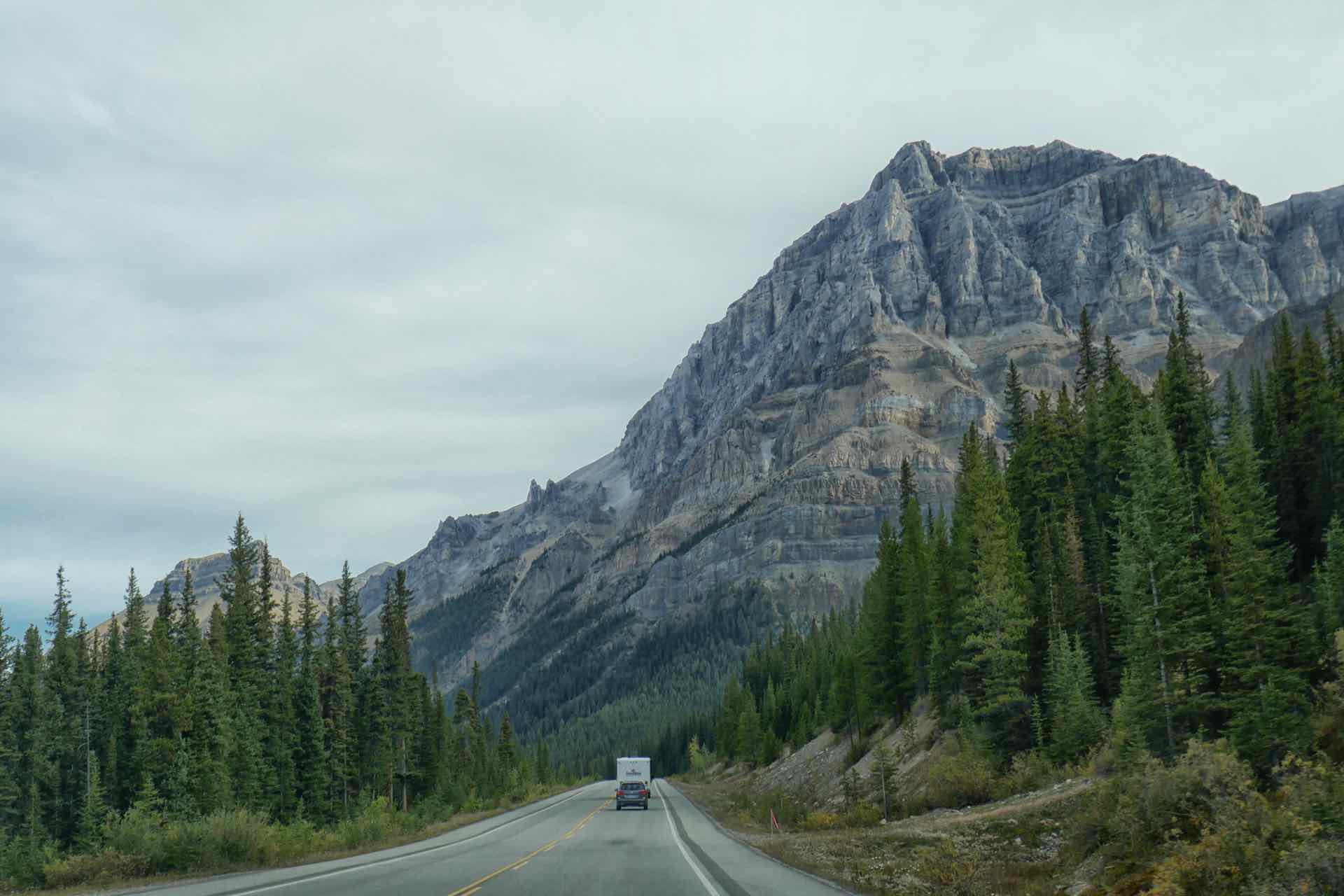
Four images giving an idea of the views along the Icefields Parkway
We had planned three stops which, having done the research, we thought would be spectacular in their own right. The first was Peyto Lake. However after about 30 minutes driving we came across a large lay-by on the opposite side of the road with a small crowd of cars parked up. We quickly saw why and pulled across to view Bow Lake and Glacier in all its finery. It was flat calm and the reflections of the surrounding mountains in the water was magical. The Bow Glacier, sat high in the mountains at one end and added to the scene.
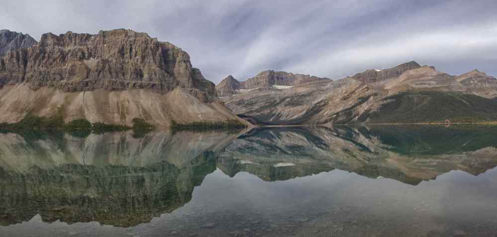


Three images of Bow Lake just off the Icefields Parkway
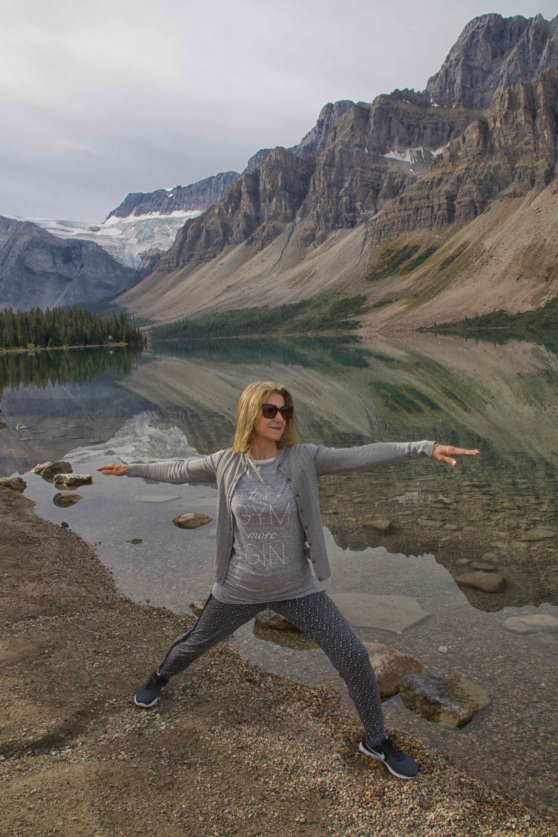
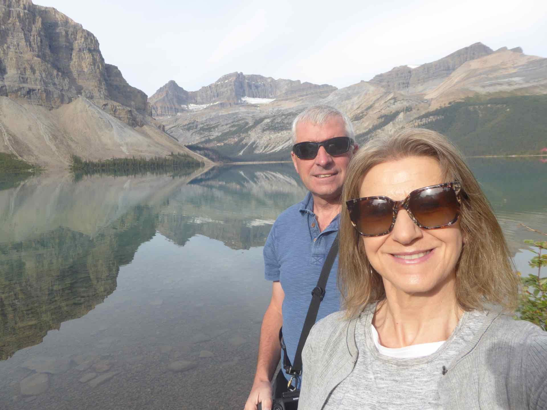
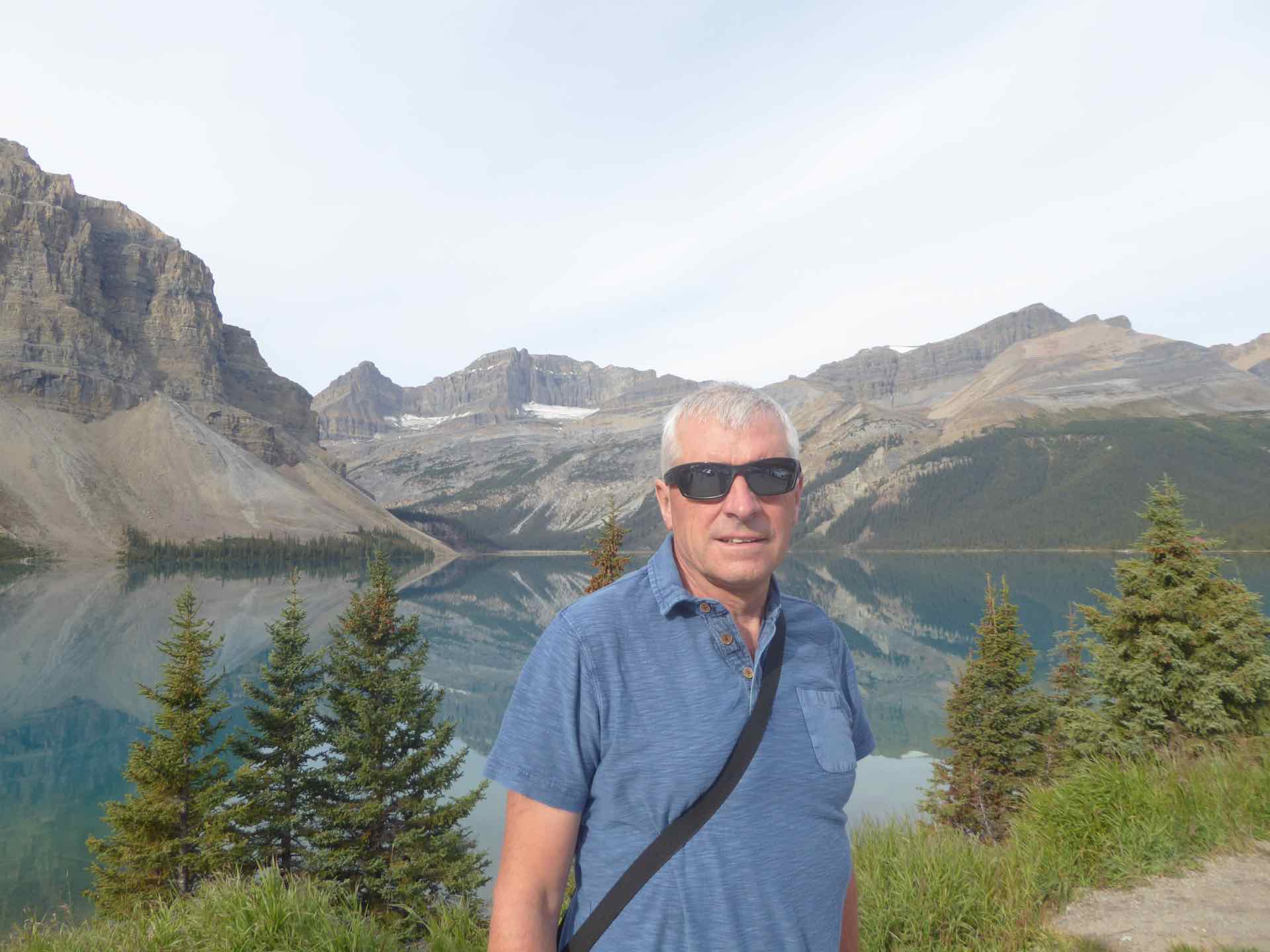
Top: Lyn and yoga – Bow Lake. Centre: Us at Bow Lake. Bottom: DH at Bow Lake
From here it was a short drive to Peyto Lake. Rather than a pull in, there was a badly pot-holed car park. We found a slot in a crowded corner and walked the steep path up to the observation point. Ten minutes later and we arrived at the wooden viewing platform to see hoards of people crammed into a small space. Many had clambered over the barrier down to the open rocks below but this had its own hazards, as off the end of the rocks was a 200ft drop to the stony bed below. We did not linger long and returned to the car, heading off to our coffee stop and then on to the Icefields Centre.


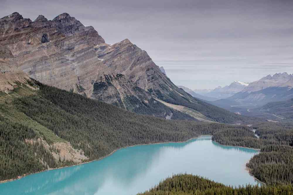
1 and 2: The crowds at the viewing platform and rocks – 3. Us at Peyto Lake; Bottom: Peyto Lake without the crowds.

Viewpoint on the Icefields Parkway
The car parks at the centre were both full, so we parked on some rough ground opposite with the glacier away in the distance. After a quick lunch we walked along the track, over rocky ground towards a ridge in front of the Columbia Icefields. The area we were walking on has been revealed as the glacier retreated over hundreds of years. It was an amazing sight, a wide field of ice with mountains either side. A tour company offered trips on to the glacier and we could see small groups of people in the distance, taking their steps on the ice.


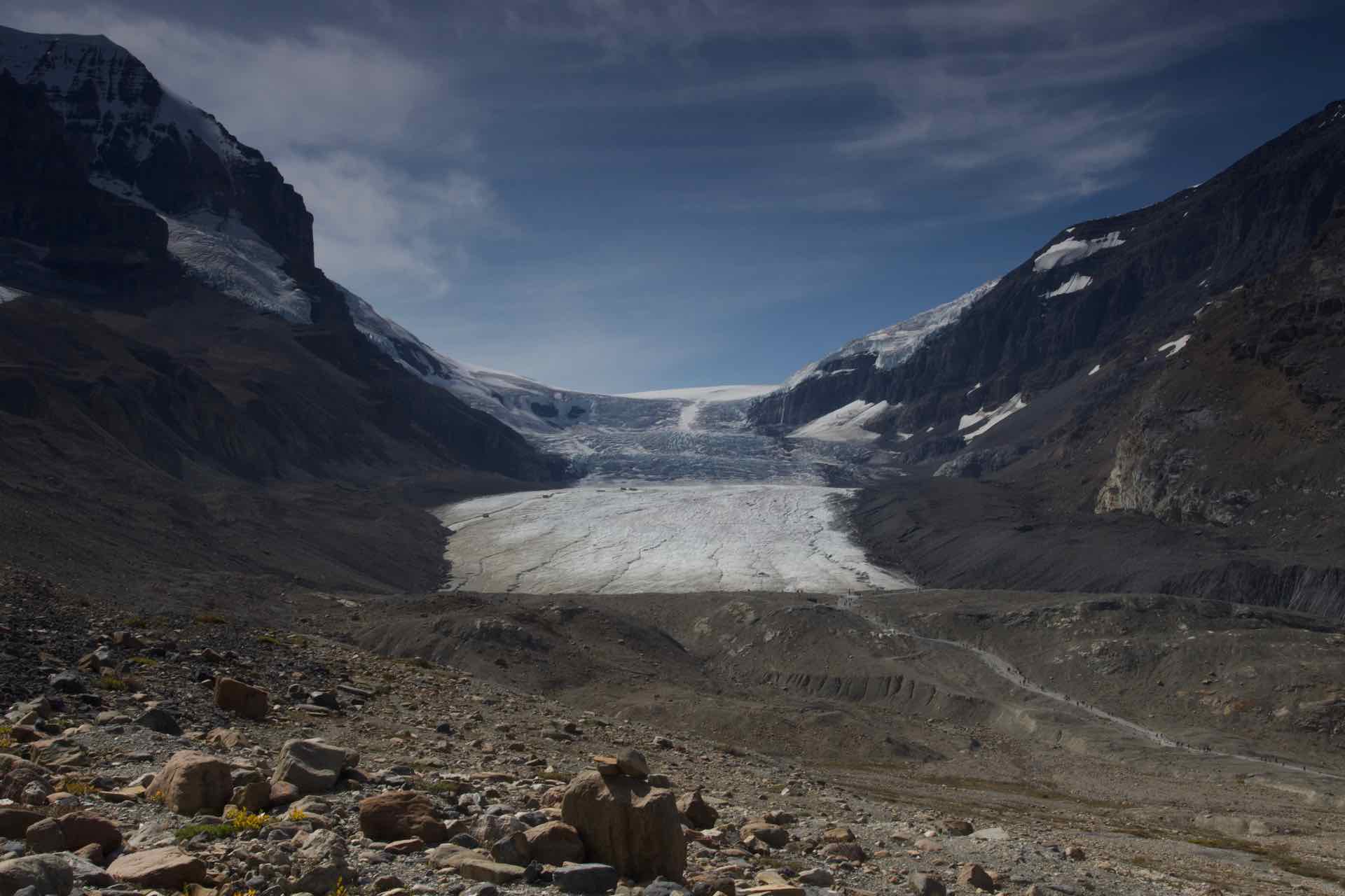
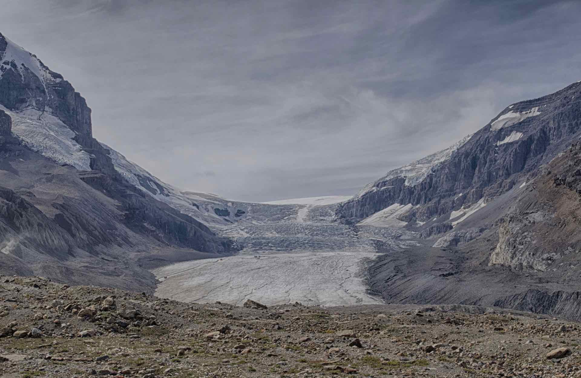
Four images of the Columbia Icefields – Icefields Parkway
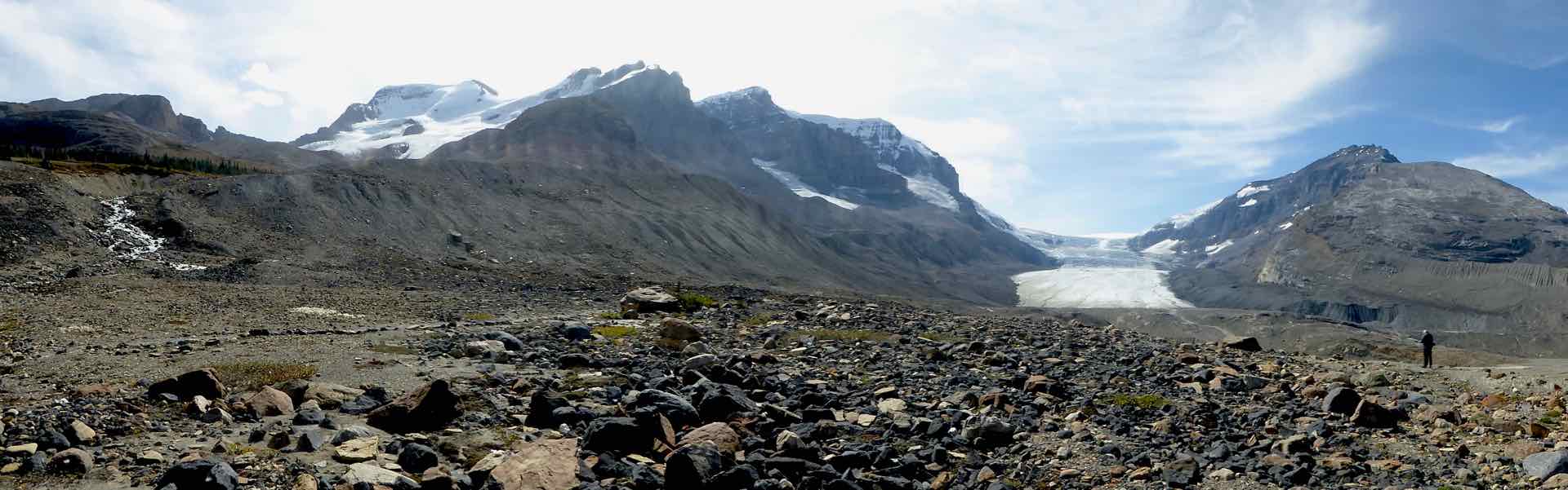


Top: Panorama of The Columbian Icefields; Centre and bottom: Lyn moved to yoga by the Columbian Icefields
We spent quite a while walking around the rock field in front of the glacier before heading off on the last leg into Jasper.
Jasper lies at the north end of the Icefields Parkway and takes its name from Jasper Hawes, an employee of the Northwest Company which established a trading post here after the area was opened up by fur traders around 1813. The town gives its name to a National Park which was established in 1907, which seeks to provide protection for the natural environment, flora and fauna that survive in the area. The area was opened up to road traffic in 1931 and the Icefield Parkway along which we had driven was opened in 1940.


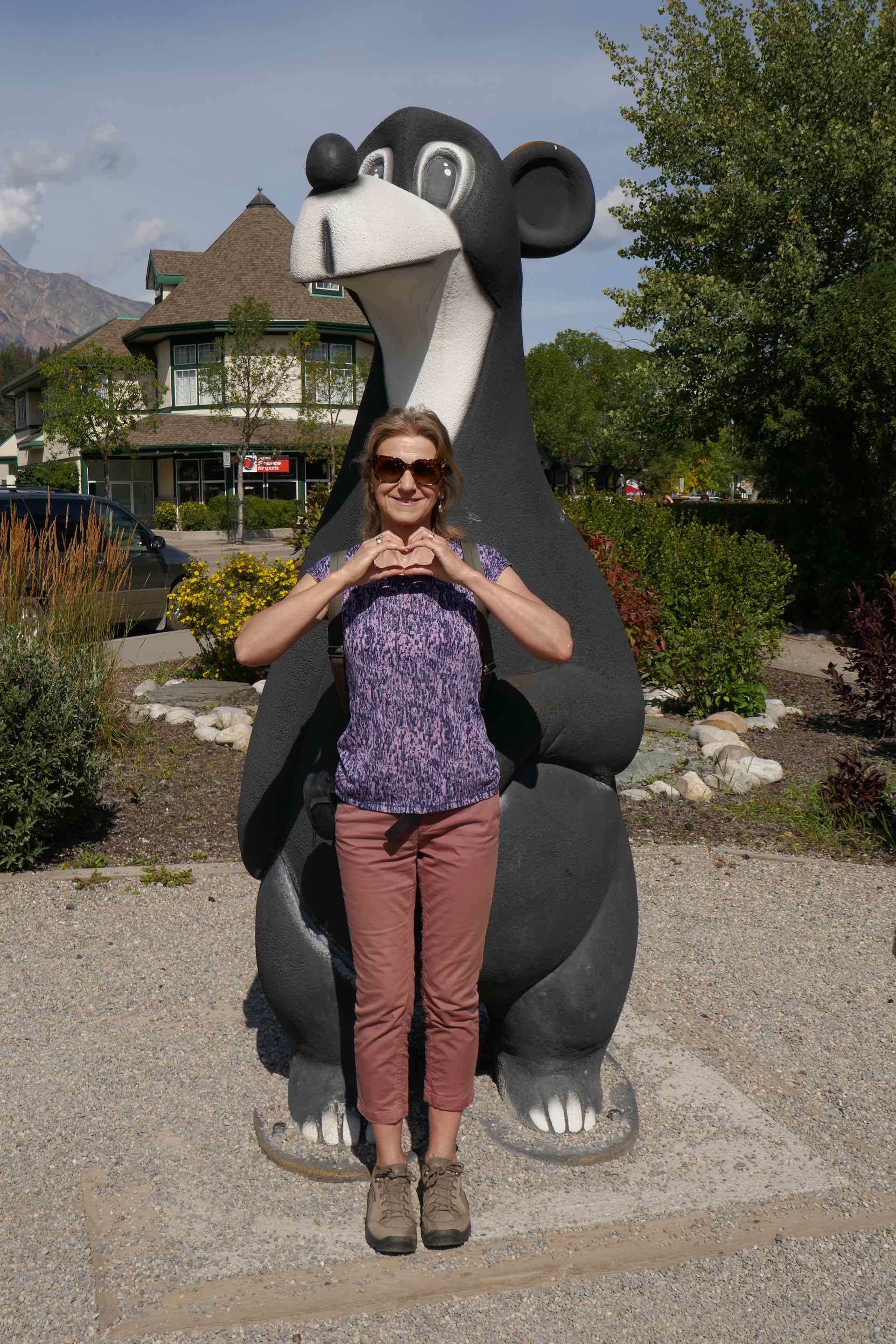
Clockwise from top left: Lyn outside the Jasper Visitors centre; Residential Street with Mount whistler behind; Lyn in Jasper; Lyn and Bear Friend


Us enjoying the sights of Jasper
The town’s present structure dates back to the start of the 20th century when the Grand Trunk Pacific Railway sought to repeat the success of the Canadian Pacific Railway by building a route across Canada and drawing in tourists to the area. Jasper has a massive freight siding which runs parallel to the highway for most of the length of the town which is a legacy of the rail development early in the last century. It is quieter than its near neighbour Banff and has more small town feel about it.


Steam locomotive 6015, Mountain type Class U-1-A and the information plaque beside it


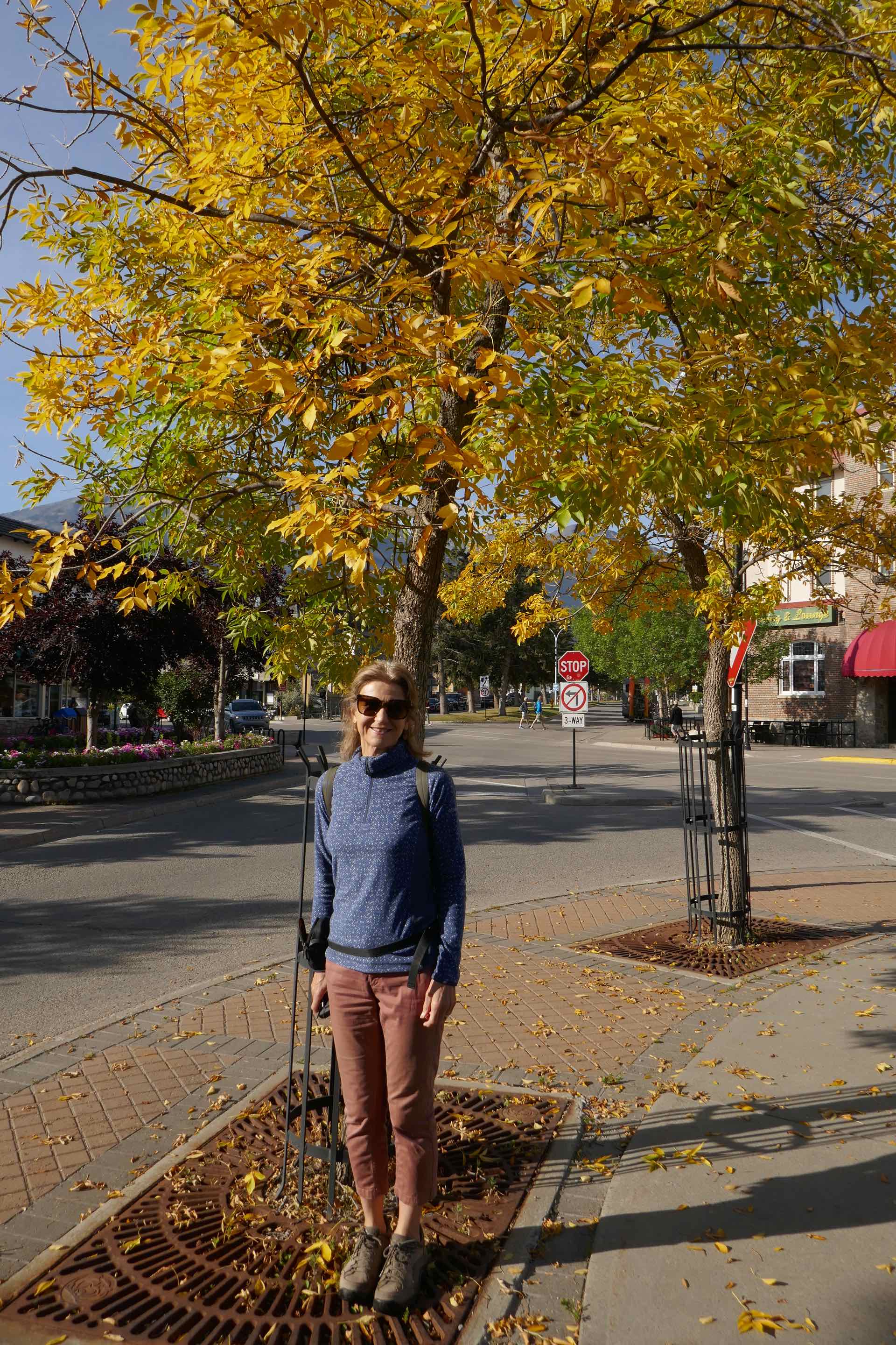
Clockwise from top left:Lyn under an Autumn tree; Residential street with Mount Whistler at rear; Jasper’s own Totem Pole: The Jasper Community Garden (both images)

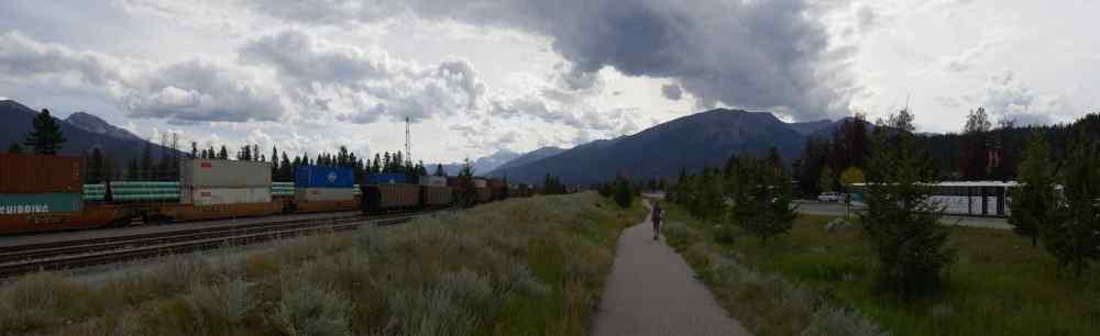

Top and Centre: Panorama images of the industrial part of Jasper by the Rail sidings; Bottom: Lyn on the Heritage Trail
We had one day in Jasper so on a lovely sunny morning we walked the mile or so into the town to explore. The town has two main attractions, the Jasper Skytram, a cable car operating about 6 miles out of town taking tourists (and skiers in winter) up the Whistlers mountain, and the Yellowhead Museum which is home to a modest display of local history and artefacts. We followed the Heritage trail for part of its 5 mile route with some interesting information points along the way detailing history and items of interest.
So why are we here? Jasper is the departure point for the next stage of our Canada trip, The Rocky Mountaineer, one of the worlds most iconic railway journeys, from Jasper, via Kamloops to Vancouver, through the Canadian Rockies.

These pics are amazing ! What a catalog of adventures your developing 💙
Sent from my iPhone
>
LikeLike
It was a stunning place despite the crowds.
LikeLike