The Northumbrian coast in the north east of England is one of the country’s best kept secrets. It is a mix of sandy and boulder strewn beaches and a “chain” of castles from Berwick on Tweed to Warkworth.
I recently joined a photographic workshop based in Bamburgh (home of one of the most noted castles in the area) led by Sarah Howard of Image Seen Photography. As well as Bamburgh, we visited a number of locations on the Northumberland coast.
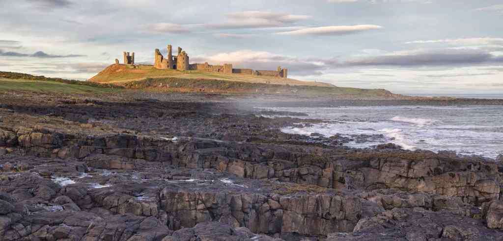
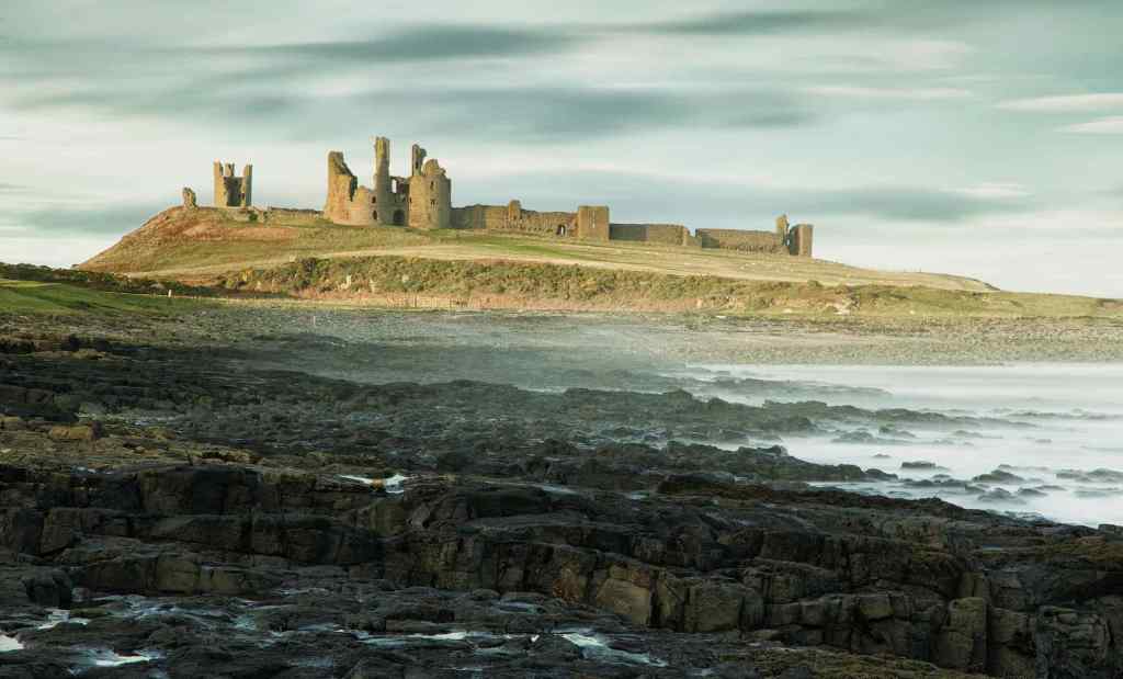
Dunstanborough Castle
We had two visits to the Dunstanborough Castle location. One was to photograph the sunrise from the “beach” to the north side and the other, the last destination on the workshop, was from the south side as the afternoon light was fading. The beaches were rocky on both sides making access quite difficult, especially on the north side where it consist of acres of very large, smooth and slippery “pebbles” Wet, they make fantastic foreground interest, though to walk across they are very hazardous and slippy.


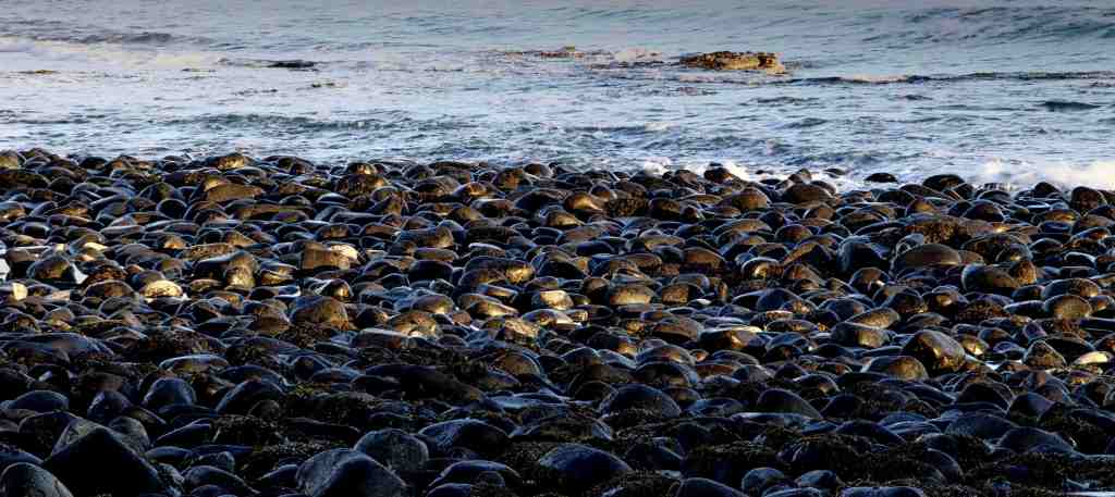
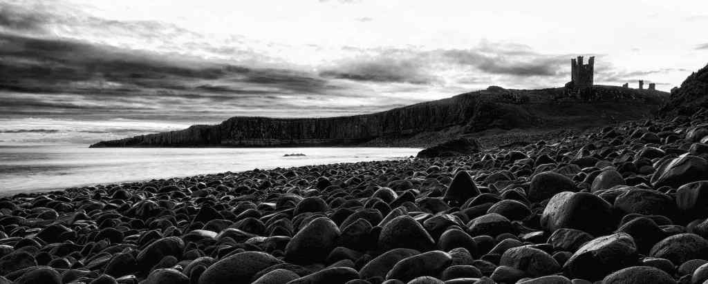
Top and 2: Dunstanborough Castle at sunrise; 3. The “beach” north of Dunstanborough Castle: 3. The pebble beach at Dunstanborough; 4. A mono conversion of the beach with Dunstanborough Castle in the background.
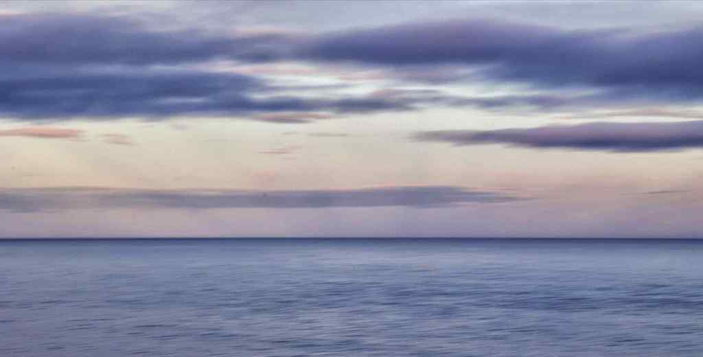
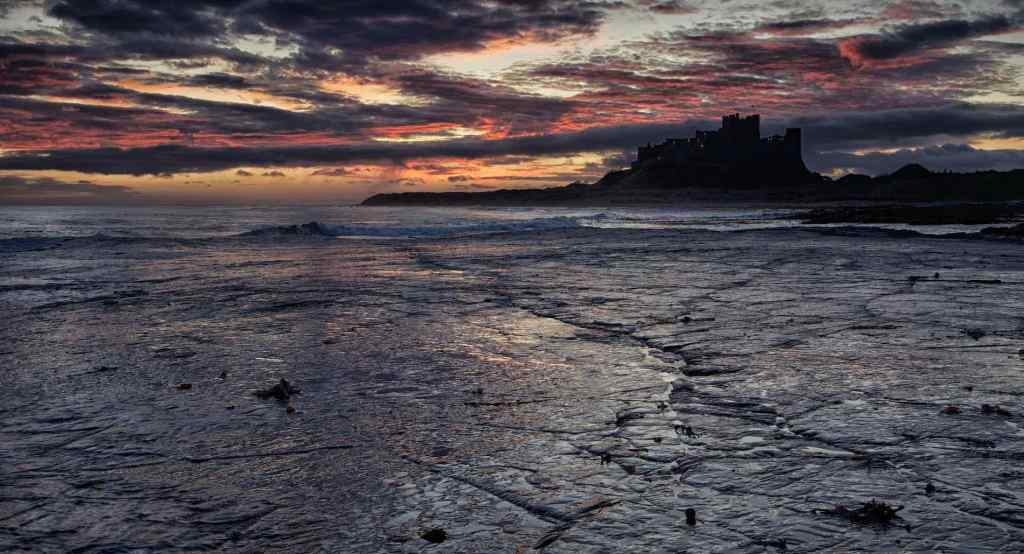
Top: Dunstanborough Castle in late afternoon light; Centre: Similar position but with 6 stop ND filter giving a slower shutter speed. Bottom: Coloured sky as the sun sets behind me. Slow shutter speed giving slightly blurry sea.
Alnmouth
Located at the mouth of the River Aln, Alnmouth was once a thriving grain and slate port but continued silting caused its deterioration until it became unusable as a port in the 1810’s. Today it is a small tidal harbour with a few boats moored in the bay. We visited on a sunny day when the tide was out and were able to get onto the muddy sand. It was an opportunity for reflections, and detail images.

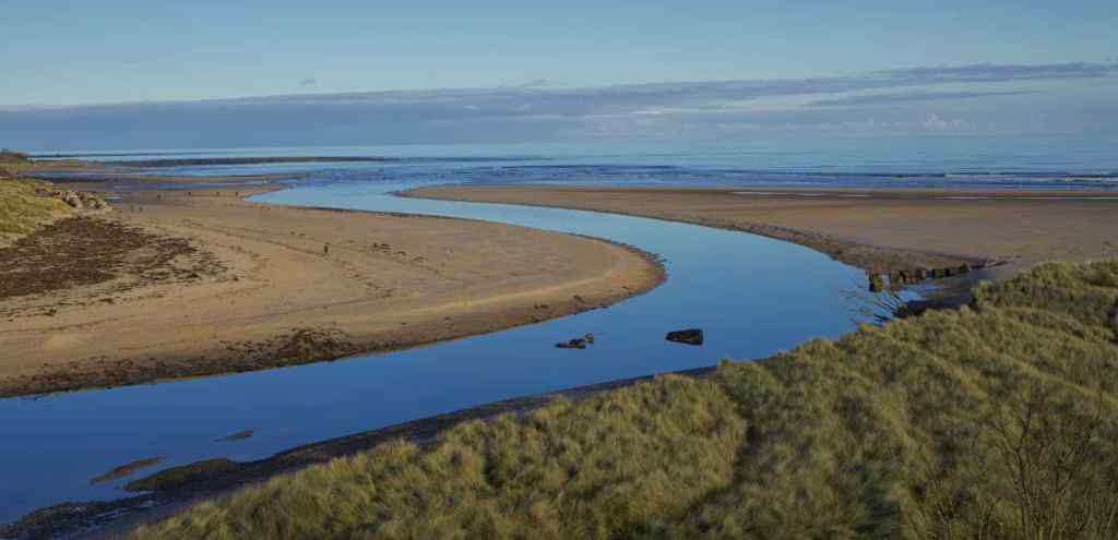
Top: Reflections - Motor boat “Sunrise” at rest on the sand; Bottom: River Aln Estuary
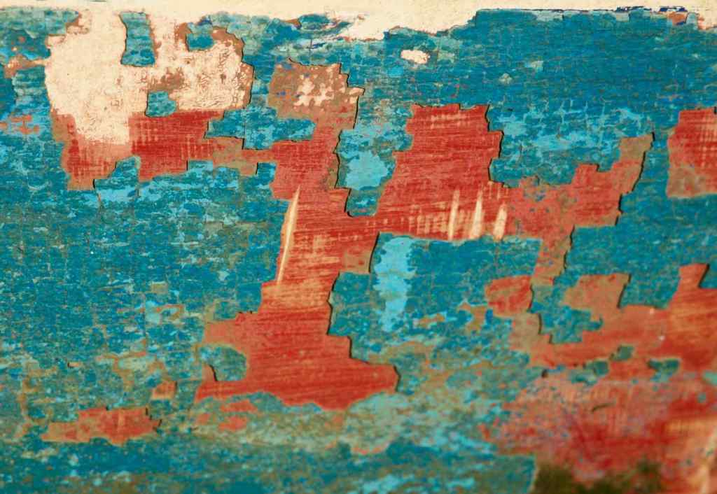
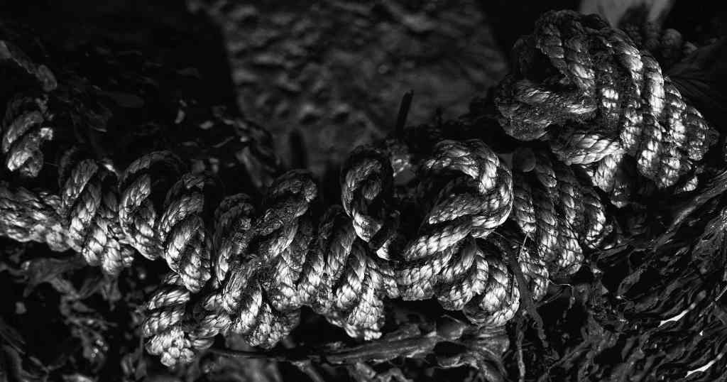
Detail/Abstract Shots – Top: Peeling Paint. I found this on the side of battered old boat and reminds me a bit of an atlas; Bottom: Coil of rope, tweaked and converted to black and white.
Amble
Amble lies to the south of Alnmouth and has a small harbour for fishing boats although in the heyday of coal production it served the collieries of the northeast of England. It lies on the estuary of the River Coquet and is noted for its extensive pier structure and a small maritime maintenance industry still exists in the town.
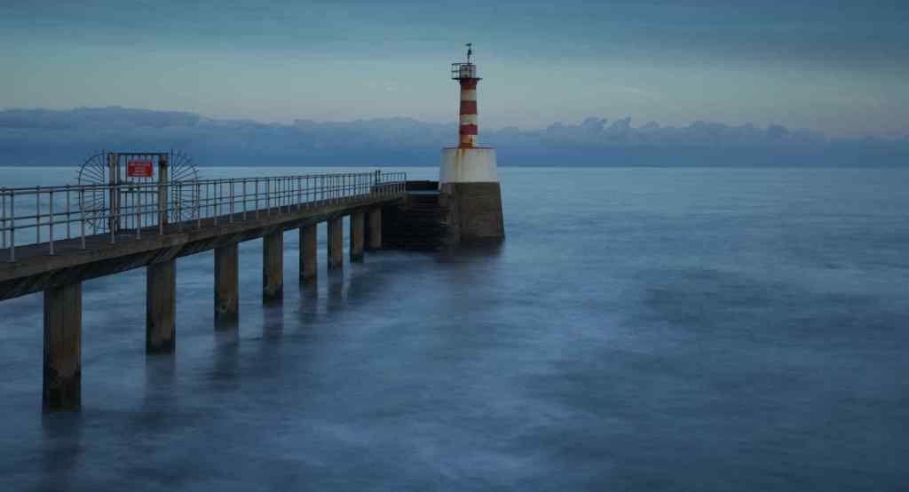

Top: Amble Lighthouse – 10 stop ND filter smooths out an ever increasing swell in the water; Bottom: Same image with mono conversion – takes away the distraction of colour and focuses one tone and atmosphere.

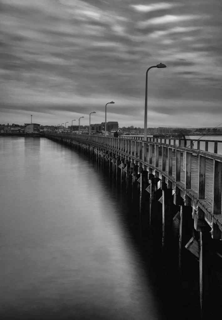
Top: Amble Pier looking back towards the town a muted colour image with a 10 stop ND filter.; Below: Same shot, once again with mono conversion.
Holy Island/Lindisfarne
Holy Island lies just to the north of Bamburgh and is only accessible at certain times of the day as the causeway linking it to the mainland is covered by the tide twice a day. We spent almost a whole day there exploring and photographing the castle, harbour and priory.

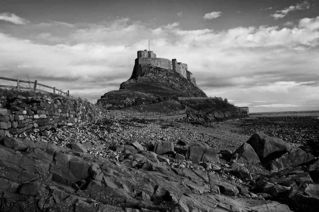

Top: Lindisfarne Castle from the “beach” below; Centre: Mono image for the castle from a similar perspective. Bottom: The castle from across the bay/harbour about 30 mins before sunset.


Top: Two boats. I liked the symmetry that the bows of these boats gave. Bottom: The “harbour” bay, a shingle and mud beach with grass behind.
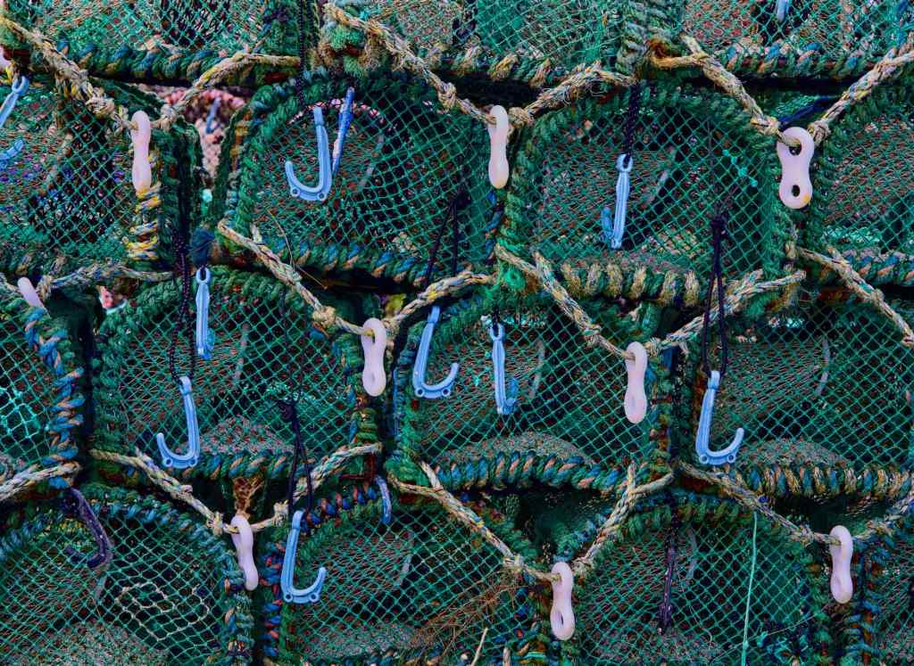

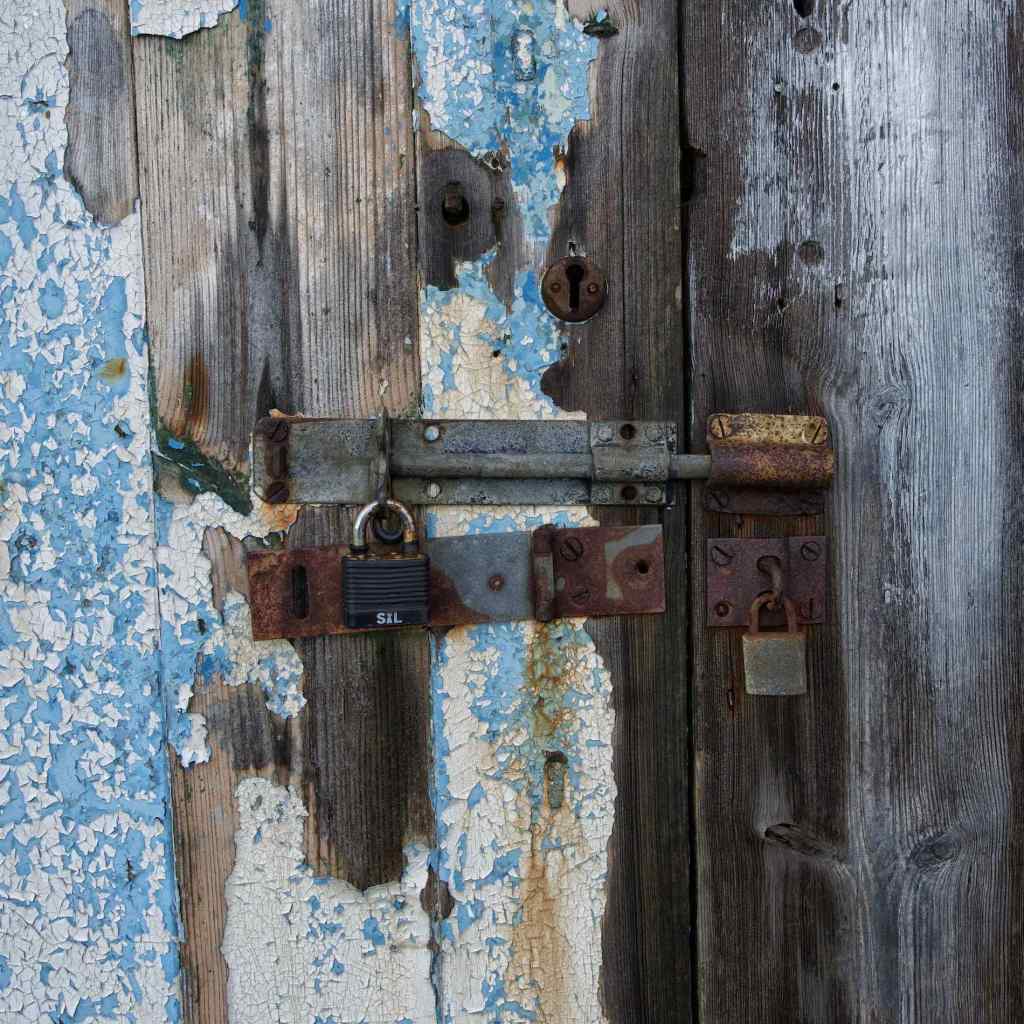
More detail shots – Top: Lobster/crab pots; Centre: Hole in the boat – a rusty hole in the bow of a boat had interest and texture; Bottom: Rusty old padlock – The hasp on this door appeared to be all that was holding it to the shed.
Bamburgh
Another dawn shoot saw us on the rocky beach to the north of Bamburgh Castle to capture the sunrise. There has been a fort or castle on this site since around 547. It changed hands several times through regional conflict but was destroyed by the Vikings in 993. The Normans constructed a new castle on the site after their invasion and it is this one which forms the core of the building which stands today. It is owned and occupied by the Armstrong family, whose ancestor bought the building during the reign of Queen Victoria.


Top, Centre and Bottom: Sunrise across the bay toward Bamburgh Castle

Looking the other way – Lighthouse in Bamburgh Bay

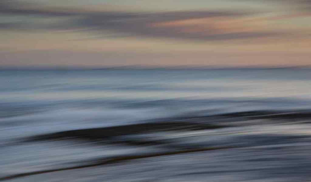
Two shots using Intentional Camera Movement (ICM) – open the shutter for about 1 second and move the camera horizontally, (as in these shots) vertically or rotationally.
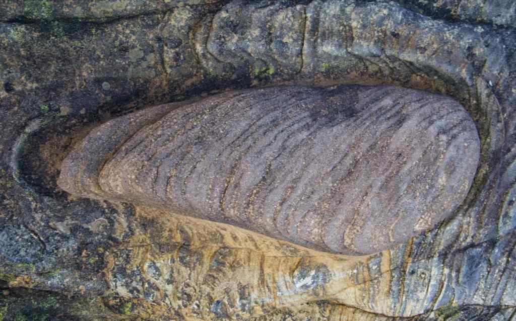
Cullernose Point
Cullernose Point is large rugged cliff tapering out to sea. Located just south of Coaster it features the classical vertical columns and fractures that characterise rocks that were once molten. The rocky beach was stable and easy to access.
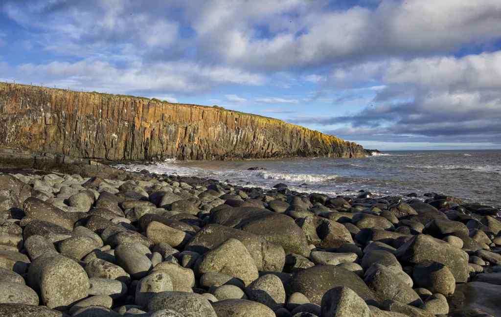

Top and Bottom: Views of Cullernose Point showing the vertical rock formations formed out of the molten rock prevalent 300 million years ago.
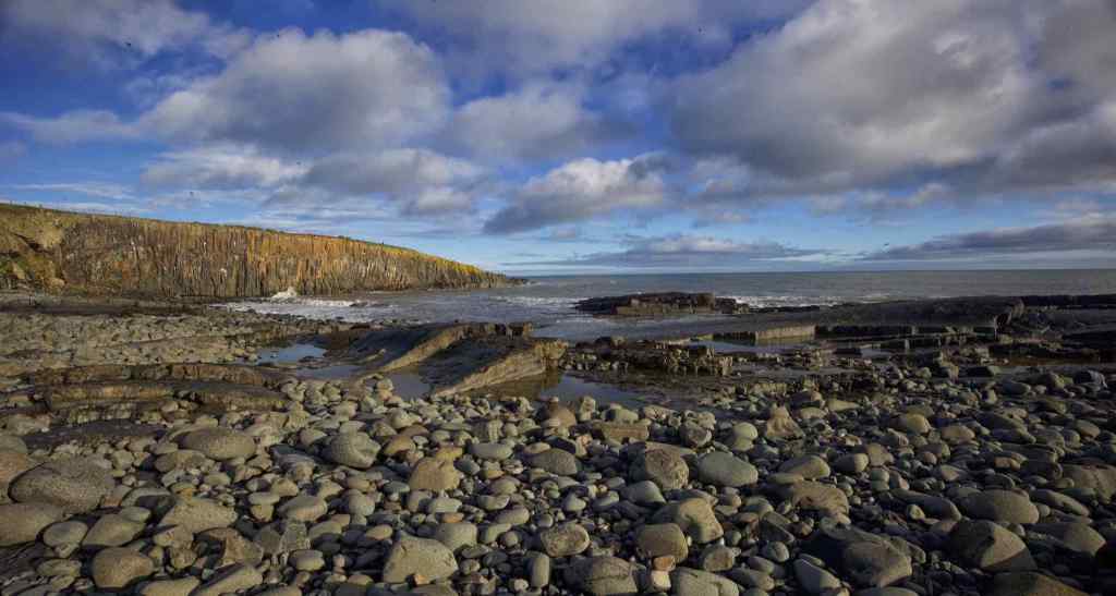

Two wide angle shots showing more of the “beach”.
Howick Scar
A little further along the coast is Howick Scar. This is a series of rock formations with fascinating details embedded in the surface. It is a complete departure for Landscapers as you are looking closely at detail as the images below illustrate.
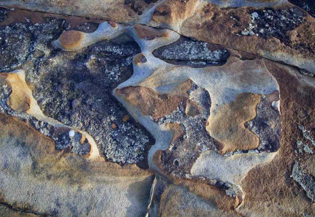

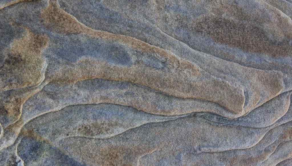
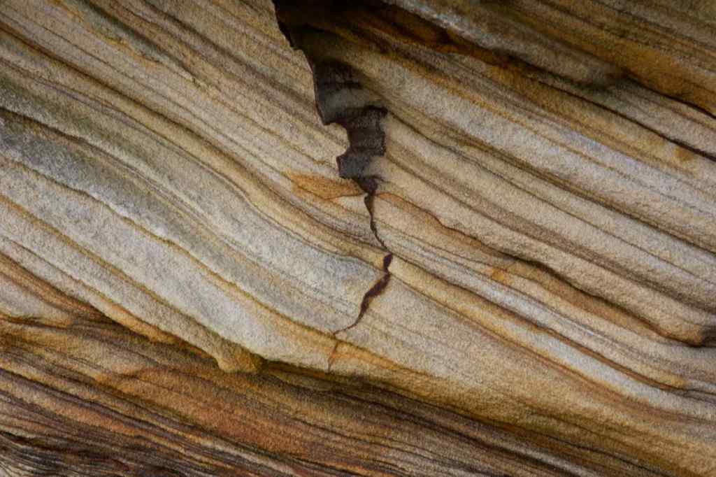
Four images showing the widely different detailed patterns in the rock at Howick Scar.


Three more images showing the detail of the rock formations at Howick Scar.
Howick Scar was a fascinating location with so many different rock formations to choose from. I can’t begin to imagine the geological forces and occurrences that went into creating these rocks upwards of 200 million years ago.
All in all a great workshop and we were blessed with good weather for the most part.
